The Namibian economy has a modern market sector, which produces most of the country's wealth, and a traditional subsistence sector. Although the majority of the population engages in subsistence agriculture and herding, Namibia has more than 200,000 skilled workers and a considerable number of well-trained professionals and managerials.

South West Africa was the name for modern-day Namibia when it was under South African administration, from 1915 to 1990.

Erongo is one of the 14 regions of Namibia. The capital is Swakopmund. The region comprises the Swakopmund magisterial district up to the Ugab River and includes the Walvis Bay, Omaruru and Karibib magisterial districts. This region is named after Mount Erongo, a well-known landmark in Namibia and in this area. All the main centres within this region are connected by paved roads. The Governor of Erongo Region is Cleophas Mutjavikua.

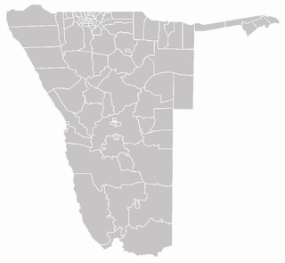
Each of the 14 regions in Namibia is further subdivided into electoral constituencies. The size of the constituencies varies with the size and population of each region. There are currently 121 constituencies in Namibia. The most populous constituency is Walvis Bay Urban; the least populous is Walvis Bay Rural, both in the Erongo region.

The Trans-Caprivi highway opened in 1999 runs from Rundu, in north eastern Namibia, along the Caprivi Strip to Katima Mulilo on the Zambezi River which forms the border between Namibia and Zambia. The Katima Mulilo Bridge spans the river to the Zambian town of Sesheke from where a recently upgraded paved road runs to Livingstone joining the main southern highway to Lusaka, connecting onwards to the Copperbelt.

Lüderitz Bay or Lüderitzbaai, also known as Angra Pequena, is a bay in the coast of Namibia, Africa. The city of Lüderitz is located at the edge of the bay.
The Trans-Kalahari Corridor is a paved highway corridor that provides a direct route from Walvis Bay and Windhoek in central Namibia, through Botswana, to Pretoria in Gauteng province in South Africa. It initially cost approximately 850 million Namibian dollars and was officially opened in 1998.

The Namibia Premier League (NPL), also known as MTC Namibia Premier League due to sponsorship reasons, is the highest level of domestic association football in Namibia. The league was established in 1985 and was trimmed to 12 teams from the traditional 16 in 2005.

Walvis Bay International Airport is an airport serving Walvis Bay, a town in the Erongo Region of Namibia. The airport is about 15 km (9 mi) east of the town.

Walvis Bay railway station is a railway station serving the port city of Walvis Bay in Namibia. It is part of the TransNamib railway network.
The Namibian Ports Authority, or Namport, is a state owned enterprise established by an act of parliament government of Namibia as the national ports authority of Namibia, managing principally the ports of Walvis Bay and Lüderitz, as well as managing a Syncrolift dry dock facility in Walvis Bay. Namport was founded in 1994. Its head office is located in Walvis Bay.

Bird Island is a man-made platform off the coast of Namibia between Walvis Bay and Swakopmund. It serves as a breeding ground for birds and yields guano which is collected and sold.

Walvis Bay Rural constituency is a constituency in the Erongo Region of Namibia. It comprises the rural area surrounding the constituency's district capital city of Walvis Bay. With a voting population of 623 in 2004, Walvis Bay Rural was the least populous constituency in Namibia at that time.

The Namibian Navy is the Maritime Warfare Branch of the Namibian Defence Force.

Dorob National Park is a protected area in Erongo, along the central Namibian coast, which is 1,600 kilometres (990 mi) in length. It was gazetted as a national park under the Nature Conservation Ordinance No.4 of 1975 on 1 December 2010, and with Namib-Naukluft Park covers an area of 107,540 square kilometres (41,520 sq mi).

Walvis Bay Commando was a light infantry regiment of the South African Army. It formed part of the South African Army Infantry Formation as well as the South African Territorial Reserve.

The Walvis Bay Military Area was a specific militarised zone bordering South West Africa during the South African Border War. Military equipment was freighted through the harbour to support operations throughout South West Africa.


