
Clayton is a city in and the county seat of St. Louis County, Missouri, and borders the independent city of St. Louis. The population was 17,355 at the 2020 census. Organized in 1877, the city was named after Ralph Clayton, who donated the land for the St. Louis County courthouse.

The Central West End is a neighborhood in St. Louis, Missouri, stretching from Midtown's western edge to Union Boulevard and bordering on Forest Park with its outstanding array of free cultural institutions. It includes the Cathedral Basilica of Saint Louis on Lindell Boulevard at Newstead Avenue, which houses the largest collection of mosaics in the world. The Central West End sits entirely within the 9th Ward.
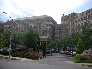
The Ville is a historic African-American neighborhood with many African-American businesses located in North St. Louis, Missouri, U.S.. This neighborhood is a forty-two-square-block bounded by St. Louis Avenue on the north, Martin Luther King Drive on the south, Sarah on the east and Taylor on the west. From 1911 to 1950, The Ville was the center of African American culture within the city of St. Louis.
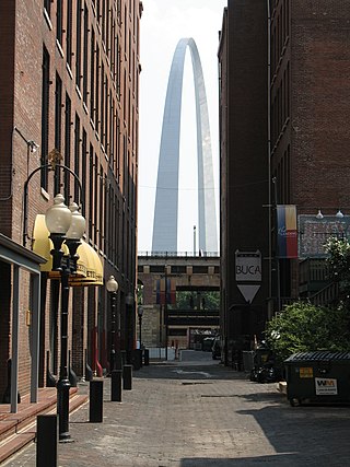
Downtown St. Louis is the central business district of St. Louis, Missouri, the hub of tourism and entertainment, and the anchor of the St. Louis metropolitan area. The downtown is bounded by Cole Street to the north, the river front to the east, Chouteau Avenue to the south, and Tucker Boulevard to the west. The downtown is the site of many corporate headquarters, including Stifel Financial Corp., HOK, Spire Inc, and a host of other companies.

Cermak Road, also known as 22nd Street, is a 19-mile, major east–west street on Chicago's near south and west sides and the city's western suburbs. In Chicago's street numbering system, Cermak is 2200 south, or twenty-two blocks south of the baseline of Madison Street. Normally, one mile comprises eight Chicago blocks, but the arterial streets Roosevelt Road, formerly named Twelfth Street and at 1200 South, and Cermak Road were platted before the eight-blocks-per-mile plan was implemented. Roosevelt Road is one mile south of Madison Avenue and there are twelve blocks within that mile. Cermak Road is two miles south of Madison Avenue and there are ten blocks within the mile between Roosevelt and Cermak Roads.

Shaw is a neighborhood in St. Louis, Missouri. It is bordered on the North by Interstate 44, the east by S. Grand Blvd, the west by Tower Grove Ave and the Missouri Botanical Gardens, and the south by Tower Grove Park. The Shaw Neighborhood is a local historic district whose historic structure and character is protected by ordinance.

Southampton is a neighborhood in St. Louis, Missouri. Located in the southwestern reaches of the city, its borders are Chippewa Street on the north, Hampton Avenue on the west, Eichelberger Street on the south, and South Kingshighway Boulevard on the east.
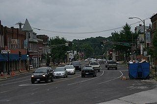
Baden is a neighborhood of St. Louis, Missouri.

Mid-City is a neighborhood of the city of New Orleans. A sub-district of the Mid-City District Area, its boundaries as defined by the New Orleans City Planning Commission are: City Park Avenue, Toulouse Street, North Carrollton, Orleans Avenue, Bayou St. John and St. Louis Street to the north, North Broad Street to the east, and the Pontchartrain Expressway to the west. It is a historic district on the National Register of Historic Places. In common usage, a somewhat larger area surrounding these borders is often also referred to as part of Mid-City.

North Point is a neighborhood of St. Louis, Missouri, US. It is bounded by Goodfellow on the North, Northcrest, West Florissant on the Southwest, and Riverview Boulevard on the East and Northeast.

Dutchtown is a neighborhood of St. Louis, Missouri. It is called "Dutch" from Deutsch, i.e., "German", as it was the southern center of German-American settlement in St. Louis in the early 19th century. It was the original site of Concordia Seminary, Concordia Publishing House, Lutheran Hospital, and other German community organizations. The German Cultural Society still has its headquarters there. St Anthony of Padua Catholic Church towers over the neighborhood and is a symbol of the neighborhood.
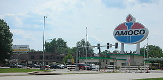
Hi-Pointe is a neighborhood of St. Louis, Missouri, within a section known as Dogtown. It is bounded by Clayton Avenue and Oakland Avenue on the north, City Limits on the west, Dale Avenue on the south, and Louisville Avenue on the east. It is bordered by the Skinker-DeBaliviere neighborhood and Forest Park on the north, the Clayton-Tamm neighborhood on the east, the Franz Park neighborhood on the south and the city of Richmond Heights, part of St. Louis County on the west.

Skinker DeBaliviere is a neighborhood of St. Louis, Missouri, located directly north of Forest Park. In addition to the park, its boundaries are Delmar Boulevard to the north, DeBaliviere Avenue to the east, and the western city limits near Skinker Boulevard. It is home to The Pageant, Pin-up Bowl, and all the other establishments of the Delmar Loop east of University City. It also includes the west end of the Forest Park – DeBaliviere and the entire Skinker MetroLink stations. The Delmar Loop station is just outside of its north boundary. In 1978, the neighborhood was designated a Local Historic District by the City of St. Louis, and the private subdivision of Parkview is listed in the National Register of Historic Places.

St. Louis Hills is a neighborhood in St. Louis, Missouri. The neighborhood, which is home to the Chippewa location of Ted Drewes Frozen Custard, is situated in the southwest part of St. Louis. It is bounded by Chippewa Street to the northwest and north, Hampton Avenue to the east, Gravois Avenue to the southeast, and the St. Louis county border to the southwest.

Lindenwood Park is a neighborhood of St. Louis, Missouri. The Lindenwood Neighborhood is defined by Arsenal Street and I-44 to the north, Watson and Chippewa Street to the south, Hampton Avenue on the east and the city limits to the west.

O'Fallon is a neighborhood of St. Louis, Missouri. The neighborhood is located on the north side of the City of St. Louis, nestled between O'Fallon Park and Fairground Park. It is bounded by West Florissant, Harris Avenue, Algernon Street and Adelaide on the north, Pope Avenue on the northwest, Kossuth and Natural Bridge Avenues on the south via Fair Avenue, Warne on the east, and Newstead on the west. The O'Fallon neighborhood is located in the 21st Ward which is currently represented by Alderman John Collins-Muhammad.

Patch is a neighborhood of St. Louis, Missouri. The Patch neighborhood forms the southern tip of the Carondelet neighborhood. It is defined by Robert Avenue on the north, the City Limits to the south, Alabama Avenue to the west, and by the Mississippi River to the east.
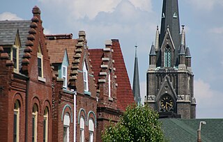
Tower Grove East is a neighborhood of St. Louis, Missouri. The Tower Grove East neighborhood is bordered by Shenandoah Avenue to the north, Nebraska Avenue to the east, Gravois Avenue to the south, and south Grand Boulevard to the west.

The Hi-Pointe–DeMun Historic District is a historic district that was listed on the National Register of Historic Places in 2005. The district, commonly referred to as “DeMun,” is a neighborhood straddling the city limits of St. Louis, Missouri and Clayton, Missouri. The district is roughly bounded by Clayton Road to the south, Big Bend Boulevard to the west, Northwood Avenue to the north, and Skinker Boulevard to the east, and consists of two subdivisions: DeMun Park and Hi-Pointe.
The streets of St. Louis, Missouri, United States, and the surrounding area of Greater St. Louis are under the jurisdiction of the City of St. Louis Street Department. According to the Streets Division, there are 1,000-mile (1,600 km) of streets and 600-mile (970 km) of alleys within the city.


