Related Research Articles

Clayton is a city in and the county seat of St. Louis County, Missouri, and borders the independent city of St. Louis. The population was 17,355 at the 2020 census. Organized in 1877, the city was named after Ralph Clayton, a citizen who donated the land for the St. Louis County courthouse.
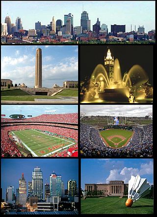
The Kansas City metropolitan area is a bi-state metropolitan area anchored by Kansas City, Missouri. Its 14 counties straddle the border between the U.S. states of Missouri and Kansas. With 8,472 square miles (21,940 km2) and a population of more than 2.2 million people, it is the second-largest metropolitan area centered in Missouri and is the largest metropolitan area in Kansas, though Wichita is the largest metropolitan area centered in Kansas. Alongside Kansas City, Missouri, these are the suburbs with populations above 100,000: Overland Park, Kansas; Kansas City, Kansas; Olathe, Kansas; Independence, Missouri; and Lee's Summit, Missouri.
Waldo is a neighborhood located on the southside of Kansas City, Missouri, that has continued to maintain its own unique character, even though it was annexed by Kansas City in 1909. Waldo's boundaries are Gregory Boulevard on the north to 91st Street on the south, and Troost Ave on the east to State Line on the west.
Crown Center is a shopping center and neighborhood located near Downtown Kansas City, Missouri between Gillham Road and Main Street to the east and west, and between OK/E 22nd St and E 27th St to the north and south. The shopping center is anchored by Halls, a department store which is owned and operated by Hallmark Cards. The neighborhood contains numerous residences, retail establishments, entertainment venues, and restaurants including the American Restaurant, the only Forbes Travel Guide four-star restaurant in Missouri. It is home to Hallmark Cards, and the headquarters of Shook, Hardy & Bacon and Lathrop GPM, two of Kansas City's largest law firms.

Quality Hill is a historic neighborhood near downtown Kansas City, Missouri, USA, on a 200-foot-high bluff which overlooks the confluence of the Kansas and Missouri rivers in the West Bottoms below.

The West Bottoms is a historic industrial neighborhood of Kansas City, Missouri, immediately west of downtown and straddling the border of Kansas City, Missouri and Kansas City, Kansas. At the confluence of the Missouri River and the Kansas River, it faces Kaw Point, an early campsite of the Lewis and Clark Expedition. The region was originally settled by the native tribes, and this spot was permanently settled as French Bottoms in the early 1800s by François Chouteau for his trade with the tribes and early American pioneers. It is one of the oldest areas of the metro along with Westport. Its neighboring Quality Hill neighborhood is a historical center of the pioneer Town of Kansas, which became Kansas City, Missouri.

Ward Parkway is a boulevard in Kansas City, Missouri, United States. Ward Parkway begins at Brookside Boulevard on the eastern edge of the Country Club Plaza and travels west 2.8 miles along Brush Creek as U.S. Route 56 before turning south near Kansas-Missouri state line. It continues south for 4 miles, terminating at Wornall Road near Bannister Road. A short spur, Brush Creek Parkway, connects Ward Parkway to Shawnee Mission Parkway at State Line Road.

The Library District is an officially designated neighborhood in Downtown Kansas City, Missouri, United States, roughly bounded by 9th and 11th Streets on the north and south and Main Street and Broadway on the east and west. The District contains a sub-district named the West Ninth Street/Baltimore Avenue Historic District listed on the National Register and which includes several buildings individually listed on the National Register of Historic Places. It also contains other notable structures not listed on the National Register.
Volker is a historic neighborhood in Kansas City, MO that lies just northwest of the Westport historic and entertainment district. The 39th Street West District and the Old Westport Shopping Center lie within the Volker neighborhood. The boundaries of the Volker Neighborhood are 31st Street on the north and Westport Road/43rd Street on the south. The western boundary is State Line Road. On the east, the boundaries are Roanoke Road on the north side of 39th and Southwest Trafficway south of 39th.
Main Street or Main is one of the major streets in Kansas City, Missouri and the Kansas City metropolitan area. Main Street serves as the main administrative dividing line for house numbering and east–west streets in Kansas City; for example, it separates East 59th Street from West 59th Street. Address numbers on east–west streets increase in both directions as one moves away from Main Street. This should not be confused with the Kansas City "East Side" and "West Side," a cultural distinction which has arisen from a history of racist segregation in the city, separated by Troost Avenue approximately 1 mile east of Main Street.

Southmoreland is a neighborhood of Kansas City, Missouri. It hosts the Nelson-Atkins Museum of Art, the Kemper Museum of Contemporary Art, and the Kansas City Art Institute. Southmoreland is located between 39th Street on the north, Rockhill, and Gillham Road on the east, Emanuel Cleaver II Boulevard on the south and Main Street on the west. Since 2019, following finalized plans for a streetcar extension from Union Station to University of Missouri–Kansas City, there has been new real estate development along Main Street.

Lincoln Park is a neighborhood and public park close to downtown Denver, Colorado and the location of the Art District on Santa Fe. The neighborhood is one of Denver's oldest and is just to the south of the area where Denver was first settled in the 1850s. Many houses date from about 1900. The neighborhood is sometimes called "La Alma/Lincoln Park" or the West Side.

Poplar is a neighborhood in Lower North Philadelphia, Pennsylvania, United States. It is located north of Callowhill, between Spring Garden/Fairmount and Northern Liberties, bounded roughly by Girard Avenue to the north, North Broad Street to the west, Spring Garden Street to the south, and 5th Street to the east. The neighborhood is predominantly residential, with commercial frontage on Broad Street and Girard Avenue and some industrial facilities to the west of the railroad tracks along Percy St. and 9th St.
39th Street is a major east–west street in Kansas City, Missouri, running almost 5 miles from State Line Road at the Kansas-Missouri border to Topping Avenue in Kansas City's East Side. It was originally named Rosedale Avenue as it led to the town of Rosedale. It continues west into Kansas as 39th Avenue through The University of Kansas Hospital's Kansas City, Kansas, campus.
Gillham Road is a major north/south main street that runs in Kansas City, Missouri from the intersection of 22nd Street at Oak Street to Harrison Road between 45th and 46th Streets. Gillham Road becomes Gillham Plaza from 31st Street to 34th Street. This causes Gillham Road to go over one block east into a residential neighborhood.

Union Hill is a historic neighborhood in Kansas City, Missouri. The neighborhood is located between 27th Street and 31st Street and Main Street to Gillham Road.
The Jefferson–Chalmers Historic Business District is a neighborhood located on East Jefferson Avenue between Eastlawn Street and Alter Road in Detroit, Michigan. The district is the only continuously intact commercial district remaining along East Jefferson Avenue, and was listed on the National Register of Historic Places in 2004.

Armour Hills is a neighborhood located in Kansas City, Missouri. It is bounded on the west by Brookside Road, on the north by 65th Street, on the east by Oak Street and the south by Gregory Boulevard. The name of this area derives from the fact that the land was owned by members of the Armour family of the Armour and Company.
Valentine is a historic neighborhood in Midtown Kansas City, Missouri. It is just north of the Westport entertainment district, bounded by Broadway on the east, Southwest Trafficway on the west, 31st Street on the north, and 40th Street on the south.

Situated in the township of Boardman and developed in the 1920s, Newport Village was one of Youngstown’s earliest automobile accessible suburban developments. The twenty-four and a half acre district comprises Jennette Drive, Chester Drive, seven lots on Overhill Road, and a majority of the area on Market Street’s west side. Gently curving streets with both Tudor and Colonial architecture blend into the natural landscape of the area and Mill Creek Park. Newport Village became part of the National Register of Historic Places in 2006.
References
39°02′34″N94°36′09″W / 39.04266°N 94.60254°W
| | This Missouri state location article is a stub. You can help Wikipedia by expanding it. |