Related Research Articles

Tooele County is a county in the U.S. state of Utah. As of the 2010 United States Census, the population was 58,218. Its county seat and largest city is Tooele. The county was created in 1850 and organized the following year.

Eureka County is a county in the U.S. state of Nevada. As of the 2020 census, the population was 1,855, making it the second-least populous county in Nevada. Its county seat is Eureka.

Elko County is a county in the northeastern corner of Nevada, United States. As of the 2020 census, the population was 53,702. Its county seat is Elko. The county was established on March 5, 1869, from Lander County.

Elko is the largest city in and county seat of Elko County, Nevada, United States. With a 2020 population of 20,564, Elko is currently growing at a rate of 0.31% annually and its population has increased by 11.86% since the 2010 Census, which recorded a population of 18,297. Elko serves as the economic hub of the Ruby Valley, a region with a population of over 55,000. Elko is 21 miles (34 km) from Lamoille Canyon and the Ruby Mountains, dubbed the Swiss Alps of Nevada, providing year round access to recreation including hiking, skiing, hunting, and more than 20 alpine lakes. The city straddles the Humboldt River. Most of the residents in Elko live within the Tree Streets, houses lined with trees and greenery. Spring Creek, Nevada, serves as a bedroom community 6 miles (9.7 km) from the city with a population of 13,805.

West Wendover is a small city in Elko County, Nevada, United States. The population was 4,410 at the 2010 census. It is part of the Elko micropolitan area. West Wendover is located on the eastern border of Nevada and the western edge of the Great Salt Lake Desert and is contiguous with Wendover, Utah, with which it is sometimes confused. It is home to five casinos which attract many visitors from neighboring Utah, where gambling is illegal. Interstate 80 runs just north of the cities, while Interstate 80 Business runs through the two cities.

Wendover is a city on the western edge of Tooele County, Utah, United States. The population was 1,115 at the 2020 census.

Tuscarora is an unincorporated community in Elko County, Nevada, United States. The community lies on the east side of the Tuscarora Mountains approximately 40 miles north of Carlin. Tuscarora is part of the Elko Micropolitan Statistical Area. Far from being a ghost town, as several websites proclaim, Tuscarora is home to two schools, a library, a post office and a bar and grill, as well as homes for its very much alive residents.
There are several lakes named Mud Lake within the U.S. state of Nevada.

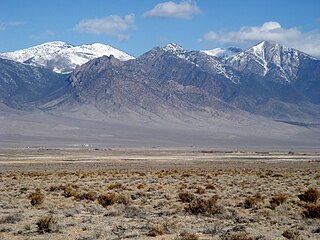
Ruby Valley is a large basin located in south-central Elko and northern White Pine counties in the northeastern section of the state of Nevada in the western United States. From Secret Pass it runs south-southwest for approximately 60 miles (96 km) to Overland Pass. To the west is the steep escarpment of the Ruby Mountains, and to the north is the East Humboldt Range and Clover Valley. The east side of the valley is less well defined, but its maximum width is about 10 miles (16 km) near Franklin Lake. At its south end lies the Ruby Lake National Wildlife Refuge.
Hopewell is an unincorporated community in Laurel County, Kentucky, United States. It lies at an elevation of 1260 feet.

The Te-Moak Tribe of Western Shoshone Indians of Nevada is a federally recognized tribe of Western Shoshone Indians in northeastern Nevada.
The Antelope Valley adjacent to the Nevada/Utah state line, and located in southeast Elko County and northeast White Pine County, Nevada is a 70 mi (113 km) long endorheic valley. The valley curves around the Dolly Varden and Kinsley Mountains, and the Antelope Range.

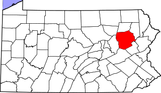
Japan is a small village in eastern Hazle Township, Luzerne County, Pennsylvania, located on Route 940. It is located just west of the borough of Jeddo and these two names were designated by the Hazleton Coal Company, which used the Japanese port of Jeddo. It is drained by the Black Creek, a tributary of the Nescopeck Creek, westward into the Susquehanna River. It is split between the Hazleton zip codes of 18201 and 18202.

Deep Creek Valley is a 35-mile (56 km) long valley located in southwest Tooele County at the Utah-Nevada border; the extreme south of the valley is in northwest Juab County. The valley parallels the west flank of the Deep Creek Range, both north-trending. In the north-northeast, its outlet widens into the southwest of the Great Salt Lake Desert region.
Cottonwood is a former community in Elko County, Nevada, United States. The community was a stagecoach station on the Shepherd toll road located 25 miles (40 km) south of Elko.
Coin is an unincorporated community in Elko County, in the U.S. state of Nevada.
West Deep Creek also known as Round Valley Creek, Spring Creek and West Creek is a tributary stream with its head at the confluence of Spring Creek and an unnamed stream, in White Pine County, Nevada, and its mouth in Tooele County, Utah at its confluence with East Deep Creek that forms the head of Deep Creek.
Ferber Hills is a range of hills in Elko County, Nevada and Tooele County, Utah. The range is formed in three parallel ridges of hills trending northwest to southeast. Its highest summit is Utah Peak, in the center of the central ridge of the range, at an elevation of 6,680 feet, just east of the state line in Tooele County, Utah. Its second highest Summit is Ferber Peak, that rises to and elevation of 6,601 feet, at the south end of the southernmost ridge of the range at 40°12′43″N114°03′18″W just west of the state line in Elko County, Nevada. The highest point in the smaller northernmost ridge is an unnamed summit at 40°17′12″N113°59′48″W with an elevation of 5,745 feet in Tooele County.
Tank Wash is a wash in Tooele County, Utah.
References
Coordinates: 40°09′00″N113°59′33″W / 40.15000°N 113.99250°W