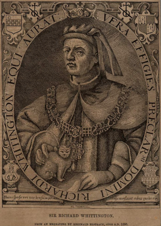
Richard Whittington of the parish of St Michael Paternoster Royal, City of London, was an English merchant and a politician of the late medieval period. He is also the real-life inspiration for the English folk tale Dick Whittington and His Cat. He was four times Lord Mayor of London, a member of parliament and a Sheriff of London. In his lifetime he financed a number of public projects, such as drainage systems in poor areas of medieval London, and a hospital ward for unmarried mothers. He bequeathed his fortune to form the Charity of Sir Richard Whittington which, nearly 600 years later, continues to assist people in need.
The Company of Watermen and Lightermen (CWL) is a historic City guild in the City of London. However, unlike the city's 111 livery companies, CWL does not have a grant of livery. Its meeting rooms are at Waterman's Hall on St Mary at Hill, London.

Cubitt Town is a district on the eastern side of the Isle of Dogs in London, England. This part of the former Metropolitan Borough of Poplar was redeveloped as part of the Port of London in the 1840s and 1850s by William Cubitt, Lord Mayor of London (1860–1862), after whom it is named. It is on the east of the Isle, facing the Royal Borough of Greenwich across the River Thames. To the west is Millwall, to the east and south is Greenwich, to the northwest Canary Wharf, and to the north — across the Blue Bridge — is Blackwall. The district is situated within the Blackwall & Cubitt Town Ward of Tower Hamlets London Borough Council.
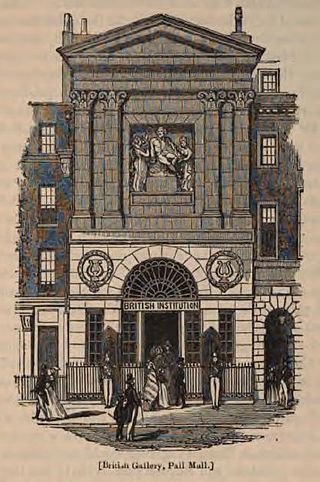
George Dance the Younger RA was an English architect and surveyor as well as a portraitist.

Christ Church Greyfriars, also known as Christ Church Newgate Street, was a church in Newgate Street, opposite St Paul's Cathedral in the City of London. Established as a monastic church in the thirteenth century, it became a parish church after the Dissolution of the Monasteries. Following its destruction in the Great Fire of London of 1666, it was rebuilt to the designs of Sir Christopher Wren. Except for the tower, the church was largely destroyed by bombing during the Second World War. The decision was made not to rebuild the church; the ruins are now a public garden.

Baynard's Castle refers to buildings on two neighbouring sites in the City of London, between where Blackfriars station and St Paul's Cathedral now stand. The first was a Norman fortification constructed by Ralph Baynard, 1st feudal baron of Little Dunmow in Essex, and was demolished by King John in 1213. The second was a medieval palace built a short distance to the south-east and later extended, but mostly destroyed in the Great Fire of London in 1666. According to Sir Walter Besant, "There was no house in [London] more interesting than this".
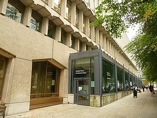
The Guildhall Library is a public reference library in London, England, specialising in subjects relevant to London and its history. It is administered by the Corporation of London, the government of the City of London, which is the historical heart of London. The collection has its greatest depth on topics specifically concerned with the City, but also contains much material on other parts of metropolitan London.
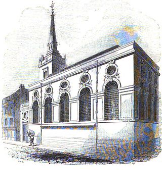
St. Michael Queenhithe was a church in the City of London located in what is now Upper Thames Street. First recorded in the 12th century, the church was destroyed during the Great Fire of London in 1666. Rebuilt by the office of Sir Christopher Wren, it was demolished in 1876.

St Michael Paternoster Royal is a church in the City of London. The original building, which was first recorded in the 13th century, was destroyed in the Great Fire of London in 1666. The church was rebuilt under the aegis of Sir Christopher Wren. However St Michael's was severely damaged during the London Blitz in the Second World War. It was restored between 1966 and 1968.

Vintry is one of the 25 wards of the City of London. Located within it is the City end of Southwark Bridge and, adjacent to that, the hall of the Worshipful Company of Vintners, the City livery company for the wine trade.

St Michael's Wood Street was a church and parish of medieval origin in Cripplegate Ward in the City of London, and is first mentioned in 1225 as St. Michael de Wudestrate. It stood on the west side of Wood Street, initially with a frontage on Huggin Lane but later on Wood Street itself.
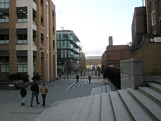
St Peter, Paul's Wharf, was a Church of England parish church in the City of London. It was destroyed in the Great Fire in 1666.

Kingston Museum is an accredited museum in Kingston upon Thames, southwest London, England. The Scottish-American philanthropist Andrew Carnegie funded the building of the museum, which adjoins Kingston Library.

Coldharbour, also spelled Cold Harbour, Cold Harborough, Cold Herbergh, Cold Herberge, and Cold Inn, were two London neighbouring estates in the since dissolved parishes of All-Hallows-the-Less and All-Hallows-the-Great, in today's Dowgate Ward of the City of London. From the 13th century to the mid-17th century Coldharbour occupied the area between Upper Thames Street and the Thames to the east of Cannon Street station. It was destroyed in the Great Fire of 1666. One of the estates was used by the Dukes of Exeter and briefly as a college of heralds.

Deptford Wharf in London, United Kingdom, is on the Thames Path southeast of South Dock Marina, across the culverted mouth of the Earl's Sluice and north of Aragon Tower. In the late 18th and early 19th century this area was used for shipbuilding with several building slips. With the coming of the railway in 1848 Deptford wharf and docks were used to import coal and for other goods. The housing here, completed in 1992, is on the site of former railway sidings and riverside wharves.
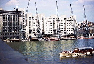
Fresh Wharf was a wharf located in the City of London close to London Bridge, on the north bank of the River Thames. The site was used as a quay in Roman times and later as an unloading place for Anglo-Saxon boats. A wharf was constructed there at some point in the medieval period and appears to have acquired its name from its customary usage as a landing place for fresh fish. In the 16th century, Fresh Wharf was made a "Legal Quay" authorised for the import of certain goods during the reign of Queen Elizabeth I of England. It expanded as London's river-borne trade grew in the 18th and 19th centuries, with large warehouses being established immediately behind the wharf. In the 20th century, the wharf's owners took over the adjoining wharves immediately upstream and downstream, built a new ten-storey warehouse and renamed the site New Fresh Wharf. By the end of the 1960s, however, London's docks had fallen into disuse with the advent of containerization, for which they were not suited, and the wharf was closed down in 1970. An office block was built on the site of the warehouse in 1977 and the former quayside is now part of a public footpath along the Thames.

Cox & Hammond's Quay was a wharf located in the City of London, on the north bank of the River Thames a short distance downstream from London Bridge. It was originally two separate quays, Cox's Quay and Hammond's Quay, separated by Gaunt's Quay. On the landward side, the wharf was accessed via Lower Thames Street just behind the site of the church of St Botolph Billingsgate.
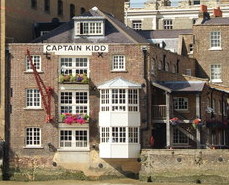
The Captain Kidd is a pub in Wapping, East London, that is named after the seventeenth century pirate William Kidd, who was executed at the nearby Execution Dock. The pub is a Grade II listed building, and was historically used as a coffee warehouse.
Botolph Wharf or St Botolph's Wharf was a wharf located in the City of London, on the north bank of the River Thames a short distance downstream from London Bridge. It was situated between Cox and Hammond's Quay upstream and Nicholson's Wharf downstream. On the landward side, the wharf was accessed via Thames Street. It had a frontage of 78 ft (24 m). The wharf was used for at least a thousand years before being destroyed during the Second World War. A late 1980s office building currently occupies the site.

Stratford-upon-Avon Guildhall is a historic building in Church Street, Stratford-upon-Avon, Warwickshire, England. It is a Grade I listed building. Dating from the early 15th century, the Guildhall was for centuries at the centre of life in Stratford, being used for assemblies, as a meeting place for the local council, and as a school building for the King Edward VI School. Most famously William Shakespeare almost certainly attended school here. The building was opened to the public in 2016, after being restored.


