
The Youghiogheny River, or the Yough for short, is a 134-mile-long (216 km) tributary of the Monongahela River in the U.S. states of West Virginia, Maryland, and Pennsylvania. It drains an area on the west side of the Allegheny Mountains northward into Pennsylvania, providing a small watershed in extreme western Maryland into the tributaries of the Mississippi River. Youghiogheny is a Lenape word meaning "a stream flowing in a contrary direction".

A water gap is a gap that flowing water has carved through a mountain range or mountain ridge and that still carries water today. Such gaps that no longer carry water currents are called wind gaps. Water gaps and wind gaps often offer a practical route for road and rail transport to cross the mountain barrier.

Blue Mountain Ridge, Blue Mountain, or the Blue Mountains of Pennsylvania is part of the geophysical makeup of the Ridge-and-Valley Appalachians in the U.S. state of Pennsylvania. It is a ridge that forms the southern and eastern edge of the Appalachian mountain range spanning over 255 miles (410 km) from the Delaware Water Gap as it cuts across the eastern half of the state on a slight diagonal from New Jersey tending southerly until it turns southerly curving into Maryland, and beyond.

Chartiers is a neighborhood in Pittsburgh, Pennsylvania's west area. It has a zip code of 15204, and has representation on Pittsburgh City Council by the council member for District 2. The neighborhood was named after Peter Chartier, a trapper of French and Native American parentage who established a trading post at the mouth of Chartiers Creek in 1743.

Esplen is a neighborhood in Pittsburgh, Pennsylvania's west city area. It has a zip code of 15204, and has representation on Pittsburgh City Council by the council member for District 2.

Cowans Gap State Park is a 1,085-acre (439 ha) Pennsylvania state park in Todd Township, Fulton County and Metal Township, Franklin County, Pennsylvania in the United States. The park is largely surrounded by Buchanan State Forest in Allens Valley just off Pennsylvania Route 75 near Fort Loudon.

The Geography of Pennsylvania varies from sea level marine estuary to mountainous plateau, is significant for its natural resources and ports, and is notable for its role in the history of the United States.
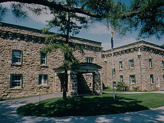
Kings Gap Environmental Education Center is a 1,454-acre (588 ha) Pennsylvania state park in Cooke, Dickinson and Penn Townships, Cumberland County, Pennsylvania in the United States. The Commonwealth of Pennsylvania acquired the land in 1973, from the C. H. Masland and Son Carpet Company. Kings Gap Environmental Education Center is 2.5 miles (4.0 km) from Pennsylvania Route 233 on South Mountain.

The Nittany Valley is an eroded anticlinal valley in the central portion of Centre County, Pennsylvania in the United States. It is separated from the Bald Eagle Valley by Bald Eagle Mountain and from Penns Valley by Mount Nittany. The valley is closed to the north by a high plateau that joins these two mountain ridges, but is open to the south at the southern terminus of Mount Nittany. The valley drains to the Bald Eagle Creek through water gaps in Bald Eagle Mountain formed by Spring Creek, and Fishing Creek, along with smaller streams running through Curtain Gap and Howard Gap. The Northwest side of the valley between the Bald Eagle Mountain ridge and the lower Sand Ridge is also known as the "Little Nittany Valley".

Evitts Creek is a tributary stream of the North Branch Potomac River in the U.S. states of Pennsylvania and Maryland. The confluence of Evitts Creek and the North Branch Potomac River is located 2 miles (3 km) east of Cumberland, Maryland.

Tussey Mountain is a stratigraphic ridge in central Pennsylvania, United States, trending east of the Bald Eagle, Brush, Dunning and Evitts Mountain ridges. Its southern foot just crosses the Mason–Dixon line near Flintstone, Maryland, running north 130 km (80 mi) to the Seven Mountains of central Pennsylvania, near Tusseyville, making it one of the longest named ridges in this section of the Ridge-and-valley Appalachians. The ridge line separates Morrison Cove from the Woodcock Valley and Friends Cove from the Black Valley. Tussey Mountain lies in, and the ridge line forms parts of the borders of, Centre, Blair, Bedford and Huntingdon counties.

The Geology of Pennsylvania consists of six distinct physiographic provinces, three of which are subdivided into different sections. Each province has its own economic advantages and geologic hazards and plays an important role in shaping everyday life in the state. They are: the Atlantic Coastal Plain Province, the Piedmont Province, the New England Province, the Ridge and Valley Province, the Appalachian Plateau Province, and the Central Lowlands Province.
Kieran Purcell is an Irish retired sportsperson. He played hurling with his local club Windgap and was a member of the Kilkenny senior inter-county team from 1971 until 1977.

Tullahought is a small village in south Kilkenny. Tullahought, also a townsland in the area, is located approximately 8 miles north of Carrick on Suir and 25 miles south of Kilkenny City. The village, itself located in the towns land of Kilmacoliver and Poulrone is best known for its association with the Ormonde Slate Quarries which is situated at the foot of the Booly Hills, on which Tullahought is situated.
Windgap GAA is a Gaelic Athletic Association club located in Windgap, County Kilkenny, Ireland. The club was founded in 1954 and is almost exclusively concerned with the game of hurling .Windgap are a Junior club located in South Kilkenny on the Tipperary border. Senior County hurlers from the club are Kieran Purcell and Paddy Walsh. Due to low numbers the underage team amalgamated with Galmoy in 2006 and won the "B" league the same year, they are still joined together in underage levels and have had some good successes. The Juniors have not had any major successes in recent years and are still slugging away in Junior.
Windgap also have a successful senior Camogie team. Senior County camogie players from the club include Denise Gaule and Catherine Foley. The camogie club has enjoyed multiple successes, most recently the under 16 camogie team has won the rionn B county final, 2016.

The gaps of the Allegheny, meaning gaps in the Allegheny Ridge in west-central Pennsylvania, is a series of escarpment eroding water gaps along the saddle between two higher barrier ridge-lines in the eastern face atop the Allegheny Ridge or Allegheny Front escarpment. The front extends south through Western Maryland and forms much of the border between Virginia and West Virginia, in part explaining the difference in cultures between those two post-Civil War states. While not totally impenetrable to daring and energetic travelers on foot, passing the front outside of the water gaps with even sure footed mules was nearly impossible without navigating terrain where climbing was necessary on slopes even burros would find extremely difficult.

Kells is a barony in the south-west of County Kilkenny, Ireland. It is one of 12 baronies in County Kilkenny. The size of the barony is 155.6 square kilometres (60.1 sq mi). There are 10 civil parishes in Kells, made up of 167 townlands. The chief town is Kells.
The 1974 Kilkenny Senior Hurling Championship was the 80th staging of the Kilkenny Senior Hurling Championship since its establishment by the Kilkenny County Board.


