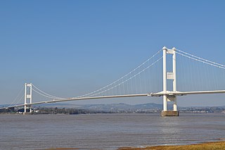
Wye Bridge is a section of the Severn Bridge, the first road bridge built over the Severn Estuary which now carries the M48 motorway.
Wye Bridge may also refer:

The River Severn, at 220 miles (354 km) long, is the longest river in Great Britain. It is also the river with the most voluminous flow of water by far in all of England and Wales, with an average flow rate of 107 m3/s (3,800 cu ft/s) at Apperley, Gloucestershire. It rises in the Cambrian Mountains in mid Wales, at an altitude of 2,001 feet (610 m), on the Plynlimon massif, which lies close to the Ceredigion/Powys border near Llanidloes. The river then flows through Shropshire, Worcestershire and Gloucestershire. The county towns of Shrewsbury and Gloucester and the City of Worcester lie on its course.

The River Wye is the fourth-longest river in the UK, stretching some 250 kilometres from its source on Plynlimon in mid Wales to the Severn estuary. For much of its length the river forms part of the border between England and Wales. The Wye Valley is designated an Area of Outstanding Natural Beauty. The Wye is important for nature conservation and recreation, but is severely affected by pollution.

The A48 is a trunk road in Great Britain running from the A40 at Highnam, 3 miles (4.8 km) west of Gloucester, England, to the A40 at Carmarthen, Wales. Before the Severn Bridge opened on 8 September 1966, it was a major route between England and South Wales. For most of its route, it runs almost parallel to the M4 motorway. During times of high winds at the Severn Bridge, the A48 is used as part of the diversion route and is still marked as a Holiday Route.

The M48 is a 13-mile (21 km) long motorway in Great Britain, which crosses the Severn near Chepstow, Monmouthshire, linking England with Wales via the Severn Bridge. This road used to be the M4, and as a result is anomalously numbered: as it lies to the north of the M4 and to the west of the M5, it is in the Motorway Zone 5. The M4, M48 and the A48(M) motorway are the only motorways in Wales.

Tidenham is a village and civil parish in the Forest of Dean of west Gloucestershire, England, adjoining the Welsh border. Tidenham is bounded by the River Wye to the west and the River Severn to the south. Offa's Dyke runs through the western part of the parish, terminating at Sedbury cliff above the River Severn.

Lydney railway station is a railway station serving the town of Lydney in Gloucestershire, England. It is located on the Gloucester-Newport line. The station is located a mile south of Lydney, and was originally called Lydney Junction, which is now the name of the nearby station on the preserved Dean Forest Railway.

The Severn Bridge is a motorway suspension bridge that spans the River Severn between South Gloucestershire in England and Monmouthshire in South East Wales. It is the original Severn road crossing between England and Wales, and took three and a half years to build, at a cost of £8 million. It replaced the 137-year-old Aust Ferry.

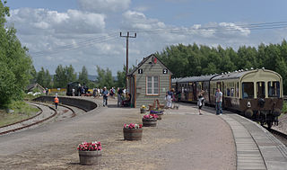
Lydney Junction railway station is a railway station near Lydney in Gloucestershire. The station is now the southern terminus of the Dean Forest Railway. It is located to the south of Lydney, near the A48 road.

The A466, also known as the Wye Valley Road, is a road from Hereford, England to Chepstow, Wales via Monmouth, Tintern and the Wye Valley.

Aust Severn Powerline Crossing is the longest overhead power line span in the United Kingdom with a length of 1,618 m (5,308 ft).

The Severn and Wye Railway began as an early tramroad network established in the Forest of Dean to facilitate the carriage of minerals to watercourses for onward conveyance. It was based on Lydney, where a small harbour was constructed, and opened its line to Parkend in 1810. It was progressively extended northwards, and a second line, the Mineral Loop was opened to connect newly opened mineral workings.

The Lydney Canal is a one-mile canal in Gloucestershire that runs inland from the River Severn to Lydney. It was opened in 1813 to trans-ship iron and coal from the Forest of Dean. It was once connected by a horse-drawn tramroad to Pidcock's Canal which brought materials down to the wharves by tub-boat.

The Wye Valley Railway was a standard gauge railway that ran for nearly 15 miles (24 km) along the Lower Wye Valley between the towns of Chepstow and Monmouth, crossing several times between Wales and England. Opened on 1 November 1876, it was leased to, and worked by, the Great Western Railway (GWR), before being fully absorbed by the GWR in 1905.

Berkeley railway station served the town of Berkeley in Gloucestershire, England. The station was on the Sharpness Branch Line, part of the Midland Railway (MR), which connected the Bristol and Gloucester Railway main line at Berkeley Road station with the docks at Sharpness.
The Coleford Railway was a railway company that constructed a short railway from near Monmouth to Coleford, close to the Forest of Dean. The company was sponsored by the Great Western Railway. It was built on part of the course of the Monmouth Railway, a horse-operated plateway, and it was intended that its primary business would be the conveyance of minerals and forest products from the Forest of Dean.

The Ross and Monmouth Railway was a standard gauge railway of 13 miles (21 km) which ran between Ross-on-Wye, in Herefordshire, England and Monmouth, Wales.

The Severn Bridge Railway was a railway company which constructed a railway from Lydney to Sharpness in Gloucestershire, England. It was intended chiefly to give access for minerals in the Forest of Dean to Sharpness Docks, and the company built a long bridge, 1,387 yards (1,268 m) in length, over the River Severn. The line opened in 1879.