Worcestershire is a county in the West Midlands of England. The area that is now Worcestershire was absorbed into the unified Kingdom of England in 927, at which time it was constituted as a county. Over the centuries the county borders have been modified, but it was not until 1844 that substantial changes were made. This culminated with the abolition of Worcestershire in 1974 with its northern area becoming part of the West Midlands and the rest part of the county of Hereford and Worcester. However, in 1998 the county of Hereford and Worcester was abolished and Worcestershire was reconstituted without the northern area, which was ceded to the West Midlands.

Kidderminster is a large market and historic minster town and civil parish in Worcestershire, England, 17 miles (27 km) south-west of Birmingham and 15 miles (24 km) north of Worcester. Located north of the River Stour and east of the River Severn, in the 2011 census, it had a population of 55,530. The town is twinned with Husum, Germany.
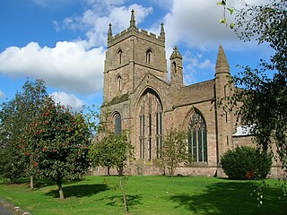
Leominster is a market town in Herefordshire, England, at the confluence of the River Lugg and its tributary the River Kenwater. The town is 12 miles north of Hereford and seven miles south of Ludlow in Shropshire. With a population of 11,700, Leominster is the largest of the five towns in the county.

Bewdley is a town and civil parish in the Wyre Forest District in Worcestershire, England on the banks of the River Severn. It is in the Severn Valley three miles west of Kidderminster and 22 miles (35 km) southwest of Birmingham. It lies on the River Severn, at the gateway of the Wyre Forest national nature reserve, and at the time of the 2011 census had a population of 9,470. Bewdley is a popular tourist destination and is known for the Bewdley Bridge, designed by Thomas Telford, and the well preserved Georgian riverside.

Poulton-le-Fylde, commonly shortened to Poulton, is a market town in Lancashire, England, situated on the coastal plain called the Fylde. In the 2001 United Kingdom census, it had a population of 18,264. There is evidence of human habitation in the area from 12,000 years ago and several archaeological finds from Roman settlement in England have been found in the area. At the time of the Norman conquest, Poulton was a small agricultural settlement in the hundred of Amounderness. The church of St Chad was recorded in 1094 when it was endowed to Lancaster Priory. By the post-Medieval period the town had become an important commercial centre for the region with weekly and triannual markets. Goods were imported and exported through two harbours on the River Wyre. In 1837, the town was described as the "metropolis of the Fylde", but its commercial importance waned from the mid-19th century with the development of the nearby coastal towns of Fleetwood and Blackpool.

Fleetwood is a coastal town in the Borough of Wyre in Lancashire, England, at the northwest corner of the Fylde. It had a population of 25,939 at the 2011 census.
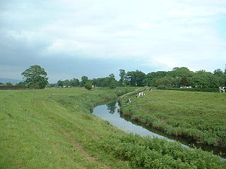
The River Wyre is a river in Lancashire, England, United Kingdom, which flows into the Irish Sea at Fleetwood. It is approximately 28 miles (45 km) in length. The river is a County Biological Heritage Site and has a sheltered estuary which, from its northwest corner, penetrates deep into the almost square peninsula of the Fylde.
Weir has several different meanings:

Wyre Piddle is a village and civil parish in the Wychavon district of Worcestershire, England. It is on the River Avon, near where that river is joined by the Piddle Brook - between Evesham and Pershore.

Preesall is a town, civil parish and electoral ward in Lancashire, England. The parish covers the eastern bank of the estuary of the River Wyre, including Knott End-on-Sea, Pilling Lane and the village of Preesall itself. The parish of Preesall had a population of 5,314 recorded in the 2001 census, rising to 5,694 at the 2011 census.

107.2 The Wyre was a local commercial radio station serving Kidderminster, Bewdley, Stourport-on-Severn, Stourbridge and Bromsgrove in England. The station was owned by MNA Broadcasting but was sold to UTV Media and merged on Monday 26 March 2012 with The Severn and 107.7 The Wolf to form Signal 107, a station also serving the Wolverhampton, Shropshire and north Worcestershire area.

Severn Area Rescue Association (SARA) or Severn Rescue is an independent, marine and land based, search and rescue organisation covering the Severn Estuary and upper reaches of the River Severn. SARA is the largest independent lifeboat service in the UK, second only to the RNLI, with 22 operational inshore lifeboats, 20 vehicles and approximately 200 personnel. They receive no funding from the RNLI.
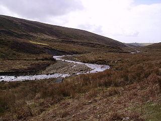
The River Calder is a 13-mile (21 km) long river that is one of the main tributaries of the River Wyre in Lancashire, England. Like the other rivers in England with the name Calder, its name is thought to derive from a mixture of Old Welsh and Old British words meaning "hard and violent water or stream".

Pilling is a village and civil parish within the Wyre borough of Lancashire, England. It is 6.5 miles (10.5 km) north-northeast of Poulton-le-Fylde, 9.4 miles (15.1 km) south-southwest of Lancaster and 14.5 miles (23.3 km) northwest of Preston, in a part of the Fylde known as Over Wyre.

Garstang is an ancient market town and civil parish within the Wyre borough of Lancashire, England. It is 10 miles (16 km) north of the city of Preston and the same distance south of Lancaster.

Inskip-with-Sowerby is a civil parish in the Borough of Wyre, in Lancashire, England. A part of the Fylde, the parish includes the village of Inskip and the hamlets Crossmoor to the west and Sowerby to the east. Also Inskip Moss Side lies about a mile north-west of the village at grid reference SD452391. In 2011 it had a population of 840.

The Bewdley School is a senior school and sixth form in Bewdley, serving north-west Worcestershire, England. Its campus is very close to the River Severn and lies on the border of the Wyre Forest national nature reserve. Bewdley is an educational research partner of the University of Worcester and University of Birmingham and is recognised for its focus on international and cultural education. In 2019, Bewdley hosted the Global Happiness Conference in partnership with the British Council.
An arrow is a projectile launched from a bow.

Hillylaid Pool is a water channel running through the Fylde and Wyre areas of Lancashire in England. It is 4.55 miles (7.32 km) long, and it is part of the Fleetwood Peninsula Tributary catchment area.