An Internet Protocol address is a numerical label such as 192.0.2.1 that is connected to a computer network that uses the Internet Protocol for communication. An IP address serves two main functions: network interface identification and location addressing.

The M62 is a 107-mile-long (172 km) west–east trans-Pennine motorway in Northern England, connecting Liverpool and Hull via Manchester, Bradford, Leeds and Wakefield; 7 miles (11 km) of the route is shared with the M60 orbital motorway around Manchester. The road is part of the unsigned Euroroutes E20 and E22.
U.S. Route 53, or U.S. Highway 53 (U.S. 53), is a north–south U.S. highway that runs for 403 miles (649 km) from La Crosse, Wisconsin to International Falls, Minnesota. It is the primary north–south route in northwestern Wisconsin, serving as a vital link between I-94 at Eau Claire, Wisconsin and the Twin Ports of Superior, Wisconsin, and Duluth, Minnesota. The entire route from Eau Claire to the city limits of Superior is a four lane divided highway. The highway's northern terminus is at the Fort Frances-International Falls Bridge in International Falls, Minnesota, at the Canada–US border. Its southern terminus is in La Crosse, Wisconsin, at U.S. Highway 14.

Wheels is a bus service that provides public transportation in the Tri-Valley Region of the San Francisco Bay Area, in the United States. Started in 1986, Wheels offers service to various communities in three cities, and connects to Bay Area Rapid Transit (BART) and Altamont Corridor Express (ACE) trains for connections to and from the greater Bay Area and Central Valley.

In computing, Serial Attached SCSI (SAS) is a point-to-point serial protocol that moves data to and from computer-storage devices such as hard disk drives and tape drives. SAS replaces the older Parallel SCSI bus technology that first appeared in the mid-1980s. SAS, like its predecessor, uses the standard SCSI command set. SAS offers optional compatibility with Serial ATA (SATA), versions 2 and later. This allows the connection of SATA drives to most SAS backplanes or controllers. The reverse, connecting SAS drives to SATA backplanes, is not possible.
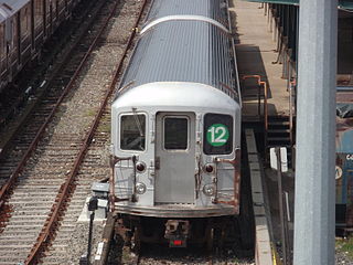
The New York City Subway currently uses various letters and numbers to designate the routes that trains use over the differing lines in the system. Along with the color corresponding to the route's trunk line, these form a unique identifier for the route, easing navigation through the complex system. Several service labels have either been phased out or never been used. This list covers the labels not used as of June 2021.

The Capital District Transportation Authority (CDTA) is a New York State public-benefit corporation overseeing a number of multi-modal parts of public transportation in the Capital District of New York State. CDTA runs local and express buses, including an express bus service called BusPlus between Albany and Schenectady, and day-to-day management of three Amtrak stations in the Capital region–the Albany-Rensselaer, Schenectady and Saratoga Springs Amtrak stations.

The N59 road is a national secondary road in Ireland. It commences in County Sligo, south of Sligo Town at the Belladrehid interchange with the N4 north of Ballysadare. The route circles around the west of Ireland, passing west from Sligo into County Mayo and through Ballina. The N59 continues around Mayo, proceeding indirectly to Westport. Continuing south through Mayo into County Galway, the road passes through the village of Leenaun. The 182-year-old bridge in the centre of the village, carrying the road across the River Lahill, collapsed in floods on 18 July 2007. Due to the local terrain and road network, the diversionary route for getting from the south of the village to Westport was 110 km long. A temporary bridge was opened eight days after the floods, on 27 July. It has since been replaced by a new bridge.

Helsby railway station serves the village of Helsby in Cheshire, England. It is recorded in the National Heritage List for England as a Grade II listed building.
Sony's LocationFree is the marketing name for a group of products and technologies for timeshifting and placeshifting streaming video. The LocationFree Player is an Internet-based multifunctional device used to stream live television broadcasts, DVDs and DVR content over a home network or the Internet. It is in essence a remote video streaming server product. It was first announced by Sony in Q1 2004 and launched early in Q4 2004 alongside a co-branded wireless tablet TV. The last LocationFree product was the LF-V30 released in 2007.

The Jurassic Coaster is an open top bus service operated by the Weymouth branch of First Hampshire & Dorset, running around the Jurassic coastline of the county of Dorset. It features five unique routes, stretching from Axminster in the west to Poole in the east, with one of the routes in TripAdvisor's 2018 poll of most scenic bus routes coming in 12th place.
This page is based on this
Wikipedia article Text is available under the
CC BY-SA 4.0 license; additional terms may apply.
Images, videos and audio are available under their respective licenses.