This page is based on this
Wikipedia article Text is available under the
CC BY-SA 4.0 license; additional terms may apply.
Images, videos and audio are available under their respective licenses.
Sukhothai Thani is a small town about 427 km (265 mi) north of Bangkok on the River Yom, a tributary of the Chao Phraya River. The population is 37,000. The town is 12 km (7.5 mi) east of the historic city of Sukhothai. This city was the capital of the first Thai kingdom, usually called the Sukhothai Kingdom, hence the modern city is often called New Sukhothai. Sukhothai Thani is the capital of Sukhothai Province.

Uthai Thani is one of the provinces (changwat) of Thailand. Neighboring provinces are Nakhon Sawan, Chai Nat, Suphan Buri, Kanchanaburi, and Tak. It is in Thailand's lower northern region, somewhat off the route between Bangkok and Chiang Mai. It is approximately 200 km from Bangkok.

Chai Nat is one of the central provinces (changwat) of Thailand. Neighbouring provinces are Nakhon Sawan, Sing Buri, Suphan Buri, and Uthai Thani. The town of Chai Nat is 188 km north of Bangkok.

Ang Thong is a town in Thailand, capital of Ang Thong Province. The town covers the entirety of tambon Talat Luang and Bang Kaeo as well as parts of the tambon Sala Daeng, Ban Hae, Ban It, Pho Sa, and Yansue, all of Mueang Ang Thong District. As of 2006 it had a population of 13,738. The town is on the Chao Phraya River.
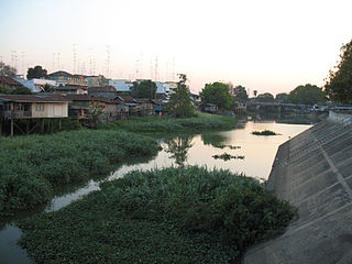
The Lopburi River is a tributary of the Chao Phraya River in central Thailand. It splits from the Chao Phraya river at Tambon Bang Phutsa, Singburi. Passing through Tha Wung district and the town of Lopburi, it enters the Chao Phraya together with the Pa Sak River at the town of Ayutthaya. It is about 95 kilometres (59 mi) long.
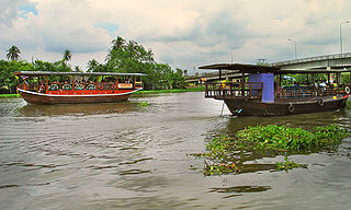
The Tha Chin river is a distributary of the Chao Phraya river, Thailand. It splits near the province of Chai Nat and then flows west from the Chao Phraya through the central plains, until it empties into the Gulf of Thailand in Samut Sakhon Province.
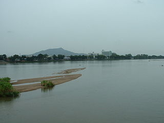
The Ping River, along with the Nan River, is one of the two main tributaries of the Chao Phraya River. It originates at Doi Thuai in the Daen Lao Range, in Chiang Dao district, Chiang Mai Province. After passing Chiang Mai, it flows through the provinces of Lamphun, Tak, and Kamphaeng Phet. At the confluence with the Nan River at Nakhon Sawan, it forms the Chao Phraya River.
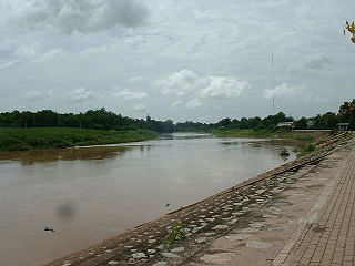
The Nan River is a river in Thailand. It is one of the most important tributaries of the Chao Phraya River.

The Yom River is a river in Thailand. It is the main tributary of the Nan River. The Yom River has its source in the Phi Pan Nam Range in Pong District, Phayao Province. Leaving Phayao, it flows through Phrae and Sukhothai as the main water resource of both provinces before it joins the Nan River at Chum Saeng District, Nakhon Sawan Province.

The Sakae Krang River is a tributary of the Chao Phraya River. It originates in Mae Wong National Park, Nakhon Sawan Province. It is 225 kilometres (140 mi) long, with most of its length in Uthai Thani Province. It joins the Chao Phraya River in Uthai Thani city near the Wat Tha Sung.
The Wat Ta Yom River is a tributary of the Nan River in Thailand.
The Noi River is a river in Thailand.

Thailand has 25 river basins with 254 sub-basins. Rainwater is one of the most important sources of water. Thailand's water resource per capita is less than that of other countries in the region.
Khlong Muak Lek or Huai Muak Lek is a watercourse of Thailand. It is a tributary of the Pa Sak River, part of the Chao Phraya River basin.
Khlong Lam Kong is a watercourse in Phetchabun Province, Thailand. It is a tributary of the Pa Sak River, part of the Chao Phraya River basin.
Lam Phaya Klang is a river of Thailand. It is a tributary of the Pa Sak River, part of the Chao Phraya River basin.

The Bhumibol Dam is a concrete arch dam on the Ping River, a tributary of the Chao Phraya River, in Sam Ngao District of Tak Province, Thailand. It is about 480 km (298 mi) north of Bangkok and was built for the purposes of water storage, hydroelectric power production, flood control, fisheries and saltwater intrusion management. The dam was named after King Bhumibol Adulyadej and it was Thailand's first multi-purpose project.
