Yakima Hill is a neighborhood in the North End of Tacoma, Washington. Commonly confused with the adjacent North Slope, Yakima Hill is a distinct area. Generally, the area is defined as bordering North I Street to the south-southwest and Tacoma Avenue to the north-northeast, with another portion extending from Tacoma Avenue to the south, North Borough Road to the west, North Stadium Way to the north and northeast, and North 3rd Street to the east.
North Tacoma is a neighborhood in Tacoma, Washington, in the United States. The area is most known for waterfront parks and restaurants, the Point Defiance Park, the University of Puget Sound, Stadium High School, and the Tacoma Narrows Bridge.
Tacoma is a mid-sized urban port city and the county seat of Pierce County, Washington, United States. The city is on Washington's Puget Sound, 32 miles (51 km) southwest of Seattle, 31 miles (50 km) northeast of the state capital, Olympia, and 58 miles (93 km) northwest of Mount Rainier National Park. The population was 198,397, according to the 2010 census. Tacoma is the second-largest city in the Puget Sound area and the third largest in the state. Tacoma also serves as the center of business activity for the South Sound region, which has a population of around 1 million.
The North Slope is a neighborhood of the north end of Tacoma, Washington, located south of Yakima Hill.
Primarily residential, Yakima Hill is at a slope and is so named because North Yakima Avenue passes through it. The area is quiet, and fairly wealthy, with a private tennis club and the Annie Wright School.
A geographic coordinate system is a coordinate system that enables every location on Earth to be specified by a set of numbers, letters or symbols. The coordinates are often chosen such that one of the numbers represents a vertical position and two or three of the numbers represent a horizontal position; alternatively, a geographic position may be expressed in a combined three-dimensional Cartesian vector. A common choice of coordinates is latitude, longitude and elevation. To specify a location on a plane requires a map projection.
This page is based on this Wikipedia article Text is available under the CC BY-SA 4.0 license; additional terms may apply. Images, videos and audio are available under their respective licenses.
Related Research Articles
Midland is a census-designated place (CDP) in Pierce County, Washington, United States. The population was 7,414 at the 2000 census.
Capitol Hill is a densely populated, residential district in Seattle, Washington, United States. It is one of the city's most prominent nightlife and entertainment districts and is the center of the city's LGBT and counterculture communities.
The Denny Triangle is a neighborhood in Seattle, Washington, USA, that stretches north of the central business district to the grounds of Seattle Center. Its generally flat terrain was originally a steep hill, taken down as part of a mammoth construction project in the first decades of the 20th century known as the Denny Regrade, which is another name for the neighborhood on the regraded area. The name Denny Triangle, referring to the northeastern portion of this regrading project, is a term that has gained currency as this neighborhood has seen increasing development in the first decades of the 21st Century.
Calvary Cemetery is a Roman Catholic cemetery in Seattle, Washington, USA, located in the Ravenna/Bryant neighborhood. Dedicated over 129 years ago on December 1, 1889, it is on the southwest slope of a hill overlooking University Village, about a mile (1.6 km) northeast of the University of Washington. The cemetery is owned and operated by the Archdiocese of Seattle.
Dr. Jose Rizal Park is a 9.6 acre park on the west slope of Beacon Hill in Seattle, Washington. The land, condemned by the city in 1917 for engineering purposes, was acquired by the Parks Department in 1971, and the park was dedicated eight years later. The park is named after José Rizal, national hero of the Philippines.
Mission Street is a north-south arterial thoroughfare in Daly City and San Francisco, California that runs from Daly City's southern border to San Francisco's northeast waterfront. The street and San Francisco's Mission District through which it runs were named for the Spanish Mission Dolores, several blocks away from the modern route. Only the southern half is historically part of El Camino Real, which connected the missions. Part of Mission Street in Daly City is signed as part of State Route 82.
Crown Hill is a neighborhood in the city of Seattle, in the U.S. state of Washington.
The Stadium District is a neighborhood of the north end of Tacoma, Washington, USA. It is named after Stadium High School, a historic landmark.
Filbert Street in San Francisco, California starts at Lyon Street on the east edge of The Presidio and runs east, crossing Van Ness Avenue and Columbus Avenue. It ends on Telegraph Hill at Kearny Street below Coit Tower and eventually resumes as a pedestrian stairway known as the Filbert Street Steps.
Hawthorne Hills is a residential neighborhood in Seattle, Washington. On the City's Atlas, it is split between Bryant and Windermere, but is generally recognized as a distinct neighborhood. The northern boundary is Northeast 65th Street. The southern and eastern boundary is Sand Point Way. The western boundary is 40th Avenue Northeast. Hawthorne Hills is bounded on the north by View Ridge, on the east by Windermere, on the south by Laurelhurst, and on the west by Bryant. There is a sign for the neighborhood along Sand Point Way.
Squire Park is a district in the city of Seattle, in the U.S. state of Washington. According to the Squire Park Community Council, it is bounded on the south by S. Jackson Street, on the west by 12th Avenue and 12th Avenue S., on the north by E. Union Street, and on the east by 23rd Avenue and 23rd Avenue S., placing it within what are commonly thought of as First Hill and the Central District. Its main thoroughfares are E. Jefferson and Cherry Streets and E. Yesler Way and 14th Avenue. Swedish Medical Center's Cherry Hill campus is located here, Seattle University, a Jesuit University has part of its campus in Squire Park, as the Admissions, some dormitories and Athletics departments are east of 12th Avenue.
Northeast Tacoma is a neighborhood in Tacoma, Washington. The generally accepted borders of Northeast Tacoma are the Port of Tacoma to the southwest, the unincorporated Fife Heights area to the southeast, the end of incorporated Tacoma at the Browns Point border to the northwest, and the King County border to the northeast. Its nearly 17,000 residents — roughly one in 12 Tacomans — are severed from the rest of the city by the shipyards, container cranes and grit of the Port of Tacoma.
Downtown Tacoma is approximately bounded by east-west by A Street and Tacoma Avenue, and north-south by South 7th Street and South 25th Street, in the inner Northeast section of Tacoma. The center of downtown is the intersection of 9th and Broadway. The city Christmas tree is located here as well.
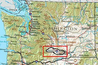
The Yakima Valley AVA was the first American Viticultural Area established within Washington State, gaining the recognition in 1983. Part of the larger Columbia Valley AVA, Yakima Valley AVA is home to more than 11,000 acres (45 km2) of vineyards, giving the area the largest concentration of wineries and vineyards in the state of Washington. The most widely planted varietals in the area are Chardonnay, Riesling, Merlot, Cabernet Sauvignon, Pinot gris, and Syrah. Nearly 40% of Washington state yearly wine production is made from Yakima Valley grapes. In addition to grapes, the Yakima Valley is also home to several fruit orchards growing apples, cherries, nectarines, peaches, pears and plums. Around the town of Zillah, there is the Zillah Fruit Loop driving tour through the area's orchards and vineyards. The area is also home to nearly 80% of the US hop production.
The McCarver Neighborhood is located in Tacoma, Washington. It is an urban neighborhood located in the Downtown and the Hilltop area of Tacoma.
The Tacoma Streetcar Disaster was a public transportation accident that took place in Tacoma, WA on July 4, 1900 when an overloaded streetcar failed to negotiate a curve and plunged down an embankment near a trestle that spans today's South Tacoma Way. The accident resulted in 43 deaths and approximately 65 injuries, many serious.
The Cornwall Hills are a range of mountainous hills in the Thompson Country of the Interior of British Columbia, Canada. They are located west and southwest of the communities of Cache Creek and Ashcroft and form the divide between the basin of the Thompson and that of Upper Hat Creek to the west. Named for Clement Francis Cornwall, distinguished colonist and later Lieutenant-Governor of British Columbia, and his brother Henry, who owned the Ashcroft Manor Ranch, also known as the Cornwall Ranch, which lay on the western slope of these hills. To their north are the Trachyte Hills, as far as the middle basin of Hat Creek and ending at Lower Hat Creek, and to their south is part of the Clear Range which forms the rest of the basin divide around Hat Creek.