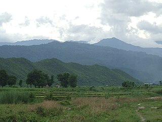
Yaw River or Ywa River is a river of Burma, a tributary of the Irrawaddy. It flows into the Irrawaddy on the right (west) just above the town of Seikpyu, [1] at 20°54′13″N94°48′39″E / 20.90361°N 94.81083°E / 20.90361; 94.81083 .

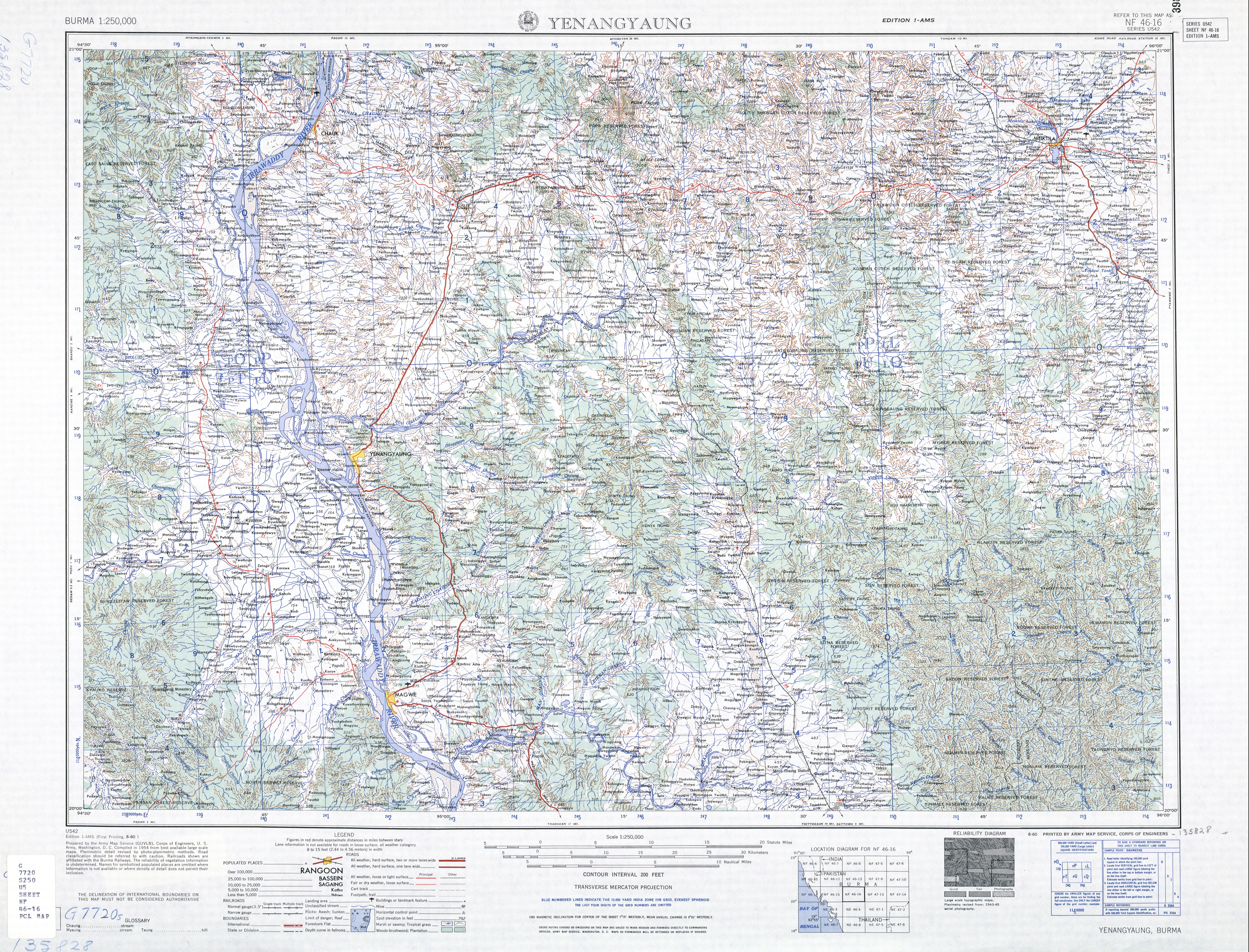
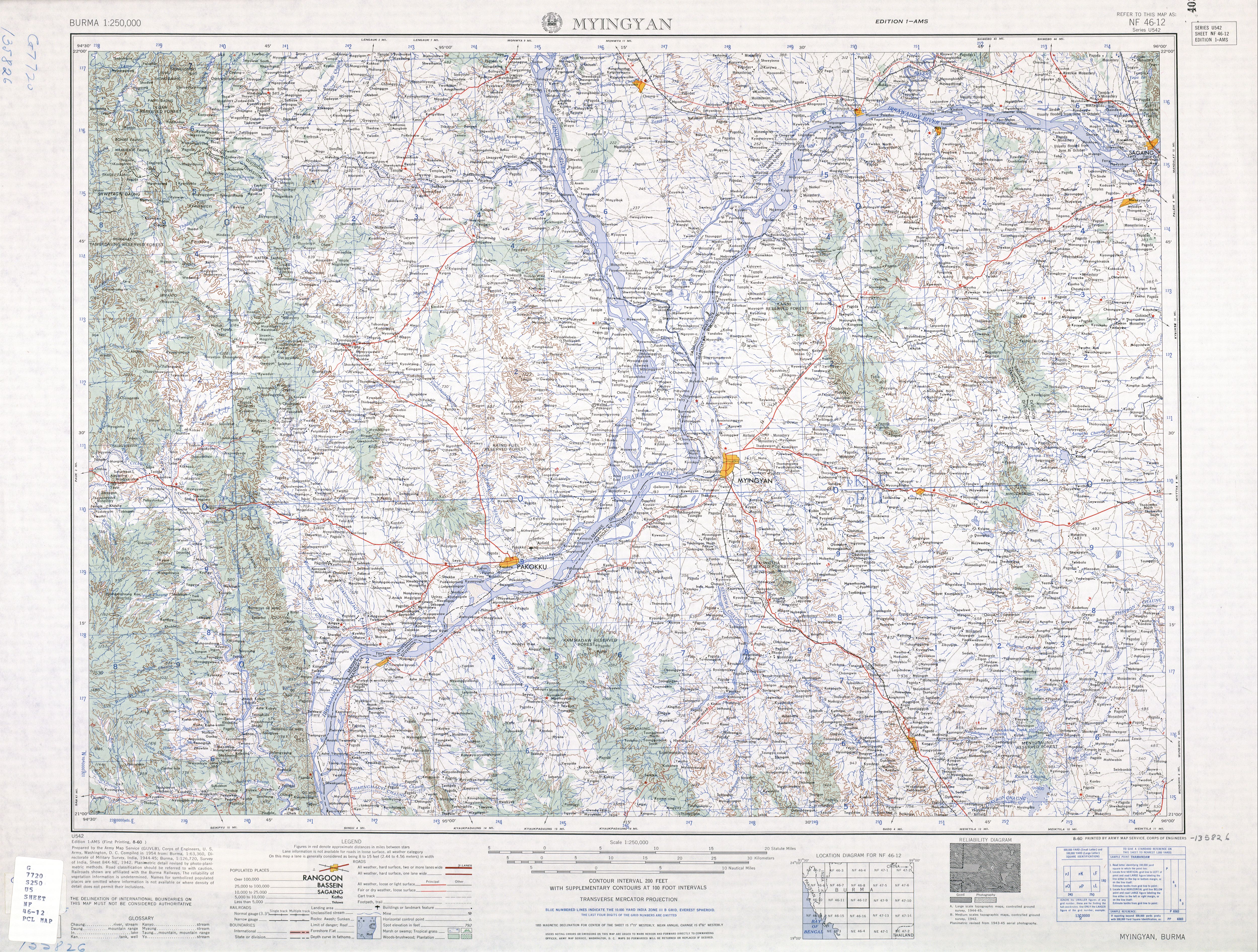
The Irrawaddy or, officially, Ayeyarwady River is a river that flows from north to south through Myanmar. It is the country's largest river and most important commercial waterway. Originating from the confluence of the N'mai and Mali rivers, it flows relatively straight North-South before emptying through the Irrawaddy Delta into the Andaman Sea. Its drainage basin of about 404,200 square kilometres (156,100 sq mi) covers a large part of Burma. After Rudyard Kipling's poem, it is sometimes referred to as 'The Road to Mandalay'.
The Yaw River forms when the Kyaw River and the Kabyu River flow together at 21°25′13″N94°36′48″E / 21.42028°N 94.61333°E / 21.42028; 94.61333 . It flows basically south with a slight trend eastward. It flows past the towns of Ledaing, Anauk Kabyu, and Dawtha with its major tributary, the Sada-on River, entering on the right just below Dawtha. [2]
The Kyaw River is a river of upper Burma (Myanmar) in Magway Division. It is a major tributary of the Yaw River which it enters just below the town of Pauk.
This page is based on this
Wikipedia article Text is available under the
CC BY-SA 4.0 license; additional terms may apply.
Images, videos and audio are available under their respective licenses.

The Chin Hills are a range of mountains in Chin State, northwestern Burma (Myanmar), that extends northward into India's Manipur state.
Thayet is a city in Thayet District of Magway Region in central Myanmar. It is a port on the right (western) bank of the Irrawaddy River, across and just south of Allanmyo, between Pyay (Prome) and Magway. Thayet is the administrative seat of both Thayet District and Thayet Township. As of 2010, the population was estimated at 108,000.

The Kaladan River is a river in eastern Mizoram State of India, and in Chin State and Rakhine State of western Myanmar. The Kaladan River is called the Chhimtuipui River in India. It forms the international border between India and Burma between 22° 47′ 10" N and 22° 11′ 06" N.
The Pyamalaw River is a river in Ayeyawady Division in south-western Burma (Myanmar). It is a distributary of the Irrawaddy. The Pyamalaw River forms the boundary between Wakema Township and Einme Township of Ayeyawady Region.
Zawgyi River is a river of eastern Burma (Myanmar). It flows through the foothills of the Shan Mountain range in Shan State. It is a tributary of the Myitnge River (Doktawaddy) entering it about 20 km north of Kyaukse at Nyaungbintha.
Htigyaing Township or Tigyaing Township is a township of Katha District in eastern Sagaing Division, in northern Burma (Myanmar). It lies on the border with the Shan State of Burma. The administrative seat is at Htigyaing.
The Yin River is a river in Magway Region, in central Burma (Myanmar), a tributary of the Irrawaddy.

Myittha River is a river of western Burma, a tributary of the Chindwin River.
Kale Township is a township in Kale District in the Sagaing Division of Burma (Myanmar). The principal town is Kalay.
Sadaung is a village in Yamethin District in the south-central part of the Mandalay Region in Myanmar. It is located south-east of Yindaw just west of Route 1, north-west of Pyawbwe, Pyawbwe Township.
Hanlin is a city in Shwebo District in south-western Sagaing Region in Burma (Myanmar). It is located in the Mu River drainage in the foothills on the western slope of the Mawdaw Mountains.
Sadaung is a village in Shwebo District in south-western Sagaing Region in Burma (Myanmar). It is in the Mu River drainage basin. It is located 2.5 km south-west of Halin Taungbo, in the foothills of the Mawdaw Mountains.
Ywatha is a village in Wetlet Township, Shwebo District, in south-western Sagaing Region in Burma (Myanmar), on the right (west) bank of the Irrawaddy River.
Kyaing is a village in Tilin Township, Gangaw District, in the north-western part of the Magway Region in Myanmar. Kyaing lies on the right (western) bank of the Ywa Chaung tributary of the Maw River.
Seikphyu is the principal town and administrative seat for Seikphyu Township in Pakokku District in the Magway Division of Myanmar, on the right (western) bank of the Irrawaddy immediately below its confluence with the Yaw River. It is located across the Irrawaddy river from Chauk and is connected by Anawrahta Bridge. It is situated 34 kilometers south-south-west of ancient Bagan City and 44 kilometers from Nyaung U Airport.
Yazagyo is the northernmost village in Kale Township, Kale District, of western Burma (Myanmar).
Minhla is a town in Thayet District, Magway Region, of central Myanmar, on the right (west) bank of the Irrawaddy. It is the administrative seat of Minhla Township.
Neyinzaya River is a river in Chin State and Sagaing Region of Burma (Myanmar). It is a tributary of the Myittha River, enterring it from the left (west) just south of Kalemyo.
The Thega River is a river lying mostly between eastern Bangladesh and Mizoram, India. The Thega River flows northwards and exits into the Karnaphuli River at 22°52′43″N 92°26′52″E. Its originates from Myanmar(Burma) and is one of the main tributaries of the Karnafuli.