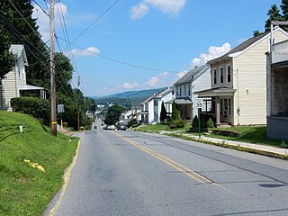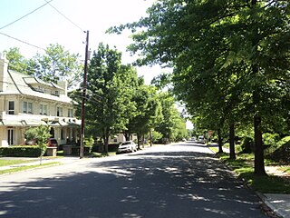
Hamburg is a borough in Berks County, Pennsylvania, United States. The population was 4,289 at the 2010 census. The town is named after Hamburg, Germany.

Phoenixville is a borough in Chester County, Pennsylvania, United States, 28 miles (45 km) northwest of Philadelphia, at the junction of French Creek with the Schuylkill River. It is located in the Philadelphia Metro Area. The population is 16,440 as of the 2010 Census.

Cressona is a borough in Schuylkill County, Pennsylvania, United States. Formed in 1857 from part of North Manheim Township, it was founded by and named for John Chapman Cresson, a Philadelphia civil engineer and manager of the Schuylkill Navigation Company, President of the Mine Hill and Schuylkill Haven Railroad and chief engineer of Fairmount Park, Philadelphia.

Mahanoy City is a borough located 38 miles (61 km) southwest of Wilkes-Barre and 13 miles southwest of Hazleton, in northern Schuylkill County, Pennsylvania in the southern Coal Region. It is located entirely within but is not part of Mahanoy Township. The name "Mahanoy" is believed to be a variation of the Native American word 'Maghonioy', or "the salt deposits".

Mechanicsville is a borough in Schuylkill County, Pennsylvania, United States. The population was 515 at the 2000 census. The borough lies between Pottsville and Port Carbon. Pottsville Street is the main street of town. The borough of part of the Pottsville Area School District.

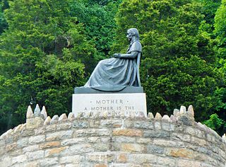
Mount Carbon is a borough in Schuylkill County, Pennsylvania, two miles south of Pottsville. It was formed from North Manheim Township in 1864. The population was 91 in the 2010 census. The borough is the smallest municipality in Schuylkill County. South Centre Street, Main Street, Sherwood Drive and the Mt. Carbon Arch are the only streets of the borough.

Palo Alto is a borough in Schuylkill County, Pennsylvania, United States. The population was 1,052 at the 2000 census. The borough stretches along the south bank of the Schuylkill River. Bacon Street is the main street of town. The borough shares Pottsville's ZIP Code, telephone exchanges, and school district. The borough maintains its own fire department and police department.

Schuylkill Haven is a borough in Schuylkill County, Pennsylvania, four miles (6 km) south of Pottsville and 89 miles (143 km) north-west of Philadelphia, in the United States. The borough's population was 5,548 as of the 2000 census. Schuylkill Haven is situated along the Schuylkill River for which it is named. Schuylkill Haven is a focal point of activity in southern Schuylkill County.

Ashland is a borough in Schuylkill County in the U.S. state of Pennsylvania, 15 miles (24 km) northwest of Pottsville. A small part of the borough also lies in Columbia County, although all of the population resided in the Schuylkill County portion as of the 2010 census. The borough lies in the anthracite coal region of eastern Pennsylvania. Settled in 1850, Ashland was incorporated in 1857, and was named for Henry Clay's estate near Lexington, Kentucky. The population in 1900 was 6,438, and in 1940, 7,045, but had dropped to 2,817 at the 2010 census.

Little Germany, known in German as Kleindeutschland and Deutschländle and called Dutchtown by contemporary non-Germans, was a German immigrant neighborhood on the Lower East Side of Manhattan in New York City. The neighborhood's ethnic cohesion began to decline in the late 19th century from the population dynamics of non-German immigrants settling in the area, and the loss of second-generation families to other German-American communities. The decline was exacerbated in 1904, when the General Slocum disaster wiped out the social core of the neighborhood.

West Philadelphia, nicknamed West Philly, is a section of Philadelphia, Pennsylvania. Though there is no official definition of its boundaries, it is generally considered to reach from the western shore of the Schuylkill River, to City Avenue to the northwest, Cobbs Creek to the southwest, and the SEPTA Media/Elwyn Line to the south. An alternate definition includes all city land west of the Schuylkill; this would also include Southwest Philadelphia and its neighborhoods. The eastern side of West Philadelphia is also known as University City.

Community boards of Manhattan are New York City community boards in the borough of Manhattan, which are the appointed advisory groups of the community districts that advise on land use and zoning, participate in the city budget process, and address service delivery in their district.
Mahantango Creek is a 36.2-mile-long (58.3 km) tributary of the Susquehanna River in Dauphin, Northumberland, Schuylkill, and Snyder County counties, Pennsylvania in the United States.
Hillcrest is a large mostly residential, middle class enclave in Paterson, New Jersey. It is located to the west of the Downtown Paterson. Its borders' limits are Preakness Avenue to the northeast, the Borough of Totowa, New Jersey border to the south and west and the Passaic River to the southeast. It is home to West Side Park, and Emerald Experience Way. Hillcrest is one of Paterson's most desirable neighborhoods. The Hillcrest section of Paterson is located in the city's 2nd Ward. It is mostly residential with a compact commercial area along Union Avenue north of Oldhams Brook.

St. John the Baptist Roman Catholic Church is a Roman Catholic church in Pottsville, Pennsylvania. The seventh oldest church in the Allentown Diocese, it was established in 1841, and is located at Tenth & Mahantongo Streets. The current structure was built in 1872.
Schuylkill Regional Medical Center is a non-profit affiliation between two community hospitals formerly known as Good Samaritan Regional Medical Center and The Pottsville Hospital and Warne Clinic, both of which are located in Pottsville, Pennsylvania, United States.


