
The Arctic Archipelago, also known as the Canadian Arctic Archipelago, is a group of islands north of the Canadian mainland.
The Zhongsha Islets is a Chinese term for a collection of two skerries, many entirely submerged banks, seamounts, and shoals in the South China Sea. There are in fact, no islands in the Macclesfield Bank, the main part of Zhongsha. The Scarborough Shoal, which consists of two skerries, is not contiguous with the Macclesfield Bank but Chinese sources treat them as one chain of geographical features. The whole of the region is claimed by both the PRC and the ROC, and various bits of the eastern parts are claimed by the Philippines. No country has constant control of the whole region, and there are disputes - for example, see Scarborough Shoal standoff.
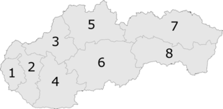
Brdárka is a village and municipality in the Rožňava District in the Košice Region of eastern Slovakia.

This is a list of the extreme points of Azerbaijan, the points that are farther north, south, east or west than any other location.
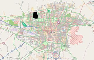
Punak is a rich neighbourhood in north-west Tehran, the capital city of Iran.

Guacarí is a town and municipality located in the Department of Valle del Cauca, Colombia.
Navas de San Antonio is a municipality located in the province of Segovia, Castile and León, Spain. According to the 2004 census (INE), the municipality has a population of 327 inhabitants.

Dziennice is a village in the administrative district of Gmina Inowrocław, within Inowrocław County, Kuyavian-Pomeranian Voivodeship, in north-central Poland. It lies approximately 6 kilometres (4 mi) south-east of Inowrocław, 36 km (22 mi) south-west of Toruń, and 45 km (28 mi) south-east of Bydgoszcz.
Traian is a commune located in Ialomița County, Romania. It is composed of a single village, Traian.
Cieciory is a village in the administrative district of Gmina Turośl, within Kolno County, Podlaskie Voivodeship, in north-eastern Poland. It lies approximately 15 kilometres (9 mi) south-west of Kolno and 97 km (60 mi) west of the regional capital Białystok.
Usnarz Górny is a village in the administrative district of Gmina Szudziałowo, within Sokółka County, Podlaskie Voivodeship, in north-eastern Poland. It is situated close to the border with Belarus. It lies approximately 8 kilometres (5 mi) north-east of Szudziałowo, 20 km (12 mi) south-east of Sokółka and 47 km (29 mi) north-east of the regional capital Białystok.

Şahməmmədli is a village in the Goranboy Rayon of Azerbaijan. The village forms part of the municipality of Goranboy.
Zasępiec is a village in the administrative district of Gmina Wolbrom, within Olkusz County, Lesser Poland Voivodeship, in southern Poland. It lies approximately 8 kilometres (5 mi) south of Wolbrom, 16 km (10 mi) east of Olkusz, and 33 km (21 mi) north of the regional capital Kraków.
Strożyska is a village in the administrative district of Gmina Nowy Korczyn, within Busko County, Świętokrzyskie Voivodeship, in south-central Poland. It lies approximately 5 kilometres (3 mi) north-west of Nowy Korczyn, 16 km (10 mi) south of Busko-Zdrój, and 62 km (39 mi) south of the regional capital Kielce.
Staplestown is a village in North County Kildare, Ireland, located 40 kilometres west of Dublin. The village has a church, a school and is home to St Kevin's GAA.
Gərəkli is a village and municipality in the Balakan Rayon of Azerbaijan. It has a population of 3,617. The municipality includes the villages of Gərəkli and Mazımçay.
Paşaoba is a village and municipality in the Quba Rayon of Azerbaijan. It has a population of 993.
Mali i Mesit is a mountain peak in the south of Albania and in the north of Greece. Mali i Mesit, which means 'Middle Peak' in English is, a peak in the mountain of Gramos. Mali i Mesit is 2,480 m (8,136 ft) high, making it one of the highest peaks of Gramos. It is also a place were Albanians used to travel to and from Greece.

Sıraç is a village in Erdemli district of Mersin Province, Turkey. It is situated in the southern slopes of Toros Mountains at 36°46′N34°20′E. The distance to Erdemli is 25 kilometres (16 mi) and to Mersin is 40 kilometres (25 mi). The population of Sıraç was 680. as of 2012. The village was founded during Ottoman Empire and in 1865 some members of Karakeçili Turkmen tribe were settled in the village. The village was specialized in saddle manufacture. Its earlier name Saraç eventually became Sıraç. In the 20th century the former prefession was replaced by farming, beehiving and animal breeding. The springs around the village also contribute to village economy.
The Webbs Creek, a perennial stream of the Hawkesbury-Nepean catchment, is located in the Outer Metropolitan Sydney region of New South Wales, Australia.


