Slobozia, also known as Slobodzeya, is a city in the Republic of Moldova under the de facto control of the unrecognized Pridnestrovian Moldavian Republic. It is the seat of the Slobozia District of Transnistria.
Ilyinka is the name of several inhabited localities in Russia.

Doboz is a village in Békés County, in the Southern Great Plain region of south-east Hungary.
Mitocu Dragomirnei is a commune located in Suceava County, Romania. It is composed of four villages: Dragomirna, Lipoveni, Mitocași and Mitocu Dragomirnei. The Dragomirna Monastery is situated in this commune.

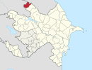
Zogallyk is a village in the Balakan Rayon of Azerbaijan.
Mehdiqışlaq is a village in the Quba Rayon of Azerbaijan.
Gilyanov is a village in the Quba Rayon of Azerbaijan.
Mazımüstü is a village in the municipality of Tülü in the Balakan Rayon of Azerbaijan.
Cağacıq is a village and municipality in the Quba Rayon of Azerbaijan. It has a population of 395.
Bázakerettye is a village in Zala County, Hungary.
Boncodfölde is a village in Zala County, Hungary.
Gutorfölde is a village in Zala County, Hungary.
Pálfiszeg is a village in Zala County, Hungary.
Petrikeresztúr is a village in Zala County, Hungary.
Pórszombat is a village in Zala County, Hungary.
Zalaapáti is a village in Zala County, Hungary.
Proletarsk is the name of several inhabited localities in Russia.

This is a list of the extreme points of Catalonia, the points that are farther north, south, east or west than any other location, as well as the highest point in the region.
Lnozavod is the name of several rural localities in Russia.

German submarine U-1165 was a Type VIIC/41 U-boat built for Nazi Germany's Kriegsmarine for service during World War II. She was laid down on 31 December 1941 by Danziger Werft, Danzig as yard number 137, launched on 20 July 1943 and commissioned on 17 November 1943 under Oberleutnant zur See Hans Homann.