Abbotsbury Blind Lane

Last updated

Abbotsbury Blind Lane (grid reference SY576856 ) is a 0.4 hectares (0.99 acres) geological Site of Special Scientific Interest in Dorset, notified in 1986; this area is slightly smaller than when it was first notified in 1977. It is also a Geological Conservation Review (GCR) site. [1]

Ordnance Survey National Grid System of geographic grid references used in Great Britain

The Ordnance Survey National Grid reference system is a system of geographic grid references used in Great Britain, distinct from latitude and longitude. It is often called British National Grid (BNG).
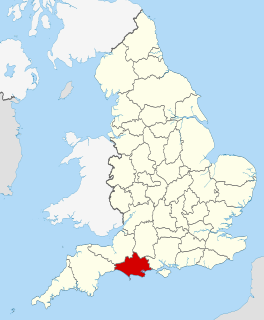
Dorset County of England

Dorset is a county in South West England on the English Channel coast. The ceremonial county comprises the unitary authority areas of Bournemouth, Christchurch and Poole and Dorset. Covering an area of 2,653 square kilometres (1,024 sq mi), Dorset borders Devon to the west, Somerset to the north-west, Wiltshire to the north-east, and Hampshire to the east. The county town is Dorchester which is in the south. After the reorganisation of local government in 1974 the county's border was extended eastward to incorporate the Hampshire towns of Bournemouth and Christchurch. Around half of the population lives in the South East Dorset conurbation, while the rest of the county is largely rural with a low population density.

The Geological Conservation Review (GCR) is produced by the UK's Joint Nature Conservation Committee and is designed to identify those sites of national and international importance needed to show all the key scientific elements of the geological and geomorphological features of Britain. These sites display sediments, rocks, minerals, fossils, and features of the landscape that make a special contribution to an understanding and appreciation of Earth science and the geological history of Britain, which stretches back more than three billion years. The intention of the project, which was devised in 1974 by George Black and William Wimbledon working for the Governmental advisory agency, the Nature Conservancy Council (NCC), was activated in 1977. It aimed to provide the scientific rationale and information base for the conservation of geological SSSIs (Sites of Special Scientific Interest, protected under British law. The NCC and country conservation agencies were established in 1990 when JNCC became established and took over responsibility for managing the GCR site assessment process, and publishing accounts of accepted sites.

Contents

Related Research Articles

Site of Special Scientific Interest Conservation designation denoting a protected area in the United Kingdom

A Site of Special Scientific Interest (SSSI) in Great Britain or an Area of Special Scientific Interest (ASSI) in the Isle of Man and Northern Ireland is a conservation designation denoting a protected area in the United Kingdom and Isle of Man. SSSI/ASSIs are the basic building block of site-based nature conservation legislation and most other legal nature/geological conservation designations in the United Kingdom are based upon them, including national nature reserves, Ramsar sites, Special Protection Areas, and Special Areas of Conservation. The acronym "SSSI" is often pronounced "triple-S I".

Holly Lane SSSI

Holly Lane SSSI is a 0.5 hectare geological Site of Special Scientific Interest near the village of Walton St. Mary, North Somerset, notified in 1990.

Thrupe Lane Swallet is a 0.5 hectares geological Site of Special Scientific Interest in Somerset, notified in 1992. It is also a Geological Conservation Review site.

Cull-Peppers Dish

Cull-Peppers Dish is a 0.9-hectare (2.2-acre) geological Site of Special Scientific Interest in Dorset, notified in 1989.

Conegar Road Cutting is a 0.15 hectare geological Site of Special Scientific Interest in Dorset, notified in 1996.

Frogden Quarry is a 0.2 hectare geological Site of Special Scientific Interest in Dorset, England, notified in 1954.

Corton Cutting is a 0.24 hectare geological Site of Special Scientific Interest in Dorset, England, notified in 1997.

Goathill Quarry is a 0.3 hectare geological Site of Special Scientific Interest near Goathill in Dorset, England, notified in 1977.

Seale Chalk Pit

Seale Chalk Pit is a 1.2-hectare (3.0-acre) geological Site of Special Scientific Interest west of Guildford in Surrey. It is a Geological Conservation Review site and part of the Seale Chalk Pit and Meadow 3-hectare (7.4-acre) private nature reserve, which is managed by the Surrey Wildlife Trust.

Westwood Quarry human settlement in United Kingdom

Westwood Quarry is a 0.07 hectare geological site of Special Scientific Interest west of Watford in Hertfordshire. It was notified in 1987 under the Wildlife and Countryside Act 1981. The planning authority is Three Rivers District Council. It is a Geological Conservation Review site.

Southerham Works Pit human settlement in United Kingdom

Southerham Works Pit is a 1-hectare (2.5-acre) geological Site of Special Scientific Interest in Lewes in East Sussex. It is a Geological Conservation Review site.

Brede Pit and Cutting human settlement in United Kingdom

Brede Pit and Cutting is a 0.6-hectare (1.5-acre) geological Site of Special Scientific Interest in Brede in East Sussex. It is a Geological Conservation Review site.

Meneage Coastal Section

Meneage Coastal Section is a coastal Site of Special Scientific Interest (SSSI) in southern Cornwall, England, UK, noted for its geological characteristics.

Gilberts Pit

Gilbert's Pit is a 5.2-hectare (13-acre) geological Site of Special Scientific Interest in Charlton in the Royal Borough of Greenwich. It was notified in 1985 and was formerly known as Charlton Sand Pit. It is a Geological Conservation Review site. It is also part of the Maryon Wilson Park and Gilbert's Pit Local Nature Reserve. It adjoins Maryon Park and is close to Maryon Wilson Park.

Oughtonhead Lane

Oughtonhead Lane is a 0.9 hectare geological Site of Special Scientific Interest in Hitchin in Hertfordshire. The local planning authority is North Hertfordshire District Council. The site has been identified as of national importance in the Geological Conservation Review.

Bierton Clay Pit geological Site of Special Scientific Interest in Bierton in Buckinghamshire

Bierton Clay Pit is a 0.07 hectare geological Site of Special Scientific Interest in Bierton in Buckinghamshire. It is listed by the Joint Nature Conservation Committee as a Geological Conservation Review site.

Gipsy Lane Pit

Gipsy Lane Pit is a 0.5 hectares geological Site of Special Scientific Interest in Leicester. It is a Geological Conservation Review site.

Dryhill Nature Reserve

Dryhill is an 11.7-hectare (29-acre) geological Site of Special Scientific Interest on the western outskirts of Sevenoaks in Kent. It is a Geological Conservation Review site, and an area of 9.5 hectares is a Local Nature Reserve

Beeding Hill to Newtimber Hill

Beeding Hill to Newtimber Hill is a 321-hectare (790-acre) biological and geological Site of Special Scientific Interest north of Shoreham-by-Sea in West Sussex. It is a Nature Conservation Review site, Grade 2, and it includes Devil's Dyke Geological Conservation Review site.

Freshfield Lane

Freshfield Lane is a 17-hectare (42-acre) geological Site of Special Scientific Interest east of Haywards Heath in West Sussex. It is a Geological Conservation Review site.

References

  1. Cox, B.M. "BLIND LANE" (PDF). Geological Conservation Review. 21. Retrieved 8 September 2014.

Sources

Coordinates: 50°40′07″N2°36′05″W / 50.66851°N 2.60133°W / 50.66851; -2.60133

Geographic coordinate system Coordinate system

A geographic coordinate system is a coordinate system that enables every location on Earth to be specified by a set of numbers, letters or symbols. The coordinates are often chosen such that one of the numbers represents a vertical position and two or three of the numbers represent a horizontal position; alternatively, a geographic position may be expressed in a combined three-dimensional Cartesian vector. A common choice of coordinates is latitude, longitude and elevation. To specify a location on a plane requires a map projection.