This article possibly contains original research .(June 2017) |
There may be different ways of writing addresses in Malaysia.
This article possibly contains original research .(June 2017) |
There may be different ways of writing addresses in Malaysia.
The format in Malaysia generally follows this order:street number, street name, region, and town/city, state. The name of town or city is actually the name of the post office which is responsible for managing the incoming mail, not the municipal name (even though by writing the municipality, the address can still be understood, provided that the correct postcode is given).
For example, addresses in Simpang Pulai in Perak should be written as "Kampung Kepayang", even though Kampung Kepayang is now a ghost town. This is simply because the incoming mails are handled by the Kampung Kepayang post office which has moved to Simpang Pulai. However, there are also some people who write "Simpang Pulai", "Ipoh" (which is the nearest city and also the municipality) or even "Kinta" (the district or daerah in Malay").
Another example is the writing of addresses in Chemor, which is under the Ipoh City Council, yet their addresses are written as "Chemor" instead of "Ipoh". This is because they have their own post office to handle their incoming mails, which also covers Kuala Kuang, Kanthan, and Klebang.
One more example is the addresses of certain places e.g. Pandan Indah, Bukit Lanjan, Taman Melawati, etc. These belong to Selangor state, but their addresses are written as "Kuala Lumpur", because they fall under the Kuala Lumpur post office.

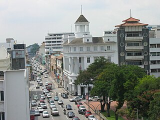
Ipoh is the capital city of the Malaysian state of Perak. Located by the Kinta River, it is nearly 180 km (110 mi) north of Kuala Lumpur and 123 km (76 mi) southeast of George Town in neighbouring Penang. As of 2010, Ipoh had a population of 657,892, making it the fourth largest city in Malaysia by population.

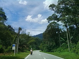
The Cameron Highlands is a district in Pahang, Malaysia, occupying an area of 712.18 square kilometres (274.97 sq mi). To the north, its boundary touches that of Kelantan; to the west, it shares part of its border with Perak. Situated at the northwestern tip of Pahang, Cameron Highlands is approximately 90 kilometres (56 mi) from Ipoh, roughly 200 kilometres (120 mi) from Kuala Lumpur or about 355 kilometres (221 mi) from Kuantan, the capital of Pahang. It is the smallest municipality in the state.

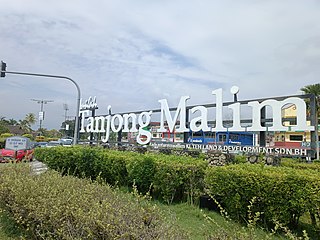
Tanjung Malim, or Tanjong Malim, is a town in Muallim District, Perak, Malaysia. It is approximately 70 km (43 mi) north of Kuala Lumpur and 120 km south of Ipoh via the North–South Expressway. It lies on the Perak-Selangor state border, with Sungai Bernam serving as the natural divider.

The Kinta District is a district in Perak, Malaysia. It contains the state capital Ipoh.
The North–South Expressway Northern Route is an interstate controlled-access highway running parallel to the northwestern coast of Peninsular Malaysia. The 460-kilometre (290-mile) expressway forms the north section of the North–South Expressway, passing through the northwestern states of Kedah, Penang, Perak and Selangor. The expressway begins at the Bukit Kayu Hitam checkpoint in Kedah where the Malaysia–Thailand border lies, and ends at Bukit Lanjan in Selangor where the expressway interchanges with the New Klang Valley Expressway. The expressway is operated by PLUS Expressways.
Federal Route 68, also known as Jalan Gombak or Jalan Karak Lama, is a federal road in Malaysia that links the city of Kuala Lumpur to Bentong, Pahang. Before Kuala Lumpur–Karak Expressway E8/FT2 was built, the road was used to be a part of Kuala Lumpur–Kuantan Road FT2; however, due to its sharp corners, narrow roadway and lack of safety features, a replacement highway known as the Kuala Lumpur–Karak Highway FT2 was built, causing the former Kuala Lumpur–Bentong section to be re-gazetted as the Federal Route 68.

Federal Route 59, or Jalan Tapah–Cameron Highlands, is a 90 km federal road in Perak and Pahang state, Malaysia. It was the main route to Cameron Highlands, Pahang from Tapah, Perak, before the second route Second East–West Highway was built in 2001.
Second East–West Highway, also known as Simpang Pulai–Kuala Berang Highway, Federal Route 185 and Federal Route 36, is a highway in Peninsular Malaysia which connects Simpang Pulai in Perak to Kuala Jeneris in Terengganu. It overlaps with Federal Route 8 Federal Route 8 between Gua Musang and Sungai Relau. It is notorious for its many sharp corners which increase the risk of road accidents.
Kuala Berang is the seat and largest town of Hulu Terengganu District, Terengganu, Malaysia. The town serves as a gateway to Lake Kenyir. The historical Terengganu Inscription Stone was found near Kuala Berang in 1899. The town of Kuala Berang was the first capital of the modern Sultanate of Terengganu before moving to Kuala Terengganu.

Rail transport in Malaysia consists of heavy rail, light rapid transit (LRT), mass rapid transit (MRT), monorails, airport rail links and a funicular railway line. Heavy rail is mostly used for intercity passenger and freight transport as well as some urban public transport, while rapid transit is used for intra-city urban public transport in Kuala Lumpur, the national capital, and the surrounding Klang Valley region. There are two airport rail link systems linking Kuala Lumpur with the Kuala Lumpur International Airport and Sultan Abdul Aziz Shah Airport. The longest monorail line in the country is also used for public transport in Kuala Lumpur, while the only funicular railway line is in Penang.
Landslides in Malaysia are regular natural disasters in Malaysia which occur along hillsides and steep slopes.
Manjoi or Gugusan Manjoi is a satellite town in Ipoh, Perak, Malaysia, known as the most largest and populous Malay neighborhood in Ipoh, second to the renowned Kampung Baru at the heart of Kuala Lumpur, the nation's capital. It is known as Gugusan Manjoi in Malay due to its dense concentration in the state capital, Ipoh. Manjoi has a mosque and many feasible facilities for its residents. It is a combination of villages which was turned into a large neighborhood. This neighborhood is under the administration of Mukim Hulu Kinta of Kinta District.
Sungai Choh is a small town in Gombak District, Selangor, Malaysia.

The Kinta Valley is a conurbation in central Perak, Malaysia, surrounding and including the state capital Ipoh. Historically the Kinta Valley was very rich in tin, and their mines have been among the most productive in the world. The valley is formed by the Kinta River, a tributary of Sungai Perak, which flows between the Main Range and the Kledang Range. It forms the largest tin field along the Siamese-Malayan peninsula tin belt. It has been mined since ancient times by indigenous peoples but more intensively mined by the Chinese and Europeans since the end of the nineteenth century. Today, the modern Kinta district is one of the ten administrative districts of Perak. In 2018 the Kinta Valley was declared Malaysia's second national Geopark.
Malaysian Sikh community is known to be the fourth largest Malaysian Indian ethnic group. It is estimated that there are around 100,000 Sikhs in Malaysia.
Cameron Highlands is an area in Pahang, Malaysia. It has three major towns: Ringlet, Tanah Rata and Brinchang. The Highlands have five settlements: Bertam Valley, Kea Farm, Tringkap, Kuala Terla, and Kampung Raja. These eight communities are linked by a 34-kilometer-long road that stretches from Ringlet to Kampung Raja.