Al-Muzayri'a (Arabic: المُزيرعة) was a Palestinian village in the Ramle Subdistrict. It was depopulated in 1948. In 1998 the new Israeli city of El'ad was built over the ruins.
Al-Muzayri'a was located 15 kilometers (9.3mi) north-northeast of al-Ramla, on limestone hill, overlooking the coastal plain. A wadi ran along its southern part, and separated it from the village of Qula. The village was about 1km east of the al-Ramla-Haifa railway line. It was also located to the east of the al-Ramla-Jaffa highway.[6]
History
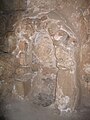
The location has a long history of habitation. A Roman mausoleum, still standing (about 1km south of the village site), was converted into a mosque dedicated to a prophet, al-Nabi Yahya ("the Prophet John").[when?] About 1km northeast of the village was Khirbat Zikhrin, a Roman-Byzantine site that was again inhabited during the Mamluk and Ottoman periods. The place has been excavated since 1982.[6]
Ottoman period
In 1596, Al-Muzayri'a was part of the Ottoman Empire, nahiya (subdistrict) of Jabel Qubal under the liwa' (district) of Nablus with a population of 7 Muslim households; an estimated population of thirty-nine. The villagers paid a fixed tax rate of 33,3% on a number of crops, including wheat, barley, and olives, as well as goats, and beehives; a total of 1,300 akçe.[8]
The village was possibly abandoned during the 17th century, only to be reoccupied in the 18th century by a family from Dayr Ghassana, named al-Rumayh.[6]
In 1838 el Muzeiri'ah was among the villages Edward Robinson noted from the top of the White Mosque in Ramla,[9] while A. Mansell mentioned passing the village in the early 1860s.[10]
In 1870, Victor Guérin described the village as sitting on a stony hill, noting that its houses appeared small.[11] An Ottoman village list of about the same year showed that "Mezari" had 68 houses and a population of 234, though the population count included men only. It also noted "a very old temple".[12][13]
In 1919, a school for boys was founded in the village. By 1945, it had become a full-fledged elementary school, with 207 students, including children of the neighboring villages. 35 dunums of land were attached to the school. A school for girls was founded in 1945, and had an initial enrollment of 78 students.[6]
In the 1945 statistics, the village had a population of 1,160, all Muslim,[4] and the total land area was 10,822 dunams.[3] A total of 953 dunums of village land was used for citrus and bananas, 5,895 dunums were used for cereals, 35 dunums were irrigated or used for orchards,[6][17] while 25 dunams were classified as built-up urban areas.[18]
1948 and aftermath
Al-Muzayri'a was located in the territory allotted to the Arab state under the 1947 UN Partition Plan.[19] Al-Muzayri was depopulated on 12 July 1948, after a military assault by Israeli forces.[2]
The Israeli moshav of Nehalim was founded in 1949 on the northwestern part of former village land. The moshav of Mazor was founded the same year on the western part of former village land.[6]
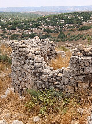
The Palestinian historian Walid Khalidi, described the place in 1992: "The site is largely forested. While a few houses remain, most have been reduced to rubble. Cacti and stone terraces are visible on the site."[6]
'Ad, Uzi (5 October 2008). "El'ad (Mazor) Final Report" (120). Hadashot Arkheologiyot – Excavations and Surveys in Israel. Archived from the original on 19 July 2011. Retrieved 9 April 2009.{{cite journal}}: Cite journal requires |journal= (help)
Dagan, Yehuda (2 August 2006). "Mazor (East) Final Report" (118). Hadashot Arkheologiyot – Excavations and Surveys in Israel. Archived from the original on 15 December 2007. Retrieved 9 April 2009.{{cite journal}}: Cite journal requires |journal= (help)
Hillel, Gili (4 December 2008). "Mazor (El'ad) Final Report" (120). Hadashot Arkheologiyot – Excavations and Surveys in Israel. Archived from the original on 19 July 2011. Retrieved 9 April 2009.{{cite journal}}: Cite journal requires |journal= (help)
Jakoel, Eriola (9 May 2017). "Elʽad" (129). Hadashot Arkheologiyot – Excavations and Surveys in Israel.{{cite journal}}: Cite journal requires |journal= (help)
Kanias, Tzach (2 April 2008). "Mazor, East Final Report" (120). Hadashot Arkheologiyot – Excavations and Surveys in Israel. Archived from the original on 19 July 2011. Retrieved 9 April 2009.{{cite journal}}: Cite journal requires |journal= (help)
Mansell, A. L. (1863): "A Surveying Trip through the Holy Land." The Nautical Magazine and Naval Chronicle. January Issue:36–40. Cited in Khalidi, 1992.
Milevski, Ianir (16 August 2007). "Mazor Final Report" (119). Hadashot Arkheologiyot – Excavations and Surveys in Israel. Archived from the original on 15 December 2007. Retrieved 9 April 2009.{{cite journal}}: Cite journal requires |journal= (help) ("c. 180 m west of the mausoleum and east of the hill where a Muslim cemetery is located")
Nagorsky, Alla (2 August 2006). "Mazor Final Report" (118). Hadashot Arkheologiyot – Excavations and Surveys in Israel. Archived from the original on 16 December 2007. Retrieved 9 April 2009.{{cite journal}}: Cite journal requires |journal= (help)
Taxel, Itamar (15 November 2006). "Mazor Final Report" (118). Hadashot Arkheologiyot – Excavations and Surveys in Israel. Archived from the original on 15 December 2007. Retrieved 9 April 2009.{{cite journal}}: Cite journal requires |journal= (help)
Al-Dawayima, Dawaymeh or Dawayma was a Palestinian town, located in the former Hebron Subdistrict of Mandatory Palestine, and in what is now the Lakhish region, some 15 kilometres south-east of Kiryat Gat.
Suhmata, was a Palestinian village, located 25 kilometres (16 mi) northeast of Acre. It was depopulated by the Golani Brigade during the 1948 Arab-Israeli war.
Al-Kabri was a Palestinian Arab town in the Galilee located 12.5 kilometers (7.8 mi) northeast of Acre. It was captured by the Haganah 21 May 1948, a week after the State of Israel was declared. In 1945, it had a population of 1,530 and a total area cultivated of 20,617 dunams. It is near the site of Tel Kabri.
Sa'sa' was a Palestinian village, located 12 kilometres northwest of Safed, that was depopulated by Israeli forces during the 1948 Arab-Israeli war. The village suffered two massacres committed by Haganah forces: one in mid-February 1948 and the other at the end of October the same year. Its place has been taken since 1949 by Sasa, an Israeli kibbutz.
Al-Malikiyya was a Palestinian village located in the Jabal Amil region. In a 1920s census, the village was registered as part of Greater Lebanon. It was later placed under the British Mandate of Palestine. Its population was mostly Metawali Shiite.
Barqa was a Palestinian Arab village located 37 km north of Gaza near the modern-day Israeli city of Ashdod. It was referred to as Barka by the Greeks and Bareca by the Romans during their rule over the ancient Philistine city. In 1945, the village had a population of 890 and total land area of 5,206 dunums.
Yazur was a Palestinian Arab town located 6 kilometers (3.7 mi) east of Jaffa. Mentioned in 7th century BCE Assyrian texts, the village was a site of contestation between Muslims and Crusaders in the 12th-13th centuries.
Al-Sawafir al-Gharbiyya was a Palestinian Arab village in the Gaza Subdistrict. It was depopulated during the 1948 War on May 18, 1948, during the second stage of Operation Barak. It was located 30 km northeast of Gaza city. It was one of three namesake villages, alongside Al-Sawafir al-Sharqiyya and Al-Sawafir al-Shamaliyya.
Khirbat Umm Burj was a Palestinian Arab village in the Hebron Subdistrict, sometimes designated in modern maps as Burgin. Its ruins are today located within the borders of Israel. It occupied an extensive site, stretching about 30 dunams on the crest of a hill, rising some 430 metres (1,410 ft) above sea level, and commanding a good prospect of the surrounding region. It was depopulated during the 1948 Arab–Israeli War on October 28, 1948, during the third stage of Operation Yo'av under the command of Yigal Allon. The site is located 17 km northwest of Hebron.
Al-Qabu was a Palestinian Arab village in the Jerusalem Subdistrict. The name is an Arabic variation of the site's original Roman name, and the ruins of a church there are thought to date to the era of Byzantine or Crusader rule over Palestine.
Aqir, also spelt Akir and Akkur, was a Palestinian Arab village in the Ramle Subdistrict, located 9 km southwest of Ramla and 1 km north of Wadi al-Nasufiyya. It was depopulated and demolished and replaced by Kiryat Ekron.
Bashshayt, also Beshshayt, was a Palestinian Arab village in the Ramle Subdistrict, located 16.5 kilometers (10.3 mi) southwest of Ramla about half a mile from wadi Bashshit. Archaeological artifacts from the village attest to habitation in the Early Islamic period and 12th and 13th centuries. Mentioned by Arab geographers from the 13th century onward, there was a tomb for the Neby Shayt in the village.
Dayr Ayyub was a Palestinian Arab village in the Ramle Subdistrict. It was depopulated during the 1947–48 Civil War in Mandatory Palestine on March 6, 1948 by the Givati and Sheva' brigades of Operation Nachshon. It was located 17.5 km southeast of Ramla, situated close to Bab al-Wad. On attack, the village was defended by the Jordanian Army but was mostly destroyed with the exception of a few houses and the village cemetery.
Al-Qubab was a Palestinian Arab village in the Ramle Subdistrict. It was depopulated in July 1948 during the Operation Dani led by the Yiftach Brigade.
Al-Tira was a Palestinian village in the Ramle Subdistrict. It was depopulated during the 1948 Arab–Israeli War on July 10, 1948, by the Alexandroni and Armored (Eighth) brigades under Operation Dani. It was located 12 km northeast of Ramla. al-Tira was mostly destroyed with the exception of a few houses survived destruction.
Zarnuqa, also Zarnuga, was a Palestinian Arab village in the Ramle Subdistrict. It was depopulated on 27–28 May 1948 during the 1948 Arab–Israeli War.
Baysamun or Beisamoun was a small Palestinian Arab village, located 16.5 kilometers (10.3 mi) in the marshy Hula Valley northeast of Safad. In 1945, it had a population of 20. It was depopulated during the 1948 War on May 25, 1948, by the Palmach's First Battalion in Operation Yiftach.
Dallata was a Palestinian Arab village, located on a hilltop 6 kilometers (3.7 mi) north of Safad. Constructed upon an ancient site, it was known to the Crusaders as Deleha. Dallata was included in the late 16th century Ottoman census and British censuses of the 20th century. Its inhabitants were primarily agriculturalists, with some involved in carpentry or trade.
Yaquq was a Palestinian Arab village, which was depopulated during the 1947–1948 Civil War in Mandatory Palestine on May 1, 1948. It was located 12.5 km north of Tiberias and was built at the site of the ancient Jewish village of Huqoq.
Fardisya was a Palestinian Arab hamlet in the Tulkarm Subdistrict, 2.5 kilometres (1.6 mi) south of Tulkarm.
This page is based on this Wikipedia article Text is available under the CC BY-SA 4.0 license; additional terms may apply. Images, videos and audio are available under their respective licenses.

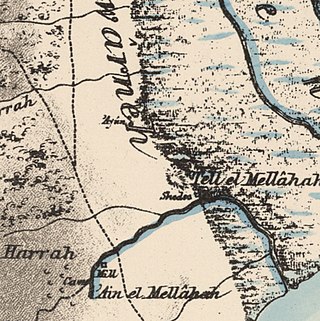
 1870s map
 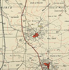 1940s map
 modern map
  1940s with modern overlay map


