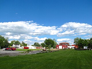
Washington County is a county located in the U.S. state of Kentucky. As of the 2010 census, the population was 11,717. Its county seat is Springfield. The county is named for George Washington.

Marion County is a county in the U.S. state of Kentucky. As of the 2010 census, the population was 19,820. Its county seat is Lebanon. The county was founded in 1834 and named for Francis Marion, the American Revolutionary War hero known as the "Swamp Fox".

Goose Creek is a home rule-class city in Jefferson County, Kentucky, United States. The population was 294 at the 2010 census.

Massac is a census-designated place (CDP) in McCracken County, Kentucky, United States. The population was 4,505 at the 2010 census, an increase from 3,888 in 2000. It is part of the Paducah, KY-IL Micropolitan Statistical Area.

Junction City is a home rule-class city in Boyle County on its border with Lincoln County in the U.S. state of Kentucky. Junction City's population was 2,241 at the 2010 U.S. census. It is part of the Danville Micropolitan Statistical Area.

Kentucky County was formed by the Commonwealth of Virginia from the western portion of Fincastle County effective December 31, 1776. During the three and one-half years of Kentucky County's existence, its seat of government was Harrodstown.

Kentucky's 2nd congressional district is a congressional district in the U.S. state of Kentucky. Located in west central Kentucky, the district includes Bowling Green, Owensboro, and Elizabethtown. The district has not seen an incumbent defeated since 1884.
Parksville is a small unincorporated community on the Chaplin River in south central Boyle County, Kentucky, United States. It is located at the eastern end of Ky Route 300, where it intersects with Ky Route 34, near the US Post Office. The global position of Parksville is 37.597N latitude and -84.891W longitude. Elevation is 1,083 feet (330 m) above sea level. Current population is approximately 900 people.

The Chaplin River is an 85.6-mile-long (137.8 km) tributary of the Beech Fork of the Salt River in the U.S. state of Kentucky.

Dunlapsville is an unincorporated community in Liberty Township, Union County, in the U.S. state of Indiana.

Moonstone is an unincorporated community in Humboldt County, California. It is located 2.5 miles (4.0 km) southeast of Trinidad, at an elevation of 121 feet. For census purposes, it is aggregated in Westhaven-Moonstone, California. The area is sited adjacent to Pacific Ocean beach and the mouth of the Little River with views of the rugged coastline.
The Rolling Fork is a 108-mile-long (174 km) river in central Kentucky. The river flows through Marion and Hardin counties, as well as being the border between LaRue and Nelson counties. The Rolling Fork drains much of the land in these counties, and is a key part of life in this area of the Knob Region. The Rolling Fork is a part of the Salt River Basin, and the larger Ohio River Basin.
Brumfield is an unincorporated community in Boyle County, Kentucky, in the United States.
Bardstown Junction is an unincorporated community in Bullitt County, Kentucky, in the United States.
Woodsonville is an unincorporated community in Hart County, Kentucky, in the United States.
Monroe is an unincorporated community in Hart County, Kentucky, in the United States.
Rowletts is an unincorporated community in Hart County, Kentucky, in the United States.
New Market is an unincorporated community in Marion County, Kentucky, in the United States.
Balltown is an unincorporated community in Nelson County, in the U.S. state of Kentucky.


