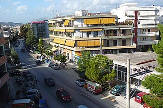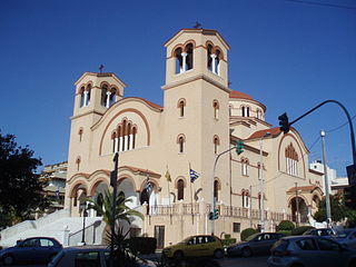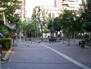
Mytilene is a city founded in the 11th century BC. Mytilene is the capital city and port of the island of Lesbos and also the capital of the North Aegean Region. The seat of the governor of the North Aegean Region is Mytilene. Mytilene is also one of 13 municipalities (counties) on the island of Lesbos. Mytilene is built on the southeast edge of the island. It is also the seat of a metropolitan bishop of the Eastern Orthodox Church.

Nea Ionia is a northern suburb of Athens, Greece, and a municipality of the Attica region. It was named after Ionia, the region in Anatolia from which many Greeks migrated in the 1920s as a part of the Population exchange between Greece and Turkey.

Kallithea is the 8th largest municipality in Greece and the 4th biggest in the Athens urban area. Additionally, it is the 2nd most densely populated municipality in Greece, with 21,192 inhabitants / km². The municipality has an area of 4.749 km2. Actual the community reports a number of close to 200.000 inhabitants.

Peristeri is a suburban municipality in the northwestern part of the Athens agglomeration, Greece. With 139,981 inhabitants, it is the seventh-largest municipality of Greece by population.

Tavros, is a suburb in the southwestern part of the Athens agglomeration, Greece. Since the 2011 local government reform it is part of the municipality Moschato-Tavros, of which it is a municipal unit.

Argyroupoli is a suburb in the southern part of the Athens agglomeration, Greece. Since the 2011 local government reform it is part of the Elliniko-Argyroupoli municipality, of which it is the seat and a municipal unit.

Kalamariá is a municipality (Borough) of the Thessaloniki Urban Area, located about 7 kilometres southeast of downtown Thessaloniki. It is the second largest municipality of the Thessaloniki Urban Area as well as one of the largest in Greece, with a population increase of 13% since the 1991 census.

Rafina is a port town located on the eastern coast of Attica in Greece. It has a population of 13,091 inhabitants. Since the 2011 local government reform it is part of the municipality Rafina-Pikermi, of which it is the seat and a municipal unit. The municipal unit has an area of 18.979 km2.

Aliveri is a town and a community in the island of Evoia, Greece. It is part of the municipal unit Tamyneoi, and the seat of the municipality Kymi-Aliveri. Aliveri is situated in the western part of the island, on the South Euboean Gulf. It is 13 km southwest of Avlonari, 14 km east of Amarynthos and 39 km east of Chalcis. The Greek National Road 44 passes through the town. The community Aliveri consists of the town Aliveri and the villages Anthoupoli, Katakalos, Latas and Milaki.

Tamyneoi is a former municipality of the island of Euboea, Greece. Since the 2011 local government reform it is part of the municipality Kymi-Aliveri, of which it is a municipal unit. The municipal unit has an area of 203.971 km2. The seat of the municipality was in Aliveri. The name reflects that of the ancient city of Tamynae.
Greek refugees is a collective term used to refer to the nearly one million Greek Orthodox natives of Asia Minor, Thrace and the Black Sea areas who fled during the Greek genocide (1914-1922) and Greece's later defeat in the Greco-Turkish War (1919–1922), as well as remaining Greek Orthodox inhabitants of Turkey who were required to leave their homes for Greece shortly thereafter as part of the population exchange between Greece and Turkey, which formalized the population transfer and barred the return of the refugees. This Convention Concerning the Exchange of Greek and Turkish Populations was signed in Lausanne, on January 30, 1923 as part of the peace treaty between Greece and Turkey and required all remaining Orthodox Christians in Turkey, regardless of what language they spoke, be relocated to Greece with the exception of those in Istanbul and two nearby islands. Although the term has been used in various times to refer to fleeing populations of Greek descent, the population strength and the influence of the Asia Minor Greeks in Greece itself, has attached the term to the Anatolian Greek population of the early 20th century. At least 300,000 Greek refugees were from Eastern Thrace, whereas at least 900,000 were from Asia Minor. At least 150,000 were from Istanbul, who left the city in three years before 1928.

Exarcheia is a neighborhood in downtown Athens, Greece close to the historical building of the National Technical University of Athens. The Exarcheia region is famous as a home for Greek anarchists. It took the name from a merchant named Exarchos who opened a large general store there. Exarcheia is bordered on the east by Kolonaki and is framed by Patission Street, Panepistimiou Street and Alexandras Avenue. Exarcheia is renowned for being Athens' historical core of radical political and intellectual activism.
Anthoupoli is a neighbourhood in the northern part of the city of Patras. The area was built from the area of the new archeological museum which is built from the sea and saw new subdivisions. Characteristically it is the great School Group of Anthoupoli which features several schools, except for the range of the area is Sychaina up to the elevation and Ampelokipoi near Paneipstimiou Street.
Synora is a neighbourhood and a settlement in the city of Patras. It is named because it was the border in which made the visitors in the years which supported the revolution. The area that time was the outer part. Synora housed when the K.E.T.E.S.. The military base today has been closed and moved to the place where it build the square with greenspaces and the new Patras courthouse. In the 1920s, the area saw refugees arrived from Constantinople, the modern Istanbul.
Prosfygika is a neighbourhood in the southern Greek city of Patras. It was founded in 1922 as displaced persons from Asia Minor arrived in the city after the 1919–1922 Greco-Turkish War and the subsequent population exchange between Greece and Turkey.
Zavlani is a neighbourhood in the northeastern part of the city of Patras, 4 kilometres (2.5 mi) direct and 5 kilometres (3.1 mi) via road from the downtown core. The neighbourhood bears the football (soccer) club team named A.P.S. Zavlani and plays in the prefectural fourth division.
During and after the Greek Civil War of 1946–1949, members or sympathisers of the defeated communist forces fled Greece as political refugees. The collapse of the Democratic Army of Greece (DSE) and the evacuation of the Communist Party of Greece (KKE) to Tashkent in 1949 led thousands of people to leave the country. It has been estimated that by 1949 over 100,000 people had left Greece for Yugoslavia and the Eastern Bloc, particularly the USSR and Czechoslovakia. These included tens of thousands of child refugees who had been evacuated by the KKE in an organised campaign. The war wrought widespread devastation right across Greece and particularly in the regions of Greek Macedonia and Epirus, causing many people to continue to leave the country even after it had ended.

Asyrmatos or Attaliotika is a neighborhood of Athens, Greece. It is located in the west slopes of Philopappos Hill, next to Ano Petralona district. It is technically part of Petralona.

Line 2 of the Athens Metro runs entirely underground from Anthoupoli in the northwest to Elliniko in the south, via Syntagma. It first opened, between Sepolia and Syntagma, on 28 January 2000, with Line 3.

The European migrant crisis or refugee crisis is a term given to a period beginning in 2013 when rising numbers of people arrived in the European Union (EU) from across the Mediterranean Sea or overland through Southeast Europe. It is part of a pattern of increased immigration to Europe from other continents which began in the mid-20th century and which has encountered resistance in many European countries.


