Asperhofen

Last updated
Asperhofen
AUT Asperhofen COA.jpg
Coat of arms
Austria adm location map.svg
Red pog.svg
Asperhofen
Location within Austria
Coordinates: 48°15′N15°55′E / 48.250°N 15.917°E / 48.250; 15.917 Coordinates: 48°15′N15°55′E / 48.250°N 15.917°E / 48.250; 15.917
Country Austria
State Lower Austria
District Sankt Pölten-Land
Government
   Mayor Katharina Wolk (ÖVP)
Area
  Total28.92 km2 (11.17 sq mi)
Elevation
212 m (696 ft)
Population
(1 January 2016) [1]
  Total2,224
  Density77/km2 (200/sq mi)
Time zone UTC+1 (CET)
  Summer (DST) UTC+2 (CEST)
Postal code
3041
Area code 02772
Website http://www.asperhofen.at

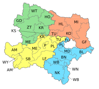
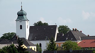
Asperhofen is a town in the district of Sankt Pölten-Land in the Austrian state of Lower Austria.
Austria Federal republic in Central Europe

Austria, officially the Republic of Austria, is a country in Central Europe comprising 9 federated states. Its capital, largest city and one of nine states is Vienna. Austria has an area of 83,879 km2 (32,386 sq mi), a population of nearly 9 million people and a nominal GDP of $477 billion. It is bordered by the Czech Republic and Germany to the north, Hungary and Slovakia to the east, Slovenia and Italy to the south, and Switzerland and Liechtenstein to the west. The terrain is highly mountainous, lying within the Alps; only 32% of the country is below 500 m (1,640 ft), and its highest point is 3,798 m (12,461 ft). The majority of the population speaks local Bavarian dialects as their native language, and German in its standard form is the country's official language. Other regional languages are Hungarian, Burgenland Croatian, and Slovene.

Lower Austria State of Austria

Lower Austria is the northeasternmost of the nine states of Austria. Since 1986, the capital of Lower Austria has been St. Polten, the most recently designated capital in Austria. Previously, Lower Austria's capital was Vienna, even though Vienna has not officially been part of Lower Austria since 1921. With a land area of 19,186 km2 (7,408 sq mi) and a population of 1.612 million people, Lower Austria is the country's largest state; it is the second most populous after the federal state of Vienna.

Geography

Asperhofen lies in the Mostviertel in Lower Austria, 6 km north of Neulengbach, on the edge of the Haspel Forest on the road to Tulln. About 20.87 percent of the municipality is forested.

Mostviertel southwestern quarter of the four quarters of Lower Austria

Mostviertel is the southwestern quarter of the four quarters of Lower Austria. It is bordered on the north by the Danube and to the south and west by the state borders of Styria and Upper Austria respectively. The Wienerwald forms the natural border to the east and gives the quarter its second name, "The Quarter Over the Wienerwald".

Neulengbach Place in Lower Austria, Austria

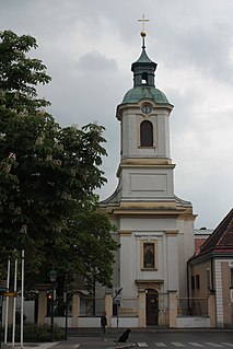
Neulengbach is a municipality in the district of Sankt Pölten-Land in Lower Austria.

Related Research Articles

Seibersdorf Place in Lower Austria, Austria

Seibersdorf is an Austrian market town with 1,283 residents in the District of Baden in Lower Austria.

Strengberg Place in Lower Austria, Austria

Strengberg is a town in the district of Amstetten in Lower Austria in Austria.

Haidershofen Place in Lower Austria, Austria

Haidershofen is a town located in Austria. The town is within the district of Amstetten, located in Lower Austria.

Neustadtl an der Donau Place in Lower Austria, Austria

Neustadtl an der Donau is a town in the district of Amstetten in Lower Austria in Austria.

Opponitz Place in Lower Austria, Austria

Opponitz is a town in the district of Amstetten in Lower Austria in Austria.

Haslau-Maria Ellend Place in Lower Austria, Austria

Haslau-Maria Ellend is a municipality in the district of Bruck an der Leitha in Lower Austria in Austria.

Höflein Place in Lower Austria, Austria

Höflein is a town in the district of Bruck an der Leitha in Lower Austria in Austria.

Aderklaa Place in Lower Austria, Austria

Aderklaa is a town in the district of Gänserndorf in Lower Austria in Austria.

Ebenthal, Lower Austria Place in Lower Austria, Austria

Ebenthal is a town in the district of Gänserndorf in the Austrian state of Lower Austria.

Groß-Schweinbarth Place in Lower Austria, Austria

Groß-Schweinbarth is a town in the district of Gänserndorf in the Austrian state of Lower Austria.

Großhofen Place in Lower Austria, Austria

Großhofen is a town in the district of Gänserndorf in the Austrian state of Lower Austria.

Hohenau an der March Place in Lower Austria, Austria

Hohenau an der March is a town in the district of Gänserndorf in the Austrian state of Lower Austria, close to Vienna and the borders with the Czech Republic and Slovakia.

Jedenspeigen Place in Lower Austria, Austria

Jedenspeigen is a town in the district of Gänserndorf in the Austrian state of Lower Austria.

Parbasdorf Place in Lower Austria, Austria

Parbasdorf is a town in the district of Gänserndorf in the Austrian state of Lower Austria.

Prottes Place in Lower Austria, Austria

Prottes is a town in the district of Gänserndorf in the Austrian state of Lower Austria.

Raasdorf Place in Lower Austria, Austria

Raasdorf is a town in the district of Gänserndorf in the Austrian state of Lower Austria.

Schönkirchen-Reyersdorf Place in Lower Austria, Austria

Schönkirchen-Reyersdorf is a town in the district of Gänserndorf in the Austrian state of Lower Austria.

Spannberg Place in Lower Austria, Austria

Spannberg is a town in the district of Gänserndorf in the Austrian state of Lower Austria.

Sulz im Weinviertel Place in Lower Austria, Austria

Sulz im Weinviertel is a town in the district of Gänserndorf in the Austrian state of Lower Austria. It is known for its open air museum in Niedersulz, the largest in Lower Austria.

Maria Enzersdorf Place in Lower Austria, Austria

Maria Enzersdorf is a town in the district of Mödling in the Austrian state of Lower Austria.

References