The Association of Pacific Coast Geographers (APCG) promotes scholarly research in geography and disseminates geographic information in the Pacific Coast region of North America.
The Association of Pacific Coast Geographers (APCG) promotes scholarly research in geography and disseminates geographic information in the Pacific Coast region of North America.
The organization was founded in 1935 at the University of California, Los Angeles and incorporated in 1962 at the University of Washington in Seattle. Since 1952, the APCG has also served as the Pacific Coast Regional Division of the Association of American Geographers, serving Alaska, Arizona, British Columbia, California, Hawaii, Idaho, Nevada, Oregon, Washington, and Yukon Territory. It is currently headquartered at California State University, Sacramento.
The APCG produces a semiannual newsletter, Pacifica, and an annual journal, the Yearbook of the Association of Pacific Coast Geographers , published by the University of Hawaii Press.

The term "United States," when used in the geographical sense, refers to the contiguous United States, Alaska, Hawaii, the five insular territories of Puerto Rico, Northern Mariana Islands, U.S. Virgin Islands, Guam, American Samoa, and minor outlying possessions. The United States shares land borders with Canada and Mexico and maritime borders with Russia, Cuba, The Bahamas, and many other countries, mainly in the Caribbeanin addition to Canada and Mexico. The northern border of the United States with Canada is the world's longest bi-national land border.

The West Coast of the United States – also known as the Pacific Coast, and the Western Seaboard – is the coastline along which the Western United States meets the North Pacific Ocean. The term typically refers to the contiguous U.S. states of California, Oregon, and Washington, but sometimes includes Alaska and Hawaii, especially by the United States Census Bureau as a U.S. geographic division.
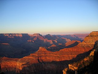
The Western United States, also called the American West, the Western States, the Far West, and the West, is the region comprising the westernmost U.S. states. As American settlement in the U.S. expanded westward, the meaning of the term the West changed. Before around 1800, the crest of the Appalachian Mountains was seen as the western frontier. The frontier moved westward and eventually the lands west of the Mississippi River were considered the West.

A subregion is a part of a larger region or continent. Cardinal directions are commonly used to define subregions. There are many criteria for creating systems of subregions; this article is focusing on the UN statistical geoscheme, which is a changing, constantly updated, UN tool based on specific political geography considerations relevant in UN statistics.
Carl Ortwin Sauer was an American geographer. Sauer was a professor of geography at the University of California at Berkeley from 1923 until becoming professor emeritus in 1957. He has been called "the dean of American historical geography" and he was instrumental in the early development of the geography graduate school at Berkeley. One of his best known works was Agricultural Origins and Dispersals (1952). In 1927, Carl Sauer wrote the article "Recent Developments in Cultural Geography," which considered how cultural landscapes are made up of "the forms superimposed on the physical landscape."

Jack Dangermond is an American billionaire businessman and environmental scientist, who in 1969 co-founded, with Laura Dangermond, the Environmental Systems Research Institute (Esri), a privately held geographic information systems (GIS) software company. As of July 2023, his net worth was estimated at US$9.3 billion.

Fragaria chiloensis, the beach strawberry, Chilean strawberry, or coastal strawberry, is one of two species of wild strawberry that were hybridized to create the modern garden strawberry. It is native to the Pacific Ocean coasts of North and South America.

The American Association of Geographers (AAG) is a non-profit scientific and educational society aimed at advancing the understanding, study, and importance of geography and related fields. Its headquarters is located in Washington, D.C. The organization was founded on December 29, 1904, in Philadelphia, as the Association of American Geographers, with the American Society of Professional Geographers later amalgamating into it in December 1948 in Madison, Wisconsin. As of 2020, the association has more than 10,000 members, from nearly 100 countries. AAG members are geographers and related professionals who work in the public, private, and academic sectors.

Pacific Islander Americans are Americans who are of Pacific Islander ancestry. For its purposes, the United States census also counts Aboriginal Australians as part of this group.
Peveril Meigs III was an American geographer, notable for his studies of arid lands on several continents and in particular for his work on the native peoples and early missions of northern Baja California, Mexico.

The University of Hawaiʻi Press is a university press that is part of the University of Hawaiʻi.

Determining the boundaries between the continents is generally a matter of geographical convention. Several slightly different conventions are in use. The number of continents is most commonly considered seven but may range as low as four when Afro-Eurasia and the Americas are both considered as single continents. An island can be considered to be associated with a given continent by either lying on the continent's adjacent continental shelf or being a part of a microcontinent on the same principal tectonic plate. An island can also be entirely oceanic while still being associated with a continent by geology or by common geopolitical convention. Another example is the grouping into Oceania of the Pacific Islands with Australia and Zealandia.
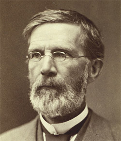
George Davidson was a geodesist, astronomer, geographer, surveyor and engineer in the United States.
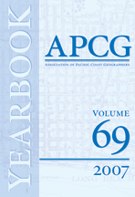
The Yearbook of the Association of Pacific Coast Geographers is a peer-reviewed annual academic journal covering education and research in geography. It is an official journal of the Association of Pacific Coast Geographers (APCG) and was established in 1935. It has been published annually except during the war years of 1943–1946. Its first editor-in-chief was Otis Willard Freeman. Its longest-serving editor was Darrick Danta. The current editor is James Craine.
Otis Willard Freeman (1889–1964) was an American academic, writer and geographer.

The megaregions of the United States are eleven regions of the United States that contain two or more roughly adjacent urban metropolitan areas that, through commonality of systems, including transportation, economies, resources, and ecologies, experience blurred boundaries between the urban centers, perceive and act as if they are a continuous urban area.
Begg Rock is an offshore rock pinnacle system located 8.8 miles (14.2 km) northwest of Vizcaino Point, the west point of San Nicolas Island, Ventura County, California. It rises 50 fathoms from the ocean floor, with its highest pinnacle reaching an elevation of 15 feet above sea level. A reef extends both the north and south of the island by over 100 yards each. A lighted whistle buoy is 500 yards (460 m) north of the rock. This rock may be found on NOAA chart 18755. This rock was given its name by the Coast Survey, being named for the boat, John Begg, which struck a nearby rock in 1824. The entire area is surrounded by Begg Rock State Marine Reserve.