Barzalosa Formation

Last updated
Barzalosa Formation
Stratigraphic range: ~Mid Eocene-Oligocene
or Oligocene-Early Miocene
~40–20  Ma
Є
O
S
D
C
P
T
J
K
Pg
N
Type Geological formation
Underlies Honda Gp., Carmen de Apicalá Conglomerate
Overlies La Tabla Fm., Olini Gp., Seca Fm.
Thickness~360 m (1,180 ft)
Lithology
Primary Conglomerates
Other Sandstones, siltstones, shale, gypsum
Location
Coordinates 4°21′50.2″N74°47′29.8″W / 4.363944°N 74.791611°W / 4.363944; -74.791611 Coordinates: 4°21′50.2″N74°47′29.8″W / 4.363944°N 74.791611°W / 4.363944; -74.791611
Approximate paleocoordinates 2°42′N71°12′W / 2.7°N 71.2°W / 2.7; -71.2
Region Upper Magdalena Valley
Central & Eastern Ranges
  Andes
CountryFlag of Colombia.svg  Colombia
Type section
Named for Barzalosa
Named byScheibe
Location Girardot
Year defined1934
Coordinates 4°21′50.2″N74°47′29.8″W / 4.363944°N 74.791611°W / 4.363944; -74.791611
Region Cundinamarca
CountryFlag of Colombia.svg  Colombia
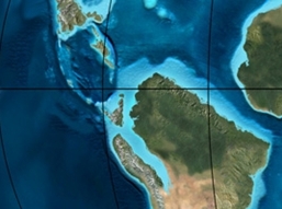
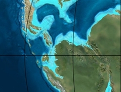
Blakey 035Ma - COL.jpg
Paleogeography of Northern South America
35 Ma, by Ron Blakey

The Barzalosa Formation (Spanish : Formación Barzalosa, Pgb, Pgba) is a fossiliferous geological formation of the Upper Magdalena Valley and the bounding foothills of the Central Ranges and Eastern Ranges of the Colombian Andes. The formation consists of conglomerates, sandstones and siltstones. The Barzalosa Formation probably dates to the Late Paleogene to Early Neogene period; Oligocene to Early Miocene epochs, and has an approximate thickness of 360 metres (1,180 ft). Fossils of Balanerodus logimus , Lophiodolodus chaparralensis , Xenastrapotherium chaparralensis , Protheosodon sp. and Proadinotherium sp. have been uncovered from the formation in Chaparral, Tolima.

Spanish language Romance language

Spanish or Castilian, is a Western Romance language that originated in the Castile region of Spain and today has hundreds of millions of native speakers in the Americas and Spain. It is a global language and the world's second-most spoken native language, after Mandarin Chinese.

Cordillera Central (Colombia) mountain range in the Colombian Andes

The Cordillera Central is the highest of the three branches of the Colombian Andes. The range extends from south to north dividing from the Colombian Massif in Cauca Department to the Serranía de San Lucas in Bolivar Departments. The highest peak is Nevado del Huila at 5,364 m (17,598 ft).

Cordillera Oriental (Colombia) mountain range in Colombia

The Cordillera Oriental is the widest of the three branches of the Colombian Andes. The range extends from south to north dividing from the Colombian Massif in Huila Department to Norte de Santander Department where it splits into the Serranía del Perijá and the Cordillera de Mérida in Venezuelan Andes. The highest peak is Ritacuba Blanco at 5,410 m (17,750 ft) in the Sierra Nevada del Cocuy.

Contents

Etymology

The formation was defined by Scheibe in 1934 and named after Barzalosa, a vereda of Girardot, Cundinamarca. Cáceres and Etayo elevated the "Pisos de Barzalosa" to a formation in 1969. [1]

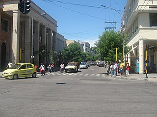
Girardot, Cundinamarca town in Cundinamarca, Colombia

Girardot is a municipality and town of Colombia in the department of Cundinamarca. It is the second most important city of Cundinamarca according to its production. It is home to a number of recreational and vacational spots, mainly visited by people from Bogotá, as it is located at two hours drive from the city but enjoys a tropical climate.

Cundinamarca Department Department in Andean Region, Colombia

Department of Cundinamarca is one of the departments of Colombia. Its area covers 22,623 square kilometres (8,735 sq mi) and it has a population of 2,598,245 as of 2013. It was created on August 5, 1886 under the constitutional terms presented on the same year. Cundinamarca is located in the center of Colombia.

Fernando Etayo Serna is a Colombian paleontologist and geologist. His contributions on the paleontology in Colombia has been mainly on the descriptions of ammonites and Etayo has helped describing many fossiliferous geologic formations of Colombia. Etayo obtained his MSc. degree in geology and geophysics from the Universidad Nacional de Colombia in 1963, and his PhD in paleontology from the University of California, Berkeley in 1975.

Description

Lithologies

The Barzalosa Formation consists of conglomerates, sandstones and siltstones. [2] In parts, the formation contains shale beds and gypsum. [3]

Conglomerate (geology) A coarse-grained clastic sedimentary rock with mainly rounded to subangular clasts

Conglomerate is a coarse-grained clastic sedimentary rock that is composed of a substantial fraction of rounded to subangular gravel-size clasts, e.g., granules, pebbles, cobbles, and boulders, larger than 2 mm (0.079 in) in diameter. Conglomerates form by the consolidation and lithification of gravel. Conglomerates typically contain finer grained sediment, e.g., either sand, silt, clay or combination of them, called matrix by geologists, filling their interstices and are often cemented by calcium carbonate, iron oxide, silica, or hardened clay.

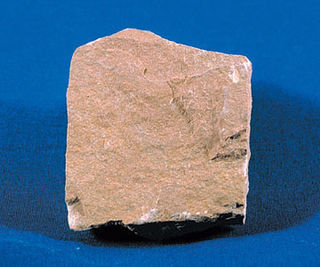
Sandstone A clastic sedimentary rock composed mostly of sand-sized particles

Sandstone is a clastic sedimentary rock composed mainly of sand-sized mineral particles or rock fragments.

Siltstone Sedimentary rock which has a grain size in the silt range

Siltstone is a sedimentary rock which has a grain size in the silt range, finer than sandstone and coarser than claystones.

Stratigraphy and depositional environment

The approximately 360 metres (1,180 ft) thick Barzalosa Formation overlies the Olini Group and the Seca Formation in the west and is overlain by the Honda Group. [2] In the east towards Fusagasugá, the formation overlies the La Tabla Formation and is overlain by the Carmen de Apicalá Conglomerate. [4] As the formation does not contain foraminifera, the age is difficult to establish, but has been estimated to be Oligocene to Early Miocene, [2] or Middle Eocene to Oligocene. [5] The depositional environment has been interpreted as alluvial fans and braided rivers. [6]

Honda Group, Colombia

The Honda Group is a geological group of the Upper and Middle Magdalena Basins and the adjacent Central and Eastern Ranges of the Colombian Andes. The group, in older literature also defined as formation, is in its present-day type section in the Tatacoa Desert in the department of Huila subdivided into two main formations; La Victoria and Villavieja.

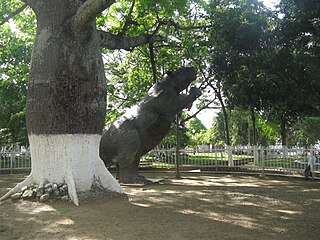
Fusagasugá Place in Andean Region, Colombia

Fusagasugá or Fusa is a town and municipality in the department of Cundinamarca, in central Colombia. It is located in the warm valley between the rivers Cuja and Panches, a central region of the Andes Mountains in South America. The municipality has an estimated population of 134,523 as of 2015. The urban region has 108,157 inhabitants. The municipality itself covers an area of 206 km2 (80 sq mi).

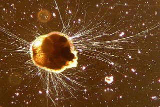
Foraminifera phylum of amoeboid protists

Foraminifera are members of a phylum or class of amoeboid protists characterized by streaming granular ectoplasm for catching food and other uses; and commonly an external shell of diverse forms and materials. Tests of chitin are believed to be the most primitive type. Most foraminifera are marine, the majority of which live on or within the seafloor sediment, while a smaller variety float in the water column at various depths. Fewer are known from freshwater or brackish conditions, and some very few (nonaquatic) soil species have been identified through molecular analysis of small subunit ribosomal DNA.

Fossil content

LocationDepartmentFossilsNotes
Alto San José, Chaparral Tolima Balanerodus logimus
[7]
Lophiodolodus chaparralensis
[8]
Xenastrapotherium chaparralensis
[9]
Protheosodon sp.
Proadinotherium sp.
Megalonychoidae indet., Gavialidae indet.

Outcrops

The Barzalosa Formation is apart from its type locality found in Tocaima and to the east of Agua de Dios, [1] and on the western side of the Magdalena River around Chaparral, Tolima. [12]

Type locality, also called type area, or type section, is the locality where a particular rock type, stratigraphic unit or mineral species is first identified. If the stratigraphic unit in a locality is layered, it is called a stratotype, whereas the standard of reference for unlayered rocks is the type locality.

Tocaima City and Municipality in Cundinamarca, Colombia

Tocaima refers to both a city and a municipality in Cundinamarca, Colombia.

Agua de Dios Town in Cundinamarca, Colombia

Agua de Dios is a municipality and town of Colombia in the department of Cundinamarca.

See also

Cscr-candidate.svg Geology of the Eastern Hills
Symbol c class.svg Middle Magdalena Valley
Symbol c class.svg Geology of the Altiplano Cundiboyacense

Related Research Articles

Simijaca Formation

The Simijaca Formation (Spanish: Formación Simijaca, K2S, Kss) is a geological formation of the Altiplano Cundiboyacense, Eastern Ranges of the Colombian Andes. The predominantly mudstone formation dates to the Late Cretaceous period; Turonian and Cenomanian epochs, and has a maximum thickness of 693 metres (2,274 ft).

Chipaque Formation

The Chipaque Formation (Spanish: Formación Chipaque, K2cp, Kc) is a geological formation of the Altiplano Cundiboyacense, Eastern Ranges of the Colombian Andes. The predominantly organic shale formation dates to the Late Cretaceous period; Cenomanian-Turonian epochs and has a maximum thickness of 1,700 metres (5,600 ft). The formation, rich in TOC, is an important oil and gas generating unit for the giant oilfields Cupiagua and Cusiana of the Eastern Ranges as well as in the Llanos Orientales.
Bogotá Formation

The Bogotá Formation (Spanish: Formación Bogotá, E1-2b, Tpb, Pgb) is a geological formation of the Eastern Hills and Bogotá savanna on the Altiplano Cundiboyacense, Eastern Ranges of the Colombian Andes. The predominantly shale and siltstone formation, with sandstone beds intercalated, dates to the Paleogene period; Upper Paleocene to Lower Eocene epochs, with an age range of 61.66 to 52.5 Ma, spanning the Paleocene–Eocene Thermal Maximum. The thickness of the Bogotá Formation ranges from 169 metres (554 ft) near Tunja to 1,415 metres (4,642 ft) near Bogotá. Fossils of the ungulate Etayoa bacatensis have been found in the Bogotá Formation, as well as numerous reptiles, unnamed as of 2017.

La Frontera Formation

The La Frontera Formation (Spanish: Formación La Frontera, K2F, Ksf) is a geological formation, part of the Villeta Group, of the Altiplano Cundiboyacense and neighbouring areas of the Eastern Ranges of the Colombian Andes. The sequence of limestones and lydites dates to the Late Cretaceous period; Turonian epoch and has a maximum thickness of 206 metres (676 ft).

Conejo Formation

The Conejo Formation (Spanish: Formación Conejo, K2C, Kscn) is a fossiliferous geological formation of the Altiplano Cundiboyacense, Eastern Ranges of the Colombian Andes. The uppermost unit of the Villeta Group, a sequence of shales and sandstones dates to the Late Cretaceous period; Turonian, Coniacian and Santonian epochs, and has a maximum thickness of 1,022 metres (3,353 ft).

The Murca Formation is a geological formation of the Altiplano Cundiboyacense, Eastern Ranges of the Colombian Andes. The predominantly subarkose sandstone with claystones and siltstones formation dates to the Early Cretaceous period; Valanginian epoch and has a maximum thickness of 924 metres (3,031 ft).

Hiló Formation

The Hiló Formation is a geological formation of the Altiplano Cundiboyacense, Eastern Ranges of the Colombian Andes. The predominantly shale formation dates to the Middle Cretaceous period; Late Albian to Early Cenomanian epochs and has a measured thickness at its type section of 470 metres (1,540 ft). The fossiliferous formation has provided a great abundance of ammonites and other marine species.

Capotes Formation

The Capotes Formation is a geological formation of the Altiplano Cundiboyacense, Eastern Ranges of the Colombian Andes. The formation consists of calcareous black shales containing gypsum and ammonites and dates to the Early Cretaceous period; Early Albian epoch and has an approximate thickness at its type section of 550 metres (1,800 ft).

Trincheras Formation

The Trincheras Formation is a geological formation of the Altiplano Cundiboyacense, Eastern Ranges of the Colombian Andes. The formation consisting of a lower unit of calcareous shales and an upper sequence of shales dates to the Early Cretaceous period; Early Aptian epoch and has a maximum thickness of 1,260 metres (4,130 ft). The formation, deposited in a marine platform environment, part of a transgressive cycle, hosts ammonite, bryozoan, mollusc and echinoid fossils.

The Las Juntas Formation or Las Juntas Sandstone is a geological formation of the Altiplano Cundiboyacense and Tenza Valley, Eastern Ranges of the Colombian Andes. The Las Juntas Formation is found in the departments Cundinamarca, Boyacá and Casanare. The predominantly sandstone formation dates to the Early Cretaceous period; Hauterivian epoch, and has a maximum thickness of 910 metres (2,990 ft).
Macanal Formation

The Macanal Formation or Macanal Shale is a fossiliferous geological formation of the Altiplano Cundiboyacense and Tenza Valley in the Eastern Ranges of the Colombian Andes. The predominantly organic shale formation dates to the Early Cretaceous period; Berriasian to Valanginian epochs and has a maximum thickness of 2,935 metres (9,629 ft). The Macanal Formation contains numerous levels of fossiliferous abundances. Bivalves, ammonites and fossil flora have been found in the formation.

Fómeque Formation

The Fómeque Formation is a geological formation of the Altiplano Cundiboyacense, Eastern Ranges of the Colombian Andes. The predominantly organic shale formation dates to the Early Cretaceous period; Barremian to Late Aptian epochs and has a maximum thickness of 1,200 metres (3,900 ft).

The La Naveta Formation is a geological formation of the Altiplano Cundiboyacense, Eastern Ranges of the Colombian Andes. The formation consists of a lower part of coraline limestones and an upper sequence of quartzitic sandstones with intercalated black shales and dates to the Early Cretaceous period; Hauterivian to Barremian epochs.
Guavio Formation

The Guavio Formation is a geological formation of the Altiplano Cundiboyacense, Eastern Ranges of the Colombian Andes. The formation consists of conglomerates, shales and limestones, dates to the Late Jurassic and Early Cretaceous periods; Tithonian to Berriasian epochs and has a maximum thickness of 1,000 metres (3,300 ft).
Villeta Group

The Villeta Group is a geological group of the Eastern Ranges of the Colombian Andes, to the west of the Altiplano Cundiboyacense. The group, a sequence of shales, limestones and sandstones, is subdivided into various formations; Conejo, La Frontera, Simijaca, Hiló, Pacho, Chiquinquirá, Capotes, Socotá, El Peñón, and Trincheras, and dates to the Cretaceous period; Aptian-Coniacian epochs. The group stretches out across four departments, from Huila in the south, through Cundinamarca and Boyacá to southern Santander in the north. The upper part of the Villeta Group is time-equivalent with the La Luna Formation of the Middle Magdalena Valley (VMM) and Sierra Nevada del Cocuy, the Oliní and Güagüaquí Groups of the Guaduas-Vélez synclinal and the Chipaque Formation of the Altiplano Cundiboyacense. The lower part has been correlated with the Simití, Tablazo and Paja Formations of the VMM, the upper Tibasosa, Une and Fómeque Formations of the Altiplano Cundiboyacense and the Capacho, Aguardiente, Tibú-Mercedes and upper Río Negro Formations of the Sierra Nevada del Cocuy.

Loma Gorda Formation

The Loma Gorda Formation is a fossiliferous geological formation of the Upper Magdalena Valley (VSM) and surrounding Central and Eastern Ranges of the Colombian Andes, extending from Cundinamarca in the north to Huila and easternmost Tolima in the south. The uppermost unit of the Güagüaquí Group, a sequence of laminated siltstones and shales, dates to the Late Cretaceous period; Turonian to Coniacian epochs, and has a maximum thickness of 167 metres (548 ft).

Hondita Formation

The Hondita Formation is a fossiliferous geological formation of the Upper Magdalena Valley (VSM) and surrounding Central and Eastern Ranges of the Colombian Andes, extending from Cundinamarca in the north to Huila and easternmost Tolima in the south. The lowermost unit of the Güagüaquí Group, a sequence of sandy limestones and shales, dates to the Late Cretaceous period; Turonian epoch, and has a maximum thickness of 90 metres (300 ft).

Oliní Group

The Oliní Group (Spanish: Grupo Oliní, K3k5o, K2ol, Kso) is a fossiliferous geological group of the VMM, VSM and the eastern flanks of the Central and western flanks of the Eastern Ranges of the Colombian Andes. The regional group stretches from north to south across approximately 700 kilometres (430 mi) and dates to the Late Cretaceous period; Coniacian, Santonian and Campanian epochs, and has a maximum thickness of 287 metres (942 ft). Fossils of Eonatator coellensis have been found in the unit, near Coello, Tolima.

Caballos Formation

The Caballos Formation is a geological formation of the Upper Magdalena Valley (VSM), Caguán-Putumayo Basin, Central and Eastern Ranges of the Colombian Andes. The sandstone and shale formation dates to the Middle Cretaceous period; Aptian to Albian epochs and has a maximum thickness of 411 metres (1,348 ft).

References

  1. 1 2 Acosta et al., 2002, p.49
  2. 1 2 3 Acosta et al., 2002, p.50
  3. Acosta & Ulloa, 2001, p.56
  4. Acosta & Ulloa, 2001, p.52
  5. Acosta & Ulloa, 2001, p.57
  6. Acosta et al., 2002, p.51
  7. Balanerodus logimus in the Paleobiology Database
  8. Lophiodolodus chaparralensis in the Paleobiology Database
  9. Xenastrapotherium chaparralensis in the Paleobiology Database
  10. Protheosodon in the Paleobiology Database
  11. Proadinotherium in the Paleobiology Database
  12. 1 2 Chaparral Alto José in the Paleobiology Database

Bibliography

Maps