
An esker, eskar, eschar, or os, sometimes called an asar, osar, or serpent kame, is a long, winding ridge of stratified sand and gravel, examples of which occur in glaciated and formerly glaciated regions of Europe and North America. Eskers are frequently several kilometres long and, because of their uniform shape, look like railway embankments.
Kirk Yetholm is a village in the Scottish Borders region of Scotland, 8 miles (13 km) south east of Kelso and less than 1 mile (1.6 km) west of the border. The first mention is of its church in the 13th century. Its sister town is Town Yetholm which lies half a mile across the Bowmont Water. The population of the two villages was recorded as 591 in the 2001 census.

Nisbet is a small hamlet on the B6400, in Roxburghshire, along the River Teviot, in the Scottish Borders area of Scotland. It is located 5.5 kilometres (3.4 mi) north of Jedburgh and 5 kilometres (3.1 mi) south of Roxburgh.

The Jed Water is a river and a tributary of the River Teviot in the Borders region of Scotland.

Garvald is a hamlet on the B7007, near Dewar, by the Dewar Burn, in the Moorfoot Hills, in the Scottish Borders area of Scotland, in the former Peeblesshire.

The River Leader, or Leader Water, is a small tributary of the River Tweed in Lauderdale in the Scottish Borders. It flows southwards from the Lammermuir Hills through the towns of Lauder and Earlston, joining the River Tweed at Leaderfoot.

Pease Bay is a bay in the Scottish Borders area of Scotland, close to the border with East Lothian as well as Cockburnspath, Cove and Dunglass. The area is notable as a holiday destination, for surfing in Scotland, and also for the large static caravan park at the bottom of the bay.
Dryhope is a village in the Scottish Borders area of Scotland, by St. Mary's Loch, on the A708. Known for its rolling green hills and ample walking paths. Also home of St Mary's Loch, the largest natural loch in the Scottish Borders.

Wauchope Forest is a forest on the Rule Water, in the Scottish Borders area of Scotland, south of Hawick, and including the A6088, the A68 and the B6357, as well as Newcastleton, Bonchester Bridge, Hobkirk, Southdean, Hyndlee, Carter Bar, Abbotrule, Chesters, Scottish Borders.

Burnfoot is a hamlet in the Scottish Borders area of Scotland, close to Roberton, by the Borthwick Water. The nearest town is Hawick to the east, and other places nearby include the Alemoor Loch, Branxholme, Broadhaugh, the Craik Forest. The meaning of Burnfoot is "Place at the foot of the burn".
Leitholm is a village in the Scottish Borders area of Scotland, 4 miles (6.4 km) north-west of Coldstream, in the former county of Berwickshire.
The Caddon Water is a small river by the village of Caddonfoot, in the Scottish Borders area of Scotland. It rises on Windlestraw Law, four miles north of Innerleithen, and flows through the Stantling Craig Reservoir. It joins the river Tweed at Caddonfoot, having completed its journey after 11 miles (18 km).

The Kale Water is a 20 miles (32 km) long tributary of the River Teviot in the Scottish Borders area of Scotland. Its feeder burns in the Cheviot Hills are the Long Burn, Hawkwillow Burn and the Grindstone Burn, east of Leithope Forest near the Anglo-Scottish Border.

The Borthwick Water(Border Scots: Borthwick Witter) is a river in the Scottish Borders area of Scotland, and a tributary of the River Teviot.

Yarrowford is a village on the A708, in the Scottish Borders area of Scotland, 4 miles north-west of Selkirk, in the Ettrick Forest.
Roxburgh is a village off the A699, by the River Teviot, near Kelso in the Scottish Borders area of Scotland.
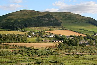
Mowhaugh is a hamlet and farm steading near the Calroust Burn and the Bowmont Water, near Morebattle, in the Scottish Borders area of Scotland, and in the former Roxburghshire. It is situated about 5 miles (8 km) from the Anglo-Scottish Border.

The Hermitage Water is a river in Liddesdale, in the Scottish Borders area of Scotland. Among its many feeder burns are Braidley Burn, Dinley Burn, Gorrenberry Burn and Twislehope Burn. The Water flows through the hamlets of Dinley and Gorrenberry, and through the village of Hermitage, and past Hermitage Castle. It continues past Toftholm where it meets the B6399, and passes Newlands, Longhaugh, Leahaugh and Redheugh. At Sandholm it joins the Liddel Water and the dismantled railway.

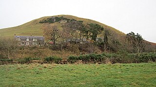
Craigierig is a village on the Megget Reservoir, in the Scottish Borders area of Scotland, in the former Selkirkshire.

Hassendean is a small village in the Scottish Borders south of Edinburgh, Scotland. The stream is the Hassendean Burn which flows down to the River Teviot five miles away. The village's name has been written at Hazeldean and Halstaneden.