A governorate, or a guberniya, was a major and principal administrative subdivision of the Russian Empire and the early Russian SFSR and Ukrainian SSR. The term is usually translated as government, governorate, or province. A governorate was ruled by a governor, a word borrowed from Latin gubernator, in turn from Greek kybernetes. Sometimes the term guberniya was informally used to refer to the office of a governor.
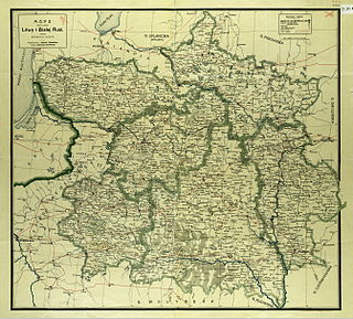
Northwestern Krai was an unofficial subdivision (krai) of the Russian Empire in the territories of the former Grand Duchy of Lithuania. The center was in Vilna city. Northwestern Krai together with the Southwestern Krai formed the Western Krai.
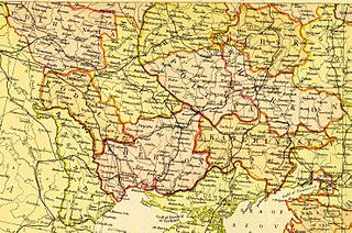
Southwestern Krai, also known as Kiev General Governorate or Kiev, Podolia, and Volhynia General Governorate was a subdivision of the Russian Empire that included some of the territory of modern-day Ukraine mostly on the right bank of the Dnieper River. The territory corresponded to the Kiev Military District.
Nevel is a town and the administrative center of Nevelsky District in Pskov Oblast, Russia, located on Lake Nevel 242 kilometers (150 mi) southeast of Pskov, the administrative center of the oblast. Population: 16,324 (2010 Census); 18,545 (2002 Census); 22,472 (1989 Census).

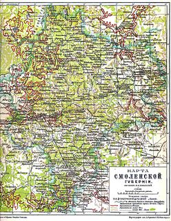
Kiev Governorate was an administrative division of the Russian Empire from 1796 to 1919 and the Ukrainian Soviet Socialist Republic from 1919 to 1925. It was formed as a governorate in the Right-bank Ukraine region following a division of the Kiev Viceroyalty into the Kiev and the Little Russia Governorates, with the administrative centre in Kiev. By the start of the 20th century it consisted of 12 uyezds, 12 cities, 111 miasteczkos and 7344 other settlements. After the October Revolution it became part of the administrative division of the Ukrainian SSR. In 1923 it was divided into several okrugs and on 6 June 1925 it was abolished by the Soviet administrative reforms.

Kunyinsky District is an administrative and municipal district (raion), one of the twenty-four in Pskov Oblast, Russia. It is located in the southeast of the oblast and borders with Toropetsky District of Tver Oblast in the north, Zapadnodvinsky District of Tver Oblast in the east, Velizhsky District of Smolensk Oblast in the south, Usvyatsky District in the southwest, and Velikoluksky District in the northwest. The area of the district is 2,621.4 square kilometers (1,012.1 sq mi). Its administrative center is the urban locality of Kunya. Population: 10,277 (2010 Census); 12,928 ; 17,698 (1989 Census). The population of Kunya accounts for 30.4% of the district's total population.

Nevelsky District is an administrative and municipal district (raion), one of the twenty-four in Pskov Oblast, Russia. It is located in the south of the oblast and borders with Novosokolnichesky District in the north, Velikoluksky District in the east, Usvyatsky District in the southeast, Haradok, Polotsk, and Rasony Districts of Vitebsk Region of Belarus in the south, Sebezhsky District in the west, and with Pustoshkinsky District in the northwest. The area of the district is 2,689.9 square kilometers (1,038.6 sq mi). Its administrative center is the town of Nevel. Population: 26,657 (2010 Census); 31,419 ; 38,951 (1989 Census). The population of Nevel accounts for 61.2% of the district's total population.

Novosokolnichesky District is an administrative and municipal district (raion), one of the twenty-four in Pskov Oblast, Russia. It is located in the south of the oblast and borders with Loknyansky District in the north, Velikoluksky District in the east, Nevelsky District in the south, Pustoshkinsky District in the west, and with Bezhanitsky District in the northwest. The area of the district is 1,616.0 square kilometers (623.9 sq mi). Its administrative center is the town of Novosokolniki. Population: 14,776 (2010 Census); 19,389 ; 21,319 (1989 Census). The population of Novosokolniki accounts for 54.9% of the district's total population.

Palkinsky District is an administrative and municipal district (raion), one of the twenty-four in Pskov Oblast, Russia. It is located in the west of the oblast and borders with Pskovsky District in the northwest, Ostrovsky District in the southeast, Pytalovsky District in the south, Viļaka and Alūksne Municipalities of Latvia in the southwest, and with Pechorsky District in the northwest. The area of the district is 1,191.2 square kilometers (459.9 sq mi). Its administrative center is the urban locality of Palkino. Population: 8,826 (2010 Census); 10,520 ; 12,392 (1989 Census). The population of Palkino accounts for 33.1% of the district's total population.
Sebezhsky District is an administrative and municipal district (raion), one of the twenty-four in Pskov Oblast, Russia. It is located in the southwest of the oblast and borders with Rasony and Verkhnyadzvinsk Districts of Vitebsk Oblast of Belarus in the south, Zilupe, Ludza, and Cibla municipalities of Latvia in the west, Krasnogorodsky and Opochetsky Districts in the north, and with Pustoshkinsky and Nevelsky Districts in the east. The area of the district is 3,100 square kilometers (1,200 sq mi). Its administrative center is the town of Sebezh. Population: 21,674 (2010 Census); 25,473 ; 26,926 (1989 Census). The population of Sebezh accounts for 29.4% of the district's total population.
Usvyatsky District is an administrative and municipal district (raion), one of the twenty-four in Pskov Oblast, Russia. It is located in the south of the oblast and borders with Velikoluksky District in the north, Kunyinsky District in the east, Velizhsky District of Smolensk Oblast in the southeast, Vitebsk and Haradok Districts of Belarus in the southwest, and Nevelsky District in the west. The area of the district is 1,100 square kilometers (420 sq mi). Its administrative center is the urban locality of Usvyaty. Population: 5,598 (2010 Census); 6,360 ; 7,905 (1989 Census). The population of Usvyaty accounts for 52.9% of the district's total population.
Rudnyansky District is an administrative and municipal district (raion), one of the twenty-five in Smolensk Oblast, Russia. It is located in the west and northwest of the oblast and borders with Velizhsky District in the north, Demidovsky District in the northeast, Smolensky District in the east, Krasnensky District in the south, and with Vitebsk, Liozna, and Dubrowna Districts of Vitebsk Region of Belarus in the west. The area of the district is 2,111.41 square kilometers (815.22 sq mi). Its administrative center is the town of Rudnya. Population: 25,244 ; 28,037 (2002 Census); 34,724 (1989 Census). The population of Rudnya accounts for 39.7% of the district's total population.

Velizhsky District is an administrative and municipal district (raion), one of the twenty-five in Smolensk Oblast, Russia. It is located in the northwest of the oblast and borders with Vitebsk District, Vitebsk Region of Belarus in the west, Usvyatsky and Kunyinsky Districts of Pskov Oblast in the northwest, Zapadnodvinsky and Zharkovsky Districts of Tver Oblast in the northeast, Demidovsky District in the east, and with Rudnyansky District in the south. The area of the district is 1,473.19 square kilometers (568.80 sq mi). Its administrative center is the town of Velizh. Population: 12,248 ; 14,329 (2002 Census); 17,239 (1989 Census). The population of Velizh accounts for 62.2% of the district's total population.

Zapadnodvinsky District is an administrative and municipal district (raion), one of the thirty-six in Tver Oblast, Russia. It is located in the west of the oblast and borders with Toropetsky District in the north, Andreapolsky District in the northeast, Nelidovsky District in the east, Zharkovsky District in the southeast, Velizhsky District of Smolensk Oblast in the south, and with Kunyinsky District of Pskov Oblast in the west. The area of the district is 2,816 square kilometers (1,087 sq mi). Its administrative center is the town of Zapadnaya Dvina. Population: 16,018 ; 19,707 (2002 Census); 24,585 (1989 Census). The population of Zapadnaya Dvina accounts for 58.6% of the district's total population.
Caucasus Krai was an administrative division of the Russian Empire. It was established in 1844. From that time until 1882 the head of the region (krai) was Viceroy-namestnik, during 1882–1905 glavnoupravlyayushchiy or glavnonachalstvuyushchy, and in 1905–1917 again namestnik.
Klichaw is a town in Mogilev Region, Eastern Belarus. It is located in the southwest of the Region and serves as the administrative center of Klichaw Raion. As of 2009, its population was 7,521.
Governorate-General was an administrative-territorial division of the Russian Empire from 1775–1917. Governorate-General usually consisted of set of guberniyas, oblasts. Sometimes used interchangeably with krai (land) or military guberniya. Moscow and Saint-Petersburg governorates were designated into a separate governorate-generals.

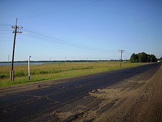
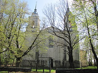
Usvyaty is an urban locality and the administrative center of Usvyatsky District of Pskov Oblast, Russia. It is located on the right bank of the Usvyacha River, between Lake Uzmen and Lake Usvyaty, two biggest lakes in the area. Municipally, it is incorporated as Usvyaty Urban Settlement, the only urban settlement in the district. Population: 2,961 (2010 Census); 3,148 (2002 Census); 3,638 (1989 Census).
The General Government of Galicia and Bukovina was a temporary Imperial Russian military administration of eastern parts of the Kingdom of Galicia and Lodomeria captured from Austria-Hungary during World War I.