A governorate, gubernia, province, or government was a major and principal administrative subdivision of the Russian Empire. After the Bolshevik Revolution in 1917, governorates remained as subdivisions in Belarus, Russia, Ukraine, and in the Soviet Union from its formation until 1929. The term is also translated as government, governorate, or province. A governorate was headed by a governor, a word borrowed from Latin gubernator, in turn from Greek κυβερνήτης.

The Taurida Governorate was an administrative-territorial unit (guberniya) of the Russian Empire. It included the territory of the Crimean Peninsula and the mainland between the lower Dnieper River with the coasts of the Black Sea and Sea of Azov. It formed after the Taurida Oblast was abolished in 1802 in the course of Paul I's administrative reform of the territories of the former Crimean Khanate annexed by the Russian Empire in 1783. The governorate's centre was the city of Simferopol. The province was named after the ancient Greek name of Crimea - Taurida.

Minsk Governorate or Government of Minsk was an administrative-territorial unit (guberniya) of the Russian Empire, with its capital in Minsk. It was created in 1793 from the land acquired in the partitions of Poland and lasted until 1921. Its territory covered a majority of modern Belarus.

Podolia Governorate, also known as Podillia Governorate, was an administrative-territorial unit (guberniya) of the Southwestern Krai of the Russian Empire. It bordered Volhynian Governorate to the north, Kiev Governorate to the east, Kherson Governorate to the southeast, Bessarabia Governorate to the south, and Austria to the west. Its administrative centre was Kamenets-Podolsky (Kamianets-Podilskyi), which later moved to Vinnitsa (Vinnytsia). The governorate covered areas of Ukraine's partially Khmelnytskyi and most of Vinnytsia Oblasts, along with the fractionally recognised state of Transnistria.

Kherson Governorate, known until 1803 as Nikolayev Governorate, was an administrative-territorial unit (guberniya) of the Russian Empire, with its capital in Kherson. The governorate encompassed 71,936 square kilometres (27,775 sq mi) in area and had a population of 2,733,612 inhabitants. At the time of the census in 1897, it bordered the Podolia Governorate to the northwest, the Kiev Governorate to the north, the Poltava Governorate to the northeast, the Yekaterinoslav Governorate to the east, the Taurida Governorate to the southeast, the Black Sea to the south, and the Bessarabia Governorate to the west. It roughly corresponds to what is now most of Mykolaiv, Kirovohrad and Odesa Oblasts and some parts of Kherson and Dnipropetrovsk Oblasts.

The Vilna Governorate was an administrative-territorial unit (guberniya) of the Northwestern Krai of the Russian Empire. In 1897, the governorate covered the area of 41,907.9 square kilometres (16,180.7 sq mi) and a population of 1,591,207 inhabitants. The governorate was defined by the Minsk Governorate to the south, the Grodno Governorate to the southwest, the Suwałki Governorate to the west, the Kovno and Courland Governorates to the north, and the Vitebsk Governorate to the east. The administrative centre was located in the city of Vilna. The city also served as the administrative centre of the Vilna Governorate-General, which existed until 1912. The area roughly corresponded to the Vilnius Region, which was later occupied by Germany, Bolsheviks, and Poland.

Grodno Governorate was an administrative-territorial unit (guberniya) of the Northwestern Krai of the Russian Empire, with its capital in Grodno (Hrodna). The governorate encompassed 38,671.5 square kilometres (14,931.1 sq mi) in area and consisted of a population of 1,631,645 inhabitants by 1897. The Grodno Governorate bordered by the Suwałki Governorate to the north, the Vilna Governorate to the northeast, the Minsk Governorate to the east, the Volhynian Governorate to the south, the Kholm Governorate to the west, and the Łomża Governorate to the northwest. The governorate covered areas of the modern Grodno Region of Belarus, part of the Podlaskie Voivodeship of Poland, and a small part of Druskininkai, Lazdijai and Varėna districts of Lithuania.

Congress Poland was subdivided several times from its creation in 1815 until its dissolution in 1918. Congress Poland was divided into departments, a relic from the times of the French-dominated Duchy of Warsaw. In 1816 the administrative divisions were changed to forms that were more traditionally Polish: voivodeships, obwóds and powiats. Following the November Uprising, the subdivisions were again changed in 1837 to bring the subdivisions closer to the structure of the Russian Empire when guberniyas (governorates) were introduced. In this way, Congress Poland was gradually transformed into the "Vistulan Country". Over the next several decades, various smaller reforms were carried out, either changing the smaller administrative units or merging/splitting various guberniyas.

Mogilev Governorate was an administrative-territorial unit (guberniya) of the Northwestern Krai of the Russian Empire. The governorate bordered the Vitebsk Governorate to the north, the Smolensk Governorate to the east, the Chernigov Governorate to the south, and the Minsk Governorate to the west. Its capital was Mogilev, also referred to as Mogilev-on-the-Dnieper, or Mogilev Gubernskiy. The area of the Mogilev Governorate covered concomitant Belarus' Vitebsk, Mogilev and Gomel Regions.

Poltava Governorate was an administrative-territorial unit (guberniya) of the Russian Empire. It included the territory of the Left-bank Ukraine and was officially created in 1802 from disbanded Little Russia Governorate, which was split between Chernigov and Poltava Governorates with its capital in Poltava.

Lithuania Governorate was an administrative-territorial unit (guberniya) of the Russian Empire in 1796–1801.

The Volhynia Governorate, Volhynian Governorate or Volyn Governorate was an administrative-territorial unit (guberniya) of the Southwestern Krai of the Russian Empire. It consisted of an area of 71,736 square kilometres (27,697 sq mi) and a population of 2,989,482 inhabitants. The governorate bordered the Grodno and Minsk Governorates to the north, the Kiev Governorate to the east, the Podolia Governorate to the south, the Lublin and Siedlce Governorates, and after 1912, the Kholm Governorate and Austria to the west. The administrative centre was Zhitomir, until 1804, its administrative centre was located in Novograd-Volynsky. It corresponded to most of Volyn, Rivne and Zhytomyr Oblasts of Ukraine and some parts of Brest and Gomel Regions of Belarus.

Kiev Governorate was an administrative-territorial unit (guberniya) of the Russian Empire from 1796 to 1919 and the Ukrainian Soviet Socialist Republic from 1919 to 1925. It included the territory of the right-bank Ukraine and was formed after a division of the Kiev Viceroyalty into Kiev and Little Russia Governorates in 1796. Its capital was in Kiev. By the early 20th century, it consisted of 12 uyezds, 12 cities, 111 miasteczkos and 7344 other settlements. After the October Revolution, it became part of the administrative division of the Ukrainian SSR. In 1923 it was divided into several okrugs and on 6 June 1925 it was abolished by the Soviet administrative reforms.
The Suwałki Governorate was an administrative-territorial unit (guberniya) of the Congress Poland within the Russian Empire, which had its seat in the city of Suwałki. It covered a territory of about 12,300 km².

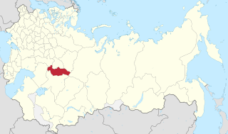
The Tambov Governorate was an administrative-territorial unit (guberniya) of the Russian Empire, Russian Republic, and the Russian SFSR, centred around the city of Tambov. The governorate was located between 51°14' and 55°6' north and between 38°9' and 43°38' east. It bordered Vladimir Governorate and Nizhny Novgorod Governorate to north, Penza Governorate and Saratov Governorate to the east, Voronezh Governorate to south and west, and Oryol Governorate, Tula Governorate, and Ryazan Governorate to the west.
Orenburg Governorate was an administrative-territorial unit (guberniya) of the Russian Empire. The capital in 1797-1802 and 1865-1928 was Orenburg, in 1802-1865 – Ufa.

Chernihiv Governorate was an administrative-territorial unit of the Ukrainian State and the Ukrainian SSR, existing from 1918 to 1925. It was inherited from the Russian system of territorial subdivisions that existed prior to World War I. Specifically, Chernigov Governorate, also known as Government of Chernigov, was an administrative-territorial unit (guberniya) of the Russian Empire. It included the territory of the Left-bank Ukraine and was officially created in 1802 from the Malorossiya Governorate with it's capital in Chernigov (Chernihiv). The Little Russian Governorate was transformed into the General Government of Little Russia and consisted of Chernigov Governorate, Poltava Governorate, and later Kharkov Governorate.

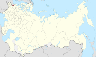
Pskov Governorate was an administrative-territorial unit (guberniya) of the Russian Empire and the Russian SFSR, which existed in 1772– 1777 and in 1796–1927. Its seat was located in Opochka between 1772 and 1776, and in Pskov after 1776. The governorate was located in the west of the Russian Empire and bordered Saint Petersburg Governorate in the north, Novgorod Governorate in the northeast, Tver Governorate in the east, Smolensk Governorate in the southeast, Belarusian Governorate in the south, and Governorate of Livonia in the west. In terms of modern administrative division of Russia, the area of the governorate is currently split between the Pskov, Tver, and Novgorod oblasts. The former border between Pskov Governorate and Governorate of Livonia still largely corresponds to the state border between Russia in the east and Estonia and Latvia in the west.

Kiev Governorate, or the Government of Kiev, was an administrative division of the Tsardom of Russia and then the Russian Empire. The government was established in December 1708 as one of the eight guberniyas first created during the reforms of Peter the Great.
Kaluga Governorate was an administrative-territorial unit (guberniya) of the Russian Empire and the Russian SFSR, which existed in 1796–1929. Its capital was Kaluga.