Heilongjiang is a province in northeast China. It is the northernmost and easternmost province of the country and contains China's northernmost point and easternmost point.

Gilan province is one of the 31 provinces of Iran. It lies along the Caspian Sea, in Iran's Region 3, west of the province of Mazandaran, east of the province of Ardabil, and north of the provinces of Zanjan and Qazvin. It borders Azerbaijan in the north.

The Kingdom of Prussia was a kingdom that constituted the German state of Prussia between 1701 and 1918. It was the driving force behind the unification of Germany in 1866 and was the leading state of the German Empire until its dissolution in 1918. Although it took its name from the region called Prussia, it was based in the Margraviate of Brandenburg. Its capital was Berlin.

Kostroma Oblast is a federal subject of Russia. Its administrative center is the city of Kostroma and its population as of the 2021 Census is 580,976. It was formed in 1944 on the territory detached from neighboring Yaroslavl Oblast.

Karelia is an area in Northern Europe of historical significance for Russia, Finland, and Sweden. It is currently divided between northwestern Russia and Finland.

The Grand Duchy of Finland, also translated as Grand Principality of Finland, was the predecessor state of modern Finland. It existed between 1809 and 1917 as an autonomous state within the former Russian Empire.

Kars Province is a province of Turkey, located in the northeastern part of the country. It shares part of its closed border with Armenia. Its area is 10,193 km2, and its population is 274,829 (2022). The provincial capital is the city of Kars. The provinces of Ardahan and Iğdır were part of Kars Province until 1992.

Erzurum Province is a province and metropolitan municipality in the Eastern Anatolia Region of Turkey. Its area is 25,006 km2, and its population is 749,754 (2022). The capital of the province is the city of Erzurum. It is bordered by the provinces of Kars and Ağrı to the east, Muş and Bingöl to the south, Erzincan and Bayburt to the west, Rize and Artvin to the north and Ardahan to the northeast. The governor of the province is Mustafa Çiftçi, appointed in August 2023. The province has an overall Turkish-majority.

Ardahan Province is a province in the north-east of Turkey, bordering Georgia and Armenia. Its area is 4,934 km2, and its population is 92,481 (2022). The provincial capital is the city of Ardahan. Ardahan borders the Turkish provinces of Erzurum, Artvin and Kars.

Iğdır Province is a province in eastern Turkey, located along the borders with Armenia, Azerbaijan, and Iran. Its adjacent provinces are Kars to the northwest and Ağrı to the west and south. Its area is 3,664 km2, and its population is 203,594 (2022). Its population was 168,634 in 2000 and 142,601 in 1990. The province is considered part of Turkish Kurdistan and has a Kurdish majority with a pretty close Azerbaijani minority.

UTC+08:00 is an identifier for a time offset from UTC of +08:00.

UTC+09:00 is an identifier for a time offset from UTC of +09:00.

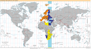
UTC+02:00 is an identifier for a time offset from UTC of +02:00. In ISO 8601, the associated time would be written as 2020-11-08T23:41:45+02:00. This time is used in:

The Governorate of Livonia, also known as the Livonia Governorate, was a province (guberniya) of the Russian Empire and the Baltic Governorate-General until 1876. The Governorate of Livonia bordered the Governorate of Estonia to the north, the Saint Petersburg and Pskov Governorates to the east, the Courland Governorate to the south, and the Gulf of Riga to the west. In 1897, the population of the governorate was 1,299,365, and it had an area of 47,030.87 square kilometres (18,158.72 sq mi). The administrative centre of the governorate was the Baltic Sea port of Riga. It roughly corresponded to most of the modern Vidzeme Region of Latvia and southern Estonia.

The Courland Governorate, also known as the Province of Courland, Governorate of Kurland and known from 1795 to 1796 as the Viceroyalty of Courland was one of the Baltic governorates of the Russian Empire, that is now part of the Republic of Latvia.

The Grodno Governorate was a governorate (guberniya) of the Northwestern Krai of the Russian Empire, with its administrative center in Grodno (Hrodna). The governorate encompassed 38,671.5 square kilometres (14,931.1 sq mi) in area and consisted of a population of 1,631,645 inhabitants by 1897. The Grodno Governorate bordered by the Suwałki Governorate to the north, the Vilna Governorate to the northeast, the Minsk Governorate to the east, the Volhynian Governorate to the south, the Kholm Governorate to the west, and the Łomża Governorate to the northwest. The governorate covered areas of the modern Grodno Region of Belarus, part of the Podlaskie Voivodeship of Poland, and a small part of Druskininkai, Lazdijai and Varėna districts.

Russia, the largest country in the world, has international land borders with 14 sovereign states as well as 2 narrow maritime boundaries with the United States and Japan. There are also two breakaway states bordering Russia, namely Abkhazia and South Ossetia. The country has an internationally recognized land border running 22,407 kilometres (13,923 mi) in total, and has the second-longest land border of any country in the world, after China. The borders of the Russian Federation were mostly drawn since 1956, and have remained the same after the dissolution of the Soviet Union. In 2014, Russia annexed Ukraine's Crimean peninsula in a move that remains internationally unrecognized.

The Province of Oulu was a province of Finland from 1775 to 2009. It bordered the provinces of Lapland, Western Finland and Eastern Finland and also the Gulf of Bothnia and Russia.


