
Jalan Besar is a one-way road in Singapore, connecting Lavender Street in Kallang and Rochor Canal Road in Rochor.

Farrer Park MRT station is an underground Mass Rapid Transit (MRT) station along the North East line, located on the boundary of Kallang and Rochor planning areas, Singapore. It is one of the two stations that serve the ethnic district of Little India. The station sits underneath the Connexion building, an integrated hospital and hotel complex.

Bugis MRT station is an underground Mass Rapid Transit (MRT) interchange station on the East West line and Downtown line in Bugis, Singapore. Located under the junction of Rochor Road and Victoria Street, the station is close to Bugis Junction, Raffles Hospital and the National Library. Built as part of the initial MRT system, the station opened in November 1989 as part of the MRT network's eastern line, while the station's Downtown line platforms were opened in December 2013.
Victoria Street is a major two-way road in Singapore. It links Kallang Road in the northeast with Hill Street in the southwest. En route, Victoria Street passes through the planning areas of Kallang, Rochor, Downtown Core and Museum.

Bugis Junction, formerly known as Parco Bugis Junction is an integrated development located at Victoria Street, Middle Road and North Bridge Road in Bugis, Downtown Core in Singapore. The development consists of a shopping mall, an office tower and the InterContinental Singapore Hotel.

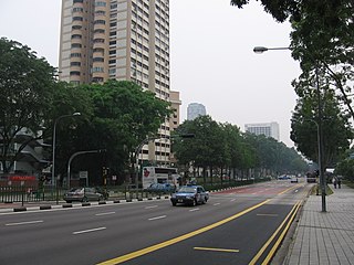
Bukit Timah Road is a major road in Singapore extending from the city centre to Woodlands Road on the way to Johor Bahru in Malaysia. The road has a length of 25 km, which makes it one of the longest roads in Singapore, and the road takes its name from the hill. En route, it passes through the areas of Little India, Newton Road, Farrer Road, Singapore Botanic Gardens and Bukit Timah.

North Bridge Road is a one-way road in Singapore, running north of the Singapore River. It starts at the junction with Crawford Street in Kallang, on the western bank of the Rochor River, and continues in a southwest direction before ending at Elgin Bridge. The stretch south of the Singapore River after Elgin Bridge is called South Bridge Road. En route, North Bridge Road travels through the planning areas of Kallang, Rochor and the Downtown Core.

Beach Road is a road located within the planning areas of Kallang, Rochor and the Downtown Core in Singapore.

Waterloo Street is a two-way street in downtown Singapore stretching from Rochor Road to Bras Basah Road. It passes through the planning areas of Rochor and Museum Planning Area.

Newton is a town that is located within the Central Area of the Central Region of Singapore. The planning area is bounded by the following planning areas - Orchard and Museum to the south, Tanglin to the west, Novena to the north, Kallang to the northeast and Rochor to the east.
Stamford Road is a one-way road in Singapore within the planning areas of Downtown Core and Museum. The road continues after the traffic light junction of Nicoll Highway, Esplanade Drive and Raffles Avenue towards Orchard Road. It then ends at the junction of Fort Canning Road, Bencoolen Street and Orchard Road, which it continues to be Orchard Road. Stamford Road is home to several landmarks, including Swissôtel The Stamford and the National Museum of Singapore.

The Museum Planning Area is a planning area located in the Central Area of the Central Region of Singapore. The area plays a "bridging role" between the Orchard area and the Downtown Core, which necessitates proper transport networks for vehicles, pedestrians and public transport. Due to the sheer size of green areas in the district, the Urban Redevelopment Authority (URA) has designated it a 'green lung' in the Central Area. However, the Museum Planning Area is also home to cultural and commercial activities. Around 65% of the area is available for future development, making it a hotbed for new infrastructure and buildings.

The Rochor River is a canalised river in Kallang of the Central Region in Singapore. The river is about 0.8 km in length.

Sungei Road is a road in Singapore situated between Serangoon Road and Jalan Besar and runs along the Rochor Canal. The area around Sungei Road formerly housed affluent Europeans and Asians, and many ornately designed buildings were built there. Since the 1930s, the road has been synonymous with Sungei Road laksa and the Thieves' Market, the largest and oldest flea market in Singapore, where locals can shop for old bric-a-brac or second-hand goods. The market was permanently closed on 10 July 2017 for "future residential development use".

Middle Road is a road in the Central Area of Singapore, stretching along the Downtown Core and Rochor planning areas. It starts from its junction with Selegie Road and ends at its junction with Nicoll Highway. Middle Road was already in existence in early Singapore, appearing in George Drumgoole Coleman's Map of Singapore in 1836. The area around Middle Road was the original settlement of the Hainanese immigrant community, a community noted for its active role in the food and beverage history of Singapore. From the late 19th century until the Second World War, the area around Middle Road, Hylam Street and Malay Street was also a bustling Japanese enclave known for its brothels of Karayuki-san and traditional shops run by the Japanese immigrants.
Kaplan Singapore is a for-profit private education institution headquartered in Singapore with other campuses in Hong Kong, Taiwan, and the People's Republic of China. It was known as the Asia Pacific Management Institute (APMI) before it was acquired by Kaplan Inc., a subsidiary of the Graham Holdings Company, in May 2005.

Rochor is a planning area located within the Central Area of the Central Region of Singapore. Rochor shares boundaries with the following planning areas – Kallang to the north and east, Newton to the west, as well as Museum and the Downtown Core to the south.
Bencoolen MRT station is an underground Mass Rapid Transit (MRT) station on the Downtown Line (DTL) in Singapore. It is located at the boundary of Rochor and Museum planning areas. Situated under Bencoolen Street, the station serves primarily the Nanyang Academy of Fine Arts (NAFA) and surrounding developments. At 43 metres (141 ft) below street level, it is the deepest station in Singapore as of 2021.

Lavender is a subzone within the planning area of Kallang, Singapore, as defined by the Urban Redevelopment Authority (URA). Lavender is composed of an area bounded by Tessensohn Road in the north; Balestier Road, Lavender Street and Crawford Street in the east; the Rochor River and Rochor Canal in the south; as well as Syed Alwi Road, Serangoon Road and Rangoon Road in the west.

Millenia Singapore is an integrated landmark development of Pontiac Land Group, nested in the Downtown Core of Singapore. It sits on land reclaimed in the 1970s from Marina Bay with five buildings designed by award-winning architects Kevin Roche, Thom Mayne, Philip Johnson and John Burgee.

