Related Research Articles
The Meriden Gap is a mostly rural area in the West Midlands between Solihull and Coventry. It is a part of the wider West Midlands Green Belt, separating Coventry from the large West Midlands conurbation, which includes Birmingham and Wolverhampton. The 'Gap' takes its name from the village central to the area, Meriden, although the largest settlement is Balsall Common. The highest point lies at 181 metres (594 ft) above sea level, slightly north of the hamlet of Eaves Green near the West Midlands-Warwickshire border.

Berkswell railway station, in the West Midlands of England, takes its name from the nearby village of Berkswell although it is located on the northern edge of the village of Balsall Common. The station originally opened in 1844 as Docker's Lane, changed to Berkswell on 1 January 1853, then to Berkswell & Balsall Common on 1 February 1928 before reverting to Berkswell again in 1955.
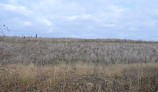
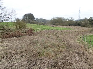
Herald Way Marsh is a 10.6 hectares biological site of Special Scientific Interest in Coventry in the West Midlands. The site was notified in 1988 under the Wildlife and Countryside Act 1981. It is also a Local Nature Reserve.

Jockey fields is an 18.05 hectares biological site of Special Scientific Interest at Walsall Wood, in the West Midlands. The site was notified in 1994 under the Wildlife and Countryside Act 1981 and is currently managed by the Country Trust.

Woodwalton Marsh is a 0.8-hectare (2.0-acre) biological Site of Special Scientific Interest north-east of Woodwalton in Cambridgeshire. It is managed by the Wildlife Trust for Bedfordshire, Cambridgeshire and Northamptonshire.

Whitewater Valley is a 4.3-hectare (11-acre) biological Site of Special Scientific Interest north-west of Wittering in Cambridgeshire.
Warboys Clay Pit is a 12.6-hectare (31-acre) geological Site of Special Scientific Interest west of Warboys in Cambridgeshire. It is a Geological Conservation Review site.

Roade Cutting is a 15.2-hectare (38-acre) geological Site of Special Scientific Interest along the West Coast Main Line north from Roade in Northamptonshire. It is a Geological Conservation Review site.

Wadenhoe Marsh and Achurch Meadow is a 47.5-hectare (117-acre) biological Site of Special Scientific Interest south of Wadenhoe in Northamptonshire.
Birch Spinney and Mawsley Marsh is a 12.3-hectare (30-acre) biological Site of Special Scientific Interest north-west of Broughton in Northamptonshire.

Syresham Marshy Meadows is a 17.8-hectare (44-acre) biological Site of Special Scientific Interest west of Silverstone in Northamptonshire.

Tickencote Marsh is a three hectare biological Site of Special Scientific Interest west of Tickencote and Great Casterton in Rutland.

Newton Burgoland Marshes is an 8.7-hectare (21-acre) biological Site of Special Scientific Interest east of Newton Burgoland in Leicestershire.

Cave's Inn Pits is a 5.8-hectare (14-acre) biological Site of Special Scientific Interest south-west of Shawell in Leicestershire.

Misterton Marshes is a 6.8-hectare (17-acre) biological Site of Special Scientific Interest north of Misterton in Leicestershire.

Lockington Marshes is an 11.3-hectare (28-acre) biological Site of Special Scientific Interest north of Ratcliffe on Soar in Leicestershire.

Tilton Cutting is a 4.4 hectares geological Site of Special Scientific Interest west of Tilton on the Hill in Leicestershire. It is a Geological Conservation Review site, and is owned and managed by the Leicestershire and Rutland Wildlife Trust as Tilton Railway Cutting.
Lincegrove and Hackett's Marshes is a 37.8-hectare (93-acre) biological Site of Special Scientific Interest on the west bank of the River Hamble between Southampton and Fareham in Hampshire. It is part of Solent and Southampton Water Ramsar site and Special Protection Area, and of Solent Maritime Special Area of Conservation. Hackett's Marsh is a 20.4 hectares Local Nature Reserve.
References
- Berkswell Marsh citation sheet Natural England . Retrieved on 2008-05-28
52°24′57″N1°39′58″W / 52.41573°N 1.66620°W
| | This article about a Site of Special Scientific Interest in England is a stub. You can help Wikipedia by expanding it. |