Bernard's Airport

Last updated
Bernard's Airport
Bernard Beaverton Mall (Beaverton, Oregon Historical Photo Gallery) (30).jpg
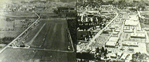
Bernard's Airport in the 1930s (looking south) with a 1980s view of the replacement shopping mall
Summary
Airport typePrivate
Location Beaverton, Oregon
Opened1928
ClosedFebruary 1969 (1969-02)
Coordinates 45°29′48.93″N122°48′37.63″W / 45.4969250°N 122.8104528°W / 45.4969250; -122.8104528
Map
USA Oregon location map.svg
Airplane silhouette.svg
Bernard's Airport
Location within Oregon

Bernard's Airport, also known as Bernard Airport, was a non-commercial airfield in Beaverton, Oregon, United States, from 1928 to 1969. [1] In its early years, it was one of two private airports located in Beaverton, [1] the other being Watts Field, about one-half mile to the south of Bernard's Airport. [2] The Bernard Airport site was redeveloped in 1969 as "Bernard's Beaverton Mall", now known as Cedar Hills Crossing.

Contents

History

Both of Beaverton's airports were opened in the latter half of the 1920s. The first was Watts Field, or Watts Airport, located on the west side of Erickson Avenue, along what is now 6th Street, to the southwest of the center of town. Different sources give its opening year as either circa 1925–26 [3] or 1928. [1]

Its site was originally developed as a motion picture studio in 1922, Premium Picture Productions opening its Beaverton Studios on the site in that year. [1] The airport was named for Dr. G.E. Watts, the financier behind the film venture in Beaverton, who was also an aviation enthusiast. [3] Premium Pictures went out of business in late 1925, [3] :134 after filmmaking on the West Coast became concentrated in Hollywood, and in 1928 the buildings were sold to Davis-Langman Aircraft Corporation, [1] but G.E. Watts remained an investor. [3] The 33-acre (130,000 m2) [1] film studio site was converted into an airstrip. In 1929, the facilities were sold to the Breese Aircraft Corporation (of San Francisco), for use in aircraft manufacturing. [4] The first airplane manufactured in Beaverton was launched in April 1930, and the Watts airstrip was used for many test flights. [3]

Bernard Airport in 1934 Bernard Airport 1934 (Beaverton, Oregon Historical Photo Gallery) (14).jpg
Bernard Airport in 1934

Later in 1928, [1] Beaverton's second airport began to take shape, as Charles Bernard erected the first hangar along what is now Cedar Hills Blvd. [1] (then Cedar Street), to the northwest of the center of Beaverton. Named Bernard's Airport, it was located about one-half mile north of Watts Airport, [2] immediately north of Beaverton Creek (with its south end just south of present-day Hall Blvd.).

Air & Space/Smithsonian has stated that the real history of grassroots aviation in Oregon began in "the hayfields of Beaverton" (i.e. Watts Field and Bernard's Airport), where aircraft innovation design achieved a wide circle of inventors and pilots. [5] As of 1932, Watts Airport had 60 acres (240,000 m2) of land, with 10 airplanes based there (and room for 40 planes), and was the third-busiest of nine airports then operating in the Portland metropolitan area, while Bernard's Airport occupied 30 acres (120,000 m2) and had only three planes based there at that time. [2]

Expansion

Aerial view of Bernard's Airport in 1966, looking north Beaverton Airport, 1966 (Beaverton, Oregon Historical Photo Gallery) (207).jpg
Aerial view of Bernard's Airport in 1966, looking north

Activity at Watts Airport began to outgrow the site, so some of its users convinced 'Charlie' Bernard (as he was commonly known) to expand his nearby airport. [3] Several additional wood frame hangars were constructed, designed by George Edward Moshofsky, a Beaverton builder whose home was across the street from the airstrip.[ citation needed ] The unusual design, which accommodated the aircraft wings, was later depicted in a mural at the Salem Airport. The home-built airplane industry in Beaverton thrived.

Bernard's Airport and Watts Airport were still in operation concurrently in 1935, [6] but Watts Airport closed not long afterwards, leading to still more expansion at the Bernard airfield.

The Oregonian of September 11, 1938, stated that Bernard Airport was "perhaps the busiest non-commercial airport in the United States". [3] By 1955, Bernard's Airport had 44 wooden hangars, along with numerous open sheds (or "plane-ports") capable of housing more than 100 additional light aircraft. [7] By that time, it was "Oregon's oldest – and one of its busiest – private airports". [7] It was also once known as the "oldest continuously-operated airport in Oregon". [3] [8]

Problems

The Cedar Hills residential area was built between 1946 and 1955, 1,500 ft (460 m) to the north of the airport. Some residents disliked having airplanes flying so near their homes and in 1955 a group of 34 property-owners filed a lawsuit claiming that the planes were trespassing in the airspace above their properties, in an attempt to force the airport to close. [9] A circuit court judge ruled against them. [8] However, soon afterward, Jenkins Road was built, cutting across the north end of the runway, despite objections by Charlie Bernard and others to the county commission. [8]

In 1963, Bernard considered selling his then-60-acre (0.24 km2) property for redevelopment as housing, after his airport began to lose money, a change he attributed to a big increase in his property taxes. [8] Bernard was still living nearby at the time, in his family's old farmhouse on Walker Road. [8] He decided against selling at that time.

Closure

In January 1969, Bernard announced that he had leased his 60 acres (0.24 km2), including the 40 acres of airport property, to a group of developers and that the airport would close in February. [10] The airport was to be replaced by a shopping mall. Closure of the runways was set for February 1. At this time, the airport had 40 hangars remaining, and around 100 planes were residing there. [11] Demolition of the hangars began in late February [12] and was nearing completion in mid-March, although the last few planes had not yet been removed at that time. [13]

The shopping mall, known since 2002 as Cedar Hills Crossing, was originally named "Bernard's Beaverton Mall" (and referred to as "Bernard Mall", for short), after the local aviation pioneer who still owned the property. [12] [14]

Related Research Articles

Beaverton, Oregon City in Oregon, United States

Beaverton is a city in Washington County, in the U.S. state of Oregon that is located 7 miles (11 km) west of Portland in the Tualatin Valley. The city is among the main cities that make up the Portland metropolitan area. Its population was 97,494 at the 2020 census, making it the second-largest city in the county and the seventh-largest city in Oregon. Beaverton is an economic center for Washington County along with neighboring Hillsboro. It is home to the world headquarters of Nike, Inc., although it sits outside of city limits on unincorporated county land.

Cedar Hills, Oregon Census-designated place in Oregon, United States

Cedar Hills is a census-designated place and neighborhood in Washington County, Oregon, United States south of U.S. Route 26 and west of Oregon Route 217 and within the Portland metropolitan area. Constructed starting in 1946, Cedar Hills was the largest single housing tract development in the western United States at the time of its completion in 1961.

Republic Airport

Republic Airport is a regional airport in East Farmingdale, New York, located one mile east of Farmingdale village limits.

MAX Red Line Light rail line in Portland, Oregon

The MAX Red Line is a light rail service in Portland, Oregon, United States, operated by TriMet as part of the MAX Light Rail system. An airport rail link, it serves 26 stations from central Beaverton through Portland City Center and Northeast Portland to Portland International Airport. From Beaverton Transit Center to Gateway/Northeast 99th Avenue Transit Center, the Red Line shares its route with the Blue Line and partially with the Green Line; it then branches to a 5.5-mile (8.9 km) segment to Portland International Airport station. Service runs for 22 hours per day with a headway of 15 minutes during most of the day. It is the second-busiest service in the MAX system; it carried an average of 10,310 passengers per weekday in September 2021.
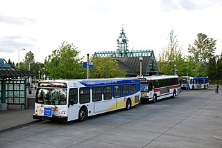
Beaverton Transit Center Transport hub located in Beaverton, Oregon, U.S.

Beaverton Transit Center is a transport hub located in Beaverton, Oregon, United States. Owned and operated by TriMet, it is a bus, commuter rail, and light rail station. The transit center is MAX Light Rail's 15th station eastbound on the Blue Line and western terminus on the Red Line. It is also the northern terminus of WES Commuter Rail and a hub for bus routes mostly serving the westside communities of the Portland metropolitan area. Beaverton Transit Center is situated on Southwest Lombard Avenue, just north of Southwest Canyon Road in central Beaverton, connected by walkway to Canyon Place Shopping Center. It recorded 9,709 average weekday boardings for all modes in fall 2018, making it TriMet's busiest transit center.
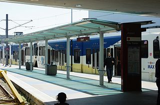
Portland International Airport station Light rail station in Portland, Oregon, United States

Portland International Airport, or just Airport on station signage, is a light rail station in Portland, Oregon, United States, operated by TriMet as part of the MAX Light Rail system. It serves Portland International Airport as the eastern terminus of the Red Line, which connects travelers to downtown Portland and Beaverton. The station is located near the southern end of the arrivals hall of the airport's main passenger terminal. It consists of a wedge-shaped island platform, just beyond which both tracks join because the section approaching the terminal is single-tracked. The station was built as part of the Airport MAX project; construction began in July 2000, and it opened on September 10, 2001. Trains serve the station for 22 hours daily with minimum headways of 15 minutes during most of the day. In late 2018, the station recorded an average of 2,461 weekday boardings.
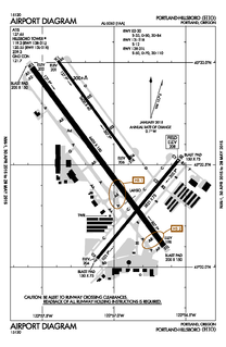
Hillsboro Airport

Hillsboro Airport, also known as Portland–Hillsboro Airport, is a corporate, general aviation and flight-training airport serving the city of Hillsboro, in Washington County, Oregon, United States. It is one of three airports in the Portland, Oregon, metropolitan area owned and operated by the Port of Portland. Established in 1928, it is Oregon's second busiest airport at over 200,000 operations annually.

Washington Square (Oregon) Shopping mall in Tigard, Oregon, United States

Washington Square is a shopping mall in the city of Tigard, Oregon, United States. Located in the Portland metropolitan area along Oregon Route 217, the shopping complex is one of the top grossing malls per square foot in the United States, with sales of $716/ft². Opened in 1973, the mall is currently managed and co-owned by The Macerich Company, a real estate investment trust, and is anchored by Macy's, Nordstrom, JCPenney, and Dick's Sporting Goods.

Grove Field

Grove Field is a public airport located three miles (5 km) north of the central business district of Camas, a city in Clark County, Washington, United States. It is located near Lacamas Lake which has a seaplane base. Due to the closing of Evergreen Field, many aircraft have moved to Grove Field.

Swan Island Municipal Airport

The Swan Island Municipal Airport was a joint civil-military airport that was operational on Swan Island in Portland, Oregon. Though it officially opened in 1927, the United States Postal Service had been using the airfield for a year. After the Portland–Columbia Super Airport was completed in the late 1930s, Swan Island Municipal Airport had little use since its runways were too small for newer aircraft and the low altitude made takeoffs and landings difficult. The airport was operational for nearly two decades, but due in part to the advances in aviation, it became obsolete soon after its construction. During World War II, a Kaiser shipyard was located at Swan Island. The shipbuilding facilities were acquired by the Port of Portland after the war.

Burns Municipal Airport

Burns Municipal Airport is six miles east of Burns, in Harney County, Oregon. The National Plan of Integrated Airport Systems for 2011–2015 categorized it as a general aviation facility.

Cedar Hills Crossing Shopping mall in Beaverton, Oregon

Cedar Hills Crossing, formerly Beaverton Mall, is a retail shopping center in the city of Beaverton, Oregon, United States. The center is notable in that it was the prior site of a historic airport, Bernard's Airport, where many of the early aircraft innovations of the 1920s and 1930s occurred. Cedar Hills Crossing has been in operation since 1969, and is located approximately between the intersection of SW Cedar Hills Boulevard and Walker Road and the intersection of SW Cedar Hills Boulevard and Hall Boulevard. The current name was adopted in September 2002 when C.E. John Company began the redevelopment of the Mall. Three extra mall entrances, new building facades and 40,000 square feet (3,700 m2) of new retail space was involved in the redevelopment, including new restaurants and interior designs.

Charles E. Bernard was an American aviation pioneer who developed Bernard's Airport, in Beaverton, Oregon, United States.

Apple Valley Airport (Oregon)

Apple Valley Airport is a private airport located one mile southeast of Buxton in Washington County, Oregon, United States. Built in 1994 by a Portland TV personality Rod Anders, the subsequent owners have pushed to expand operations at the airport. Near U.S. 26 west of the Portland metropolitan area, the 2,470 feet (750 m) long turf airstrip is used for agricultural operations.

Olinger Strip

Olinger Strip Airport is a private airport located 3 miles west of Hillsboro in Washington County, Oregon, United States. Located in the unincorporated community of Leisyville, the air strip is a single, 2,000-foot (610 m) long runway with houses running the length of the field on the north of the strip.

Sunset Air Strip

Sunset Air Strip is a private airport located one mile southwest of North Plains in Washington County, Oregon, USA. There are 16 aircraft based at the strip, which is managed by Roth Development Corp., which is owned by the neighbors. Some of the 17 neighbors to the strip have hangars on their property. The strip is owned by Roth Development, and the number of aircraft is limited to 50 by the Oregon Department of Aviation.

Vance Breese

Vance Breese (1904–1973) was an American aviation engineer and test pilot.

The Classic Aircraft Aviation Museum is an aviation museum located in Hillsboro in the U.S. state of Oregon. Started in 1998, the museum is located at the Hillsboro Airport in the Portland metropolitan area. Aircraft at the museum are either maintained in flyable condition or are restored so that they can be flown once again. As of March 2010, there were 15 aircraft in the museum's collection and Doug Donkel served as museum director.

Rodgers was a chain of five-and-dime stores based in Portland, Oregon, which was in business for 60 years, from 1938 to 1998. The chain's largest store was believed to be the largest independent variety store on the U.S. West Coast at the time of its opening in 1955. It occupied a newly constructed three-story, 100-by-100-foot building in Portland's Hollywood District and replaced two successive previous stores in that area.

Gurugram Airstrip Airport of Haryana, India

Gurugram Airstrip, also Bhondsi Airstrip and Silokhera Airstrip, is an airstrip located between Silokhera and Bhondsi villages, 10 kilometres (6.2 mi) south of Gurugram city center, in Haryana state of India.
References

  1. 1 2 3 4 5 6 7 8 Nelson, Don (March 30, 2008). "Of planes, trains, films and farms: Beaverton's past includes a movie studio, airport, rail to Portland and produce". The Sunday Oregonian . Retrieved December 10, 2013.
  2. 1 2 3 Jones, Webster A. (May 8, 1932). "Nine bustling airports now operate in and near Portland". The Sunday Oregonian, Section 4, p. 1 (including map).
  3. 1 2 3 4 5 6 7 8 Mapes, Virginia (1993). Chakeipi ("the Place of the Beaver"): The History of Beaverton, Oregon. City of Beaverton. pp. 135–138. OCLC   28908244.
  4. Planes Will Be Built; Beaverton Site Bought By Breese Company". (February 5, 1929). The Morning Oregonian, p. 13.
  5. Ken Scott (May 2007). "The Resistance". Air & Space/Smithsonian . Archived from the original on July 17, 2007. Retrieved February 29, 2016.
  6. Jones, Webster A. (March 3, 1935). "Swan Island [Air-] Port Carries Big Load; Aviation Facing Crisis Due to Landing Field Dearth". The Sunday Oregonian, Section 1, p. 13.
  7. 1 2 "Richards, Leverett G. (November 20, 1955). "Beaverton's Busiest Pasture". The Sunday Oregonian, "Northwest" magazine section, pp. 14–15.
  8. 1 2 3 4 5 Richards, Leverett G. (November 14, 1963). "Beaverton Airport Owner Ponders Sale Of Site For Portland Housing Development". The Oregonian, p. 20.
  9. "Airport Hit In New Suit" (July 24, 1955). The Oregonian, p. 38.
  10. "Oregon's Oldest Airport Closes". (January 17, 1969). The Oregonian, p. 21.
  11. "Airport closing set Saturday". (January 30, 1969). The Valley Times (Beaverton), p. 1.
  12. 1 2 "Bernard's Beaverton Mall" (photo and caption only). (February 27, 1969). The Valley Times (Beaverton), p. 1.
  13. "Bernard airport becomes part of Beaverton history: Hangars fall before bulldozer and fire". (March 13, 1969). The Valley Times (Beaverton), p. 1.
  14. "Bernard Mall Opens Friday". (March 13, 1970). The Oregonian, p. 30.

Commons-logo.svg Media related to Airport images of Beaverton, Oregon at Wikimedia Commons

Coordinates: 45°29′49″N122°48′38″W / 45.496925°N 122.810454°W / 45.496925; -122.810454