| Birtley | |
|---|---|
 Manor House, Birtley | |
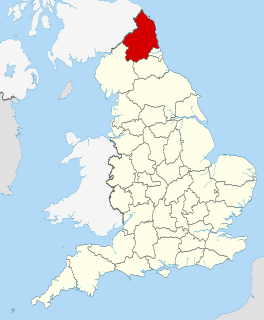
 Birtley Birtley shown within Northumberland | |
| Population | 172 (2011) [1] |
| OS grid reference | NY876778 |
| Unitary authority | |
| Ceremonial county | |
| Region | |
| Country | England |
| Sovereign state | United Kingdom |
| Post town | HEXHAM |
| Postcode district | NE48 |
| Dialling code | 01434 |
| Police | Northumbria |
| Fire | Northumberland |
| Ambulance | North East |
| EU Parliament | North East England |
| UK Parliament | |
Birtley is a village in Northumberland, England southeast of Bellingham. It is about 10 miles (16 km) north of Hexham.
Northumberland is a county in North East England. The northernmost county of England, it borders Cumbria to the west, County Durham and Tyne and Wear to the south and the Scottish Borders to the north. To the east is the North Sea coastline with a 64 miles (103 km) path. The county town is Alnwick, although the County council is based in Morpeth.

Bellingham is a village in Northumberland, to the north-west of Newcastle upon Tyne and is situated on the Hareshaw Burn at its confluence with the River North Tyne.

Hexham is a market town and civil parish in Northumberland, England, south of the River Tyne, and was the administrative centre for the Tynedale district from 1974 to 2009. In 2011, it had a population of 11,829.