
Nieuw-Vennep is a town in the Dutch province of North Holland. It is a part of the municipality of Haarlemmermeer, and lies about 10 km southwest of Amsterdam Airport Schiphol. It has about 31,300 inhabitants, half of which live in the newly built district of Getsewoud. The built-up area of the town was 3.71 km2, and contained 7,513 residences. The wider statistical area of Nieuw-Vennep has a population of around 40,000. In 2001, Nieuw-Vennep had 17,886 inhabitants, which later doubled due to the development of Getsewoud.
The IJ is a body of water, formerly a bay, in the Dutch province of North Holland. It is known for being Amsterdam's waterfront. Its name is from an obsolete Dutch word meaning "water". The name consists of the digraph ij, which behaves like a single letter. Therefore both letters are capitalized; cf. IJmuiden.

The Ringvaart is a canal in the province of North Holland, the Netherlands. The Ringvaart is a true circular canal surrounding the Haarlemmermeer polder and forms the boundary of the Haarlemmermeer municipality. Ringvaart is also the name of the dike bordering the canal.
Spaarnwoude is a hamlet in the Dutch province of North Holland. It is a part of the municipality of Haarlemmermeer and lies about 5 km (3.1 mi) northeast of Haarlem.

Burgerveen is a hamlet in the western Netherlands. It is located in the municipality of Haarlemmermeer, North Holland, about halfway between Amsterdam and The Hague.

Badhoevedorp is a town in the Dutch province of North Holland. It is a part of the municipality of Haarlemmermeer, and lies next to the Ringvaart around Haarlemmermeer at the side of the polder bordering Amsterdam / Amstelveen.

Nieuwe Meer is a hamlet in the Dutch province of North Holland. It is a part of the municipality of Haarlemmermeer, and lies about 8 km southwest of Amsterdam.
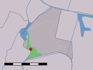
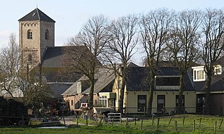
Haarlemmerliede is a small village in the Dutch province of North Holland. It is a part of the municipality of Haarlemmermeer and lies about 4 km (2.5 mi) east of Haarlem.

Remetea is a commune in Bihor County, west of Romania. It is composed of five villages: Drăgoteni (Drágota), Meziad (Mézged), Petreasa (Petrász), Remetea and Șoimuș (Gyepüsolymos).

The Museum De Cruquius occupies the old Cruquius steam pumping station in Cruquius, the Netherlands. It derives its name from Nicolaas Kruik (1678–1754), a Dutch land-surveyor and one of many promotors of a plan to pump the Haarlemmermeer dry. Like many well-educated men of his time, he latinized his name to Nicolaus Samuel Cruquius. During his lifetime the issue of the Haarlem Lake and how to pump it dry was international news, as the following excerpt from the Virginia Gazette on 31 May 1751 illustrates:

Schiphol-Rijk is an industrial estate in the Dutch province of North Holland. It is a part of Amsterdam Schiphol Airport and lies in the municipality of Haarlemmermeer. Schiphol-Rijk is named after the village Rijk that was demolished in the 1950s to make way for an extension of Schiphol Airport.
De Vennip is a former municipality in the Dutch province of South Holland. It consisted of a small area of land east of Hillegom, and a large part of the Haarlemmermeer lake, including the island of Beinsdorp.
Oude Wetering is a village in the Dutch province of South Holland. It is located in the municipality of Kaag en Braassem, east of the town of Roelofarendsveen.

Witowy is a village in the administrative district of Gmina Inowrocław, within Inowrocław County, Kuyavian-Pomeranian Voivodeship, in north-central Poland. It lies approximately 10 kilometres (6 mi) south-east of Inowrocław and 38 km (24 mi) south-west of Toruń.
Budy Radzymińskie is a village in the administrative district of Gmina Baboszewo, within Płońsk County, Masovian Voivodeship, in east-central Poland. It lies approximately 9 kilometres (6 mi) north-east of Baboszewo, 12 km (7 mi) north of Płońsk, and 72 km (45 mi) north-west of Warsaw.
Palędzie is a village in the administrative district of Gmina Dopiewo, within Poznań County, Greater Poland Voivodeship, in west-central Poland. It lies approximately 4 kilometres (2 mi) east of Dopiewo and 13 km (8 mi) west of the regional capital Poznań.

The Battle of Haarlemmermeer was a naval engagement fought on 26 May 1573, during the early stages of the Dutch War of Independence. It was fought on the waters of the Haarlemmermeer – a large lake which at the time was a prominent feature of North Holland.

Huigsloot is a hamlet in the Dutch municipality of Haarlemmermeer, in the province of North Holland. It is located on the southeast of a polder, on Ringvaart, between Buitenkaag and Vredeburg.

The 2002 Floriade international horticultural exposition took place from April 6 to October 20, 2002, in Haarlemmermeer, Netherlands, with a theme of Contribution of Horticulture in the quality of life in the 21st century. Recognised by the Bureau International des Expositions (BIE), the festival covered 65 hectares and had 30 participating countries.


