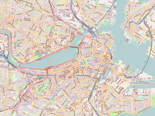
Boston & Roxbury Mill Dam

Last updated
Boston & Roxbury Mill Dam
BackBay pre1858 Boston.png
An 1858 view of the Boston Milldam
Relief map of USA Massachusetts.png
Red pog.svg
Location of Boston & Roxbury Mill Dam in Massachusetts
Location Boston, Massachusetts
Coordinates 42°21′13.19″N71°4′44.63″W / 42.3536639°N 71.0790639°W / 42.3536639; -71.0790639 Coordinates: 42°21′13.19″N71°4′44.63″W / 42.3536639°N 71.0790639°W / 42.3536639; -71.0790639
PurposeIndustrial production, transportation
Construction began1818
Opening date1821
Construction cost$700,000 ($189 million with inflation)

The Boston & Roxbury Mill Dam was an engineering project in Boston's Back Bay. Commissioned in 1814, the project intended to enclose the Back Bay basin and utilize the flowing tidal waters for industrial production. Constructing the dam would allow water to reliably flow from the Charles River to the basin, creating an ideal environment for the era's industrial mills. The project additionally added a second route to the mainland that redirected traffic away from Boston's choked Orange Street causeway. Between 1818 and 1821, the dam was constructed by extending Beacon Street westward.

Charles River river in Massachusetts, United States

The Charles River is an 80-mile-long (129 km) long river in eastern Massachusetts. From its source in Hopkinton the river's mouth is northeast of its headwaters, though it follows a highly meandering route, doubling back on itself several times and traveling through 23 cities and towns before reaching the Atlantic Ocean at Boston. The Native-American name for the Charles River was Quinobequin, meaning "meandering".

Washington Street (Boston) street in Massachusetts, United States of America

Washington Street is a street originating in downtown Boston, Massachusetts that extends southwestward to the Massachusetts–Rhode Island state line. The majority of it was built as the Norfolk and Bristol Turnpike in the early 19th century. It is the longest street in Boston, and it remains one of the longest streets in the state of Massachusetts.

Beacon Street street in Massachusetts, United States of America

Beacon Street is a major thoroughfare in Boston, Massachusetts, and several of its western suburbs. It goes through Boston, Brookline, Brighton, and Newton.

Contents

Geography

The Boston Milldam occupied what is today the westward extension of Beacon Street. Prior to the construction of the Milldam, Beacon street ended at the foot of Charles Street – Back Bay's tidal basin prevented any further construction. The dam had two arms, one stretching from Beacon Hill to Sewall's point (today, Kenmore Square) and one stretching from Roxbury's Gravelly point. These sections of the dam enclosed the back bay in a 600-acre tidal basin. The tidal basin was later filled in and is now occupied by the Back Bay Neighborhood. [1]

Charles Street (Boston) street in Massachusetts, USA

Charles Street is the name of a north-south street in the city center of Boston, Massachusetts. It begins in the north at Leverett Circle, where it connects with Nashua Street and Monsignor O'Brien Highway. Science Park station on the MBTA Green Line is located there. Charles Street runs south and gives its name to the Charles/MGH station on the MBTA Red Line, connecting via the Charles Circle rotary to Cambridge Street and the Longfellow Bridge which leads to Cambridge. This segment is a one-way street, with traffic heading northwards.

Beacon Hill, Boston Historic neighborhood in Boston, Massachusetts

Beacon Hill is a historical neighborhood in Boston, Massachusetts, and the hill upon which the Massachusetts State House resides. The term "Beacon Hill" is locally used as a metonym to refer to the state government or the legislature itself, much like Washington, D.C.'s "Capitol Hill" does at the federal level.

Kenmore Square

Kenmore Square is a square in Boston, Massachusetts, United States, consisting of the intersection of several main avenues as well as several other cross streets, and Kenmore Station, an MBTA subway stop. Kenmore Square is close to or abuts Boston University and Fenway Park, and it features Lansdowne Street, a center of Boston nightlife, and the Citgo sign. It is also the eastern terminus of U.S. Route 20, the longest U.S. Highway.

Construction

The idea for the Milldam was conceived by Uriah Cotting, a real estate merchant who had established a reputation for developing the Boston waterfront. Boston historian Justin Winsor described Cotting as "the projector and guiding spirit in nearly every enterprise involving the development of the town for business during the first twenty years" of the 19th century. [2] The idea was developed in response to a shortage of industrial goods during the War of 1812, for Cotting believed Boston's tides could be utilized to power factories.

Boston Harbor estuary and harbor of Massachusetts Bay in the northeastern United States

Boston Harbor is a natural harbor and estuary of Massachusetts Bay, and is located adjacent to the city of Boston, Massachusetts. It is home to the Port of Boston, a major shipping facility in the northeastern United States.

Justin Winsor American librarian and historian

Justin Winsor was a prominent American writer, librarian, and historian. His historical work had strong bibliographical and cartographical elements. He was an authority on the early history of North America. His self-confidence, energy and congeniality augmented his entrepreneurial skills and were well received by his peers, who elected him as the first president of the American Library Association.

War of 1812 32-month military conflict between the United States and the British Empire

The War of 1812 was a conflict fought between the United States and the United Kingdom, with their respective allies, from June 1812 to February 1815. Historians in Britain often see it as a minor theatre of the Napoleonic Wars; historians in the United States and Canada see it as a war in its own right.

On June 14, 1814, the Massachusetts Legislature approved the construction of the dam. However, a slow industrial economy following the War of 1812 delayed the dam's immediate construction. Despite the economic troubles, merchants were eager to invest in the dam. Cotting predicted that the dam would yield 81 mills and cost $250,000, but bring in $520,000 a year in revenue. It would also provide a second route to the towns of Brookline, Brighton, and Watertown. [2] Construction began in 1818, and would continue until 1821. Cotting died two years prior to the dam's completion in 1819. [3] Constructed from stone, one arm of the dam was built from the foot of Beacon Hill to Sewell's Point (now Kenmore Square) in Brookline. A second cross-dam was constructed from Gravelly Point in Roxbury, dividing Back Bay into two basins of 600 combined acres. At high tide the waters of the Charles River would enter the westerly basin, pass through channels to generate turbine power, and then empty back into the Charles at low tide. [2]

Brookline, Massachusetts Town in Massachusetts, United States

Brookline is a town in Norfolk County, Massachusetts, in the United States, and is a part of Greater Boston. Brookline borders six of Boston's neighborhoods: Brighton, Allston, Fenway–Kenmore, Mission Hill, Jamaica Plain, and West Roxbury. The city of Newton lies to the west of Brookline.

Watertown, Massachusetts City in Massachusetts, United States

Watertown is a city in Middlesex County, Massachusetts, and is part of Greater Boston. The population was 31,915 in the 2010 census. Its neighborhoods include Bemis, Coolidge Square, East Watertown, Watertown Square, and the West End. It is one of thirteen Massachusetts municipalities that retain the title of “town” while functioning under state law as cities.

Roxbury, Boston Neighborhood of Boston in Massachusetts, United States

Roxbury is a neighborhood within the city of Boston, Massachusetts.

Failure and aftermath

The milldam project is regarded as a failure. [4] Construction ran significantly over budget, costing nearly $700,000 instead of the proposed $250,000. Only three factories would become established along Boston's waters instead of the predicted 81. Pollution also became a problem immediately after the construction of the Milldam. Enclosing the dam led to stagnant and foul water, precipitating several complaints by the residents of Boston. [5] Cotton's reputation was saved by his early death, but the Boston & Roxbury Mill Corporation was negatively impacted by the dam's failure. [6] The Milldam would persist for several more decades. Wanting to use the dirty, derelict bay for practical purpose, the Back Bay land reclamation project was commissioned in 1857 to construct new residential neighborhoods over the tidal basin. Boston and Roxbury Mill Corporation thus signed over the rights to the land in 1859. [7] The seawall was extended to fill in the Back Bay mudflats in order to accommodate the new construction. The failure of the Milldam prevented back bay from becoming an industrial district, leading to its current incarnation as a rich collection of 19th-century residences.

Seawall Form of coastal defence

A seawall is a form of coastal defense constructed where the sea, and associated coastal processes, impact directly upon the landforms of the coast. The purpose of a sea wall is to protect areas of human habitation, conservation and leisure activities from the action of tides, waves, or tsunamis. As a seawall is a static feature it will conflict with the dynamic nature of the coast and impede the exchange of sediment between land and sea. The shoreline is part of the coastal interface which is exposed to a wide range of erosional processes arising from fluvial, aeolian and terrestrial sources, meaning that a combination of denudational processes will work against a seawall.

Related Research Articles

Back Bay, Boston United States historic place

Back Bay is an officially-recognized neighborhood of Boston, Massachusetts, built on reclaimed land in the Charles River basin. Construction began in 1859, as the demand for luxury housing exceeded the availability in the city at the time, and the area was fully built by around 1900. It is most famous for its rows of Victorian brownstone homes—considered one of the best preserved examples of 19th-century urban design in the United States—as well as numerous architecturally significant individual buildings, and cultural institutions such as the Boston Public Library. Initially conceived as a residential-only area, commercial buildings were permitted from around 1890, and Back Bay now features many office buildings, including the John Hancock Tower, Boston's tallest skyscraper. It is also considered a fashionable shopping destination and home to several major hotels.

Kenmore station Boston, Massachusetts light rail station

Kenmore is a light rail station on the MBTA Green Line, located under Kenmore Square in the Fenway/Kenmore neighborhood of Boston, Massachusetts. The station opened on October 23, 1932 as a one-station extension of the Boylston Street Subway to relieve congestion in the square. Kenmore is the primary station for passengers wishing to visit Fenway Park, located just one block away.

Brighton, Boston Neighborhood of Boston in Suffolk, Massachusetts, United States

Brighton is a dissolved municipality and current neighborhood of Boston, Massachusetts, United States, located in the northwestern corner of the city. It is named after the town of Brighton in the English city of Brighton and Hove. Initially Brighton was part of Cambridge, and known as "Little Cambridge". Brighton separated from Cambridge in 1807 after a bridge dispute, and was annexed to Boston in 1874. For much of its early history, it was a rural town with a significant commercial center at its eastern end.

The Fens (Boston, Massachusetts) parkland and urban wild in Boston, Massachusetts

The Back Bay Fens, often called The Fens, is a parkland and urban wild in Boston, Massachusetts, in the United States. It was established in 1879. Designed by Frederick Law Olmsted to serve as a link in the Emerald Necklace park system, the Fens gives its name to the Fenway-Kenmore neighborhood, and thereby to Fenway Park, home of the Boston Red Sox.
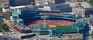
Fenway–Kenmore Neighborhood in Boston in Suffolk, Massachusetts, United States

Fenway–Kenmore is an officially recognized neighborhood of Boston, Massachusetts. While it is considered one neighborhood for administrative purposes, it is composed of numerous distinct sections that, in casual conversation, are almost always referred to as "Fenway", "the Fenway", "Kenmore Square", or "Kenmore". Furthermore, the Fenway neighborhood is divided into two sub-neighborhoods commonly referred to as East Fenway/Symphony and West Fenway.
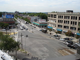
Allston Neighborhood in Suffolk, Massachusetts, United States

Allston is an officially recognized neighborhood within the City of Boston, Massachusetts. It was named after the American painter and poet Washington Allston. It comprises the land covered by the zip code 02134. For the most part, Allston is administered collectively with the adjacent neighborhood of Brighton. The two are often referred to together as "Allston–Brighton." Boston Police Department District D-14 covers the Allston-Brighton area and a Boston Fire Department Allston station is located in Union Square which houses Engine 41 and Ladder 14. Engine 41 is nicknamed "The Bull" to commemorate the historic stockyards of Allston.

Green Line "B" Branch Boston Massachusetts subway line

The "B" Branch, also called the Commonwealth Avenue Branch or Boston College Branch, is a branch of the MBTA Green Line light rail system which operates on Commonwealth Avenue west of downtown Boston, Massachusetts. One of four branches of the Green Line, the "B" Branch runs from Boston College station down the median of Commonwealth Avenue to Blandford Street. There, it enters Blandford Street Portal into Kenmore station, where it merges with the "C" and "D" branches. The combined services run into the Boylston Street Subway and Tremont Street Subway to downtown Boston. As of 2016, "B" Branch service terminates at Park Street. Unlike the other branches, the "B" branch runs solely through the city limits of Boston.
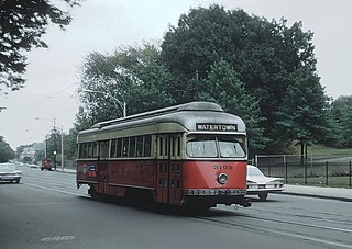
Green Line "A" Branch Former Boston Massachusetts subway line

The "A" Branch or Watertown Branch was a streetcar line in the Boston, Massachusetts area, operating as a branch of the Massachusetts Bay Transportation Authority Green Line. In 1969 it was replaced by the 57 bus, though the tracks remained continuous until March 1994.

Neighborhoods in Boston

Boston's diverse neighborhoods serve as a political and cultural organizing mechanism. The City of Boston's Office of Neighborhood Services has designated 23 Neighborhoods in the city:

Allston–Brighton is a set of two interlocking Boston neighborhoods, Allston and Brighton.

Commonwealth Avenue (Boston)

Commonwealth Avenue is a major street in the cities of Boston and Newton, Massachusetts. It begins at the western edge of the Boston Public Garden, and continues west through the neighborhoods of the Back Bay, Kenmore Square, Allston, Brighton and Chestnut Hill. It continues as part of Route 30 through Newton until it crosses the Charles River at the border of the town of Weston.

River Street Bridge (Charles River) Bridge in Boston, Massachusetts

The River Street Bridge is a bridge connecting River Street in Cambridge, MA to Cambridge Street in Allston, Boston, MA. It was built in 1925 by the Commonwealth of Massachusetts Metropolitan District Commission.

Western Avenue Bridge Bridge in Boston, Massachusetts

The Western Avenue Bridge is a bridge carrying Western Avenue over the Charles River between Cambridge, Massachusetts and Allston, Boston. It was built in 1924 by the Commonwealth of Massachusetts Metropolitan District Commission.

Brookline Avenue street in Massachusetts, United States of America

Brookline Avenue is a principal urban artery in the city of Boston, Massachusetts, terminating in the town of Brookline. The Landmark Center, Fenway Park, Emmanuel College, Longwood Medical and Academic Area and Kenmore Square are sites along its length. It runs from Kenmore Square in the Fenway-Kenmore neighborhood, forming a 1.5-mile straight line to its other terminus at Washington Street in the Brookline Village neighborhood of Brookline, Massachusetts.
Beacon Street Historic District United States historic place

The Beacon Street Historic District is a historic district running most of the length of Beacon Street in Brookline, Massachusetts, roughly from Saint Mary's Road, near Kenmore Square, to Ayr Road near Cleveland Circle. It includes a small number of properties on adjacent streets, and was listed on the National Register of Historic Places in 1985.

Charles River Speedway Defunct harness racing and cycle racing track in Massachusetts, United States

The Charles River Speedway was a former bicycle and harness racing track located in Allston, Massachusetts.

Boston Landing station

Boston Landing is an MBTA Commuter Rail station in Boston, Massachusetts. It serves the Framingham/Worcester Line. It is located in the Brighton neighborhood just west of the Everett Street bridge, next to the Massachusetts Turnpike. It serves the Allston-Brighton area as well as the Boston Landing development including Warrior Ice Arena. The station is fully handicapped accessible, with a single full-length high-level island platform. Elevators and stairs lead to Arthur Street and to the Everett Street bridge.

References

  1. Marchione, William. "Building The Mill Dam". Brighton-Allston Historical Society.
  2. 1 2 3 Marchione, William P. "Building The Mill Dam". Brighton-Allston Historical Society.
  3. Boston (Mass.). Registry Dept (1887). Volume 5 of Records Relating to the Early History of Boston. University of Virginia: Rockwell and Churchill, City Printers. p. 176.
  4. Baldwin, Loammi (1826). Letter to the Hon. John Pickering, President of the Salem Mill Dam Corporation upon the estimates &c. of that work. Andrews & Foote.
  5. Newman, William A. (2006). Boston's Back Bay . Lebanon, NH: University Press of New England. p.  26.
  6. Marchione, William P. (2008). Boston Miscellany: An Episodic History of the Hub. The History Press.
  7. Newman, William A. (2006). Boston's Back Bay . Lebanon: University Press of New England.