
Cumbria is a ceremonial and non-metropolitan county in North West England. The county and Cumbria County Council, its local government, came into existence in 1974 after the passage of the Local Government Act 1972. Cumbria's county town is Carlisle, in the north of the county. The only other major urban area is Barrow-in-Furness on the south-western tip of the county.
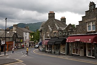
Ambleside is a town in Cumbria, in North West England. Historically in Westmorland, it marks the head of Windermere, England's largest natural lake. In the Lake District National Park, it is south of the highest road pass in the Lake District, Kirkstone Pass and both places are the meeting point of well-marked paths and mountain hiking trails.

Furness is a peninsula and region of Cumbria in northwestern England. Together with the Cartmel Peninsula it forms North Lonsdale, historically an exclave of Lancashire.

The Brathay is a river of north-west England. Its name comes from Old Norse and means broad river. It rises at a point 1289 feet above sea level near the Three Shire Stone at the highest point of Wrynose Pass in the Lake District. Its catchment area includes the northern flanks of Wetherlam, Great Carrs and others of the Furness Fells, as well as a substantial area of the Langdale Fells.

The Rothay is a spate river of the Lake District in north-west England. Its name comes from Old Norse and translates literally as the red one. This has come to mean trout river. It rises close to Rough Crag above Dunmail Raise at a point about 1542 feet above sea level. Its catchment area covers Grasmere Common including Easedale Tarn, the southern flanks of Fairfield, and several of the fells to the east of Dunmail Raise, including Great Rigg, Rydal Fell, Scandale Fell and Heron Pike.
The Howgill Fells are hills in Northern England between the Lake District and the Yorkshire Dales, lying roughly in between the vertices of a triangle made by the towns of Sedbergh, Kirkby Stephen and Tebay. The name Howgill derives from the Old Norse word haugr meaning a hill or barrow, plus gil meaning a narrow valley.

Cunsey Beck is one of several rivers and streams that replenish the lake of Windermere in the English Lake District. Being just over two miles (3.2 km) in length and generally slow flowing, the stream descends some 87 feet from the southern end of Esthwaite Water, which it drains, to the western banks of Windermere near an island called Ling Holm.

The Trout Beck is a fast flowing stream of the Lake District in North West England. It is one of the main sources of replenishment for Windermere, and is part of the Leven catchment. Its name comes from Old Norse and appears in documents from 1292 as Trutebyk. The river rises between the peaks of Stony Cove Pike and Thornthwaite Crag in the High Street range, at a height of about 1,970 feet.

Elter Water is a small lake that lies half a mile (800 m) south-east of the village of Elterwater. Both are situated in the valley of Great Langdale in the English Lake District. The name Elterwater means either Lake of the Swan or Lake of Alder. Thomas Frederick Worrall painted a watercolour of the lake with Langdale Pikes in the background. This painting is hanging in the Bishop's House, Keswick.

Ambleside Roman Fort is the modern name given to the remains of a fort of the Roman province of Britannia. The ruins have been tentatively identified as Galava, mentioned in the Antonine Itinerary. Dating to the 1st or 2nd century AD, its ruins are located on the northern shore of Windermere at Waterhead, near Ambleside, in the English county of Cumbria, within the boundaries of the Lake District National Park.

Brathay Exploration Trust, formerly Brathay Exploration Group, is a not-for-profit charity in the UK which has been providing worldwide youth expeditions since 1947. Based in Ambleside, Cumbria, England, BET aims to run around five expeditions per year, to destinations all over the world. The group is aimed at young people from all backgrounds who share an interest in the outdoors and who want to "learn new skills, make new friends, gain new self-confidence and discover new places on expeditions, in the UK, Europe and worldwide". Run predominantly by volunteers, BEG engages professional leaders on a voluntary basis.

Black Fell is a fell in the English Lake District. It rises to the north of Tarn Hows, between Coniston and Hawkshead.

Clappersgate is a village in the South Lakeland district, in the county of Cumbria, England. Clappersgate is located on the B5286 road and on the River Brathay. It is near the town of Ambleside.
Lancelot 'Lanty' Slee (1800/1802–1878) was a Lake District farmer, quarryman and notorious smuggler. The name 'Lanty' is a diminutive for Lancelot used in the Lake District.
Andrew John Trevor Brown was a Scottish cricketer and Royal Navy Engineering Officer. Brown was a left-handed batsman who bowled right-arm off break. He was born in Edinburgh.

Holy Trinity Church is in Bog Lane in the village of Brathay, Cumbria, England. It is an active Anglican parish church in the deanery of Windermere, the archdeaconry of Westmorland and Furness, and the diocese of Carlisle. The church is recorded in the National Heritage List for England as a designated Grade II listed building. The hilltop site for the church was recommended by William Wordsworth who, when describing it in a letter in 1836, said "there is no situation out of the Alps, nor among them, more beautiful than that where this building is placed".

Brathay Trust is a youth charity with its head office and residential centre based at Brathay in Cumbria, England. Founded in 1946 by Francis C. Scott, the charity is based at the Brathay Hall and estate near the town of Ambleside. The organisation's main focus is on training and developing general skills for youth, including Lake District-based outdoor education and experiential learning, but also organises people and organisation development courses for adults. In 2007, the trust began holding the Brathay Windermere Marathon, a now annual charity marathon.
Skelwith is a civil parish in the South Lakeland District of Cumbria, England. It contains 17 listed buildings that are recorded in the National Heritage List for England. Of these, one is listed at Grade II*, the middle of the three grades, and the others are at Grade II, the lowest grade. The parish is in the Lake District National Park. The only settlement of significant size is the village of Skelwith Bridge, the rest of the parish being rural. Most of the listed buildings are houses with associated structures, and farmhouses and farm buildings. The other listed buildings are a church and a bridge.
The Tranearth Group is a Silurian lithostratigraphic group in the southern Lake District and Howgill Fells of the Pennines of northern England. The name is derived from the locality of Tranearth near Torver in Cumbria. The Group is included within the Windermere Supergroup. It comprises laminated hemipelagites and siltstones and some sandstones and limestone which achieve a thickness of between 500 and 1000m. It is divided into a lower Brathay Formation which is overlain by the Birk Riggs Formation and then by an upper Coldwell Formation.


