Webster's Claypit is a 0.3 hectares geological site of Special Scientific Interest in the West Midlands. The site was notified in 1986 under the Wildlife and Countryside Act 1981 and is currently managed by the Country Trust.
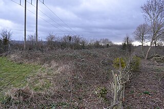
Daw End Railway Cutting is an 8.1 hectares geological site of Special Scientific Interest in the West Midlands. The site was notified in 1986 under the Wildlife and Countryside Act 1981 and is currently managed by the Country Trust.
Ketley Claypit is a 13.7 hectares geological site of Special Scientific Interest in the West Midlands. The site was notified in 1990 under the Wildlife and Countryside Act 1981. It is located in Kingswinford.

Charnwood Lodge is a 134.2-hectare (332-acre) biological and geological Site of Special Scientific Interest in Charnwood Forest, east of Coalville in Leicestershire. It is a national nature reserve, and contains two Geological Conservation Review sites. It is managed by the Leicestershire and Rutland Wildlife Trust.

Blo' Norton and Thelnetham Fens are a 21.3-hectare (53-acre) biological Site of Special Scientific Interest (SSSI) on the Norfolk/Suffolk border. Blo' Norton Fen is in the parish of Blo' Norton in Norfolk and Thelnetham Fen is in Thelnetham parish in Suffolk. It is a Nature Conservation Review site, Grade 2, and part of the Waveney and Little Ouse Valley Fens Special Area of Conservation, Thelnetham Fen is managed by the Suffolk Wildlife Trust and Blo' Norton Fen by the Little Ouse Headwaters Project (LOHP).
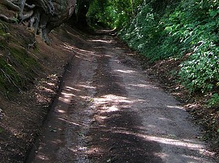
Cropthorne New Inn Section is a 0.12-hectare (0.30-acre) geological Site of Special Scientific Interest in Cropthorne in Worcestershire. It is a Geological Conservation Review site.
Great Stukeley Railway Cutting is a 34.7-hectare (86-acre) biological Site of Special Scientific Interest in Huntingdon in Cambridgeshire.

Portholme is a 106-hectare (260-acre) biological Site of Special Scientific Interest in the Parish of Brampton between Huntingdon and Godmanchester in Cambridgeshire, England. It is a Nature Conservation Review site, and a Special Area of Conservation.

Holland Hall (Melbourn) Railway Cutting is a 3.3-hectare (8.2-acre) biological Site of Special Scientific Interest near Melbourn in Cambridgeshire. It is the verge of a kilometre long stretch of an operational railway line, the Cambridge Line.
Warboys Clay Pit is a 12.6-hectare (31-acre) geological Site of Special Scientific Interest west of Warboys in Cambridgeshire. It is a Geological Conservation Review site.

Helmdon Disused Railway is a 16.6-hectare (41-acre) linear biological Site of Special Scientific Interest between Helmdon and Brackley in Northamptonshire.

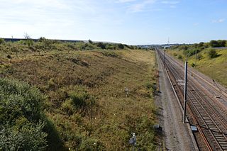
Roade Cutting is a 15.2-hectare (38-acre) geological Site of Special Scientific Interest along the West Coast Main Line north from Roade in Northamptonshire. It is a Geological Conservation Review site.

Wing Water Treatment Works is a 1.5-hectare (3.7-acre) geological Site of Special Scientific Interest east of Wing in Rutland. It is a Geological Conservation Review site.
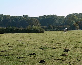
Debdale Meadow, Muston is a 4.3-hectare (11-acre) biological Site of Special Scientific Interest north of Muston in Leicestershire.

River Mease SSSI is a 23.0 hectares biological Site of Special Scientific Interest. It is a stretch of the River Mease and its tributary Gilwiskaw Brook, running between Alrewas in Staffordshire and Packington in Leicestershire. It is also a Special Area of Conservation The river goes through private land, but it is crossed by roads and footpaths.

Shepshed Cutting is a 6.0 hectares geological Site of Special Scientific Interest west of Shepshed in Leicestershire.

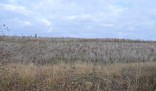
Tilton Cutting is a 4.4 hectares geological Site of Special Scientific Interest west of Tilton on the Hill in Leicestershire. It is a Geological Conservation Review site, and is owned and managed by the Leicestershire and Rutland Wildlife Trust as Tilton Railway Cutting.

Coneyhurst Cutting is a 0.2-hectare (0.49-acre) geological Site of Special Scientific Interest south-east of Billingshurst in West Sussex. It is a Geological Conservation Review site.
Park Farm Cutting is a 0.2-hectare (0.49-acre) geological Site of Special Scientific Interest west of Pulborough in West Sussex. It is a Geological Conservation Review site.

Ardley Cutting and Quarry is a 40.1-hectare (99-acre) biological and geological Site of Special Scientific Interest north-west of Bicester in Oxfordshire. It is a Geological Conservation Review site and an area of 11 hectares is managed by the Berkshire, Buckinghamshire and Oxfordshire Wildlife Trust as Ardley Wood Quarry. The site contains a Scheduled Monument, Ardley Wood moated ringwork, a Norman defended enclosure.