
Cotes is a hamlet and very small civil parish near the town of Loughborough in Leicestershire, England.Cotes has a population of about 50. At the 2011 census the population remained less than 100 and was included in the civil parish of Burton on the Wolds.

Bircotes is a mining town in the Bassetlaw district of Nottinghamshire, on the border with the metropolitan borough of Doncaster. It is located at 53°25′N1°3′W, and forms the civil parish of Harworth and Bircotes with its neighbour Harworth. The parish has a population of around 8,000 people falling to 7,948 at the 2011 Census. The nearest major towns are Doncaster and Worksop. The local school is Serlby Park Academy.
Folksworth and Washingley is a civil parish near Peterborough in Cambridgeshire, England, comprising the villages of Folksworth and Washingley.
Stoke Prior is a village in Herefordshire, England, 4 km (2.5 mi) south east of Leominster. The population is shown under the civil parish - called Ford and Stoke Prior. At the 2011 census it was 364. Previously served by the now closed Worcester, Bromyard and Leominster Railway.
Grafton is a village and civil parish in Herefordshire, England. The population of this civil parish was 258 at the 2011 census. The parish includes the villages of Grafton and Bullinghope, and is immediately to the south of Hereford city.

Dinedor is a hill, village and civil parish in Herefordshire, England. Dinedor is situated 5 km (3.1 mi) south east of Hereford. The hilltop is the site of an Iron Age fort.
All Saints is a civil parish in East Devon, Devon, England. It has a population of 498 according to the 2001 census. The parish includes the hamlets of All Saints, Smallridge, Churchill, Alston and Waggs Plot.

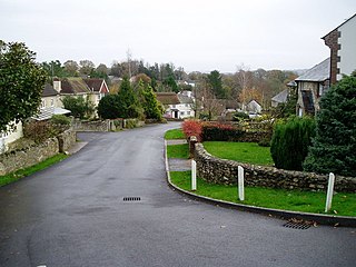
Angram Grange is a small civil parish in the Hambleton district of North Yorkshire, England, about 7 miles south-east of Thirsk. According to the 2001 census it had a population of 17. In 2015 the population was estimated at 20.

Ballidon is a village and civil parish in the Derbyshire Dales district of Derbyshire, England, on the edge of the Peak District National Park. According to the 2001 census it had a population of 79. The population at the 2011 Census remained less than 100. Details are maintained in the civil Parish of Aldwark, Derbyshire. Ballidon was listed in the Domesday Book of 1086 and was a much larger village than seen today. That area now devastated by the Tilcon Quarry was a deep valley and the site of an ambush of troops of the Jacobean Rebellion, skulls and weaponry were recovered on the left bank.

Bardsey cum Rigton is a civil parish in the City of Leeds metropolitan borough in West Yorkshire, England. According to the 2001 census it had a population of 2,385, increasing to 2,525 at the 2011 Census. The parish includes the villages of Bardsey, East Rigton and Thornhurst.
Bentley is a village and civil parish in the North Warwickshire district of Warwickshire, England, about two miles south-west of Atherstone. According to the 2001 census it had a population of 101. From the Census 2011 the population of Bentley has been included in Merevale.

Bilton-in-Ainsty with Bickerton is a civil parish in the Harrogate district of North Yorkshire, England. According to the 2001 census it had a population of 512, reducing to 463 at the 2011 Census.

Buttercrambe with Bossall is a civil parish in the Ryedale district of North Yorkshire, England. The parish had a population of 100 according to the 2001 census, increasing to 105 at the 2011 census. The parish is near Stamford Bridge, and contains Buttercrambe and Bossall.

Bulmer is a village and civil parish in the Braintree district of Essex, England. According to the 2001 census it had a population of 568, increasing to 584 at the 2011 Census. The village is about 4 miles south-west of Sudbury in Suffolk. The settlement of Bulmer Tye is located to the south of the village.
Croxdale and Hett is a civil parish in County Durham, England. It is situated approximately four miles south of Durham. The population of the civil parish as taken at the 2011 census was 866.
Gosford and Water Eaton is a civil parish in the Cherwell district of the county of Oxfordshire, England. It is north of the city of Oxford and is crossed nearby by two major roads for, or by-passing, the city. The parish contains the village of Gosford and the hamlet of Water Eaton and as at the 2011 census had 1373 people resident across its 8.75km².
Great Hanwood is a civil parish in Shropshire, England.

Upper Sapey is a small village and civil parish in Herefordshire, England. It is located 4 miles (6 km) northeast of Bromyard. The population of this civil parish as taken at the 2011 census was 460.

Goldshaw Booth is a civil parish in the Pendle district of Lancashire, England. It has a population of 248, and contains the village of Newchurch in Pendle and the hamlets of Spen Brook and Sabden Fold. Pendle Hill lies to the north.

Croft is a hamlet in north Herefordshire, England. It joins with the neighbouring village of Yarpole to create Croft and Yarpole Civil Parish. The population of this civil parish at the 2011 census was 552.


