
The maritime European exploration of Australia consisted of several waves of European seafarers who sailed the edges of the Australian continent. Dutch navigators were the first Europeans known to have explored and mapped the Australian coastline. The first documented encounter was that of Dutch navigator Willem Janszoon, in 1606. Dutch seafarers also visited the west and north coasts of the continent, as did French explorers.

The Houtman Abrolhos is a chain of 122 islands and associated coral reefs, in the Indian Ocean off the west coast of Australia, about 80 km (50 mi) west of Geraldton, Western Australia. It is the southernmost true coral reef in the Indian Ocean, and one of the highest latitude reef systems in the world. It is one of the world's most important seabird breeding sites, and is the centre of Western Australia's largest single-species fishery, the western rock lobster fishery. It has a small seasonal population of fishermen, and a limited number of tourists are permitted for day trips, but most of the land area is off limits as conservation habitat. It is well known as the site of numerous shipwrecks, the most famous being two Dutch ships: Batavia, which was wrecked in 1629, and Zeewijk, wrecked in 1727.

Jacob Le Maire was a Dutch mariner who circumnavigated the earth in 1615 and 1616. The strait between Tierra del Fuego and Isla de los Estados was named the Le Maire Strait in his honour, though not without controversy. It was Le Maire himself who proposed to the council aboard Eendracht that the new passage should be called by his name and the council unanimously agreed with Le Maire. The author or authors of The Relation took Eendracht captain Willem Schouten's side by proclaiming:

Dirk Hartog was a 17th-century Dutch sailor and explorer. Dirk Hartog's expedition was the second European group to land in Australia and the first to leave behind an artefact to record his visit, the Hartog Plate. His name is sometimes alternatively spelled Dirck Hartog or Dierick Hartochszch. Ernest Giles referred to him as Theodoric Hartog. The Western Australian island Dirk Hartog Island is named after Hartog.

Dirk Hartog Island is an island off the Gascoyne coast of Western Australia, within the Shark Bay World Heritage Area. It is about 80 kilometres long and between 3 and 15 kilometres wide and is Western Australia's largest and most western island. It covers an area of 620 square kilometres and is approximately 850 kilometres north of Perth.
The human history of Western Australia commenced between 40,000 and 60,000 years ago with the arrival of Aboriginal Australians on the northwest coast. The first inhabitants expanded across the east and south of the continent.

Willem Hesselsz de Vlamingh was a Dutch sea captain who explored the central west coast of New Holland (Australia) in the late 17th century, where he landed in what is now Perth on the Swan River. The mission proved fruitless, but he charted parts of the continent's western coast.

Willem Cornelisz Schouten was a Dutch navigator for the Dutch East India Company. He was the first to sail the Cape Horn route to the Pacific Ocean.

Cape Leeuwin is the most south-westerly mainland point of the Australian continent, in the state of Western Australia.
The Eendracht was an early 17th century Dutch wooden-hulled 700 tonne East Indiaman, launched in 1615 in the service of the Dutch East India Company (VOC). Its Dutch name means "concord", "unity" or "union", and was a common name given to Dutch ships of the period, from the motto of the Republic: Concordia res parvae crescunt . The ship was captained by Dirk Hartog when he made the second recorded landfall by a European on Australian soil, in 1616.
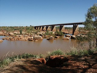
The Ashburton River is located within the Pilbara region of Western Australia.

Eendrachtsland or Eendraghtsland is an obsolete geographical name for an area centred on the Gascoyne region of Western Australia. Between 1616 and 1644, during the European age of exploration, Eendraghtsland was also a name for the entire Australian mainland. From 1644, it and the surrounding areas were known as New Holland.
Hartog Plate or Dirk Hartog's Plate is either of two pewter plates, although primarily the first, which were left on Dirk Hartog Island during a period of European exploration of the western coast of Australia prior to European settlement there. The first plate, left in 1616 by Dutch explorer Dirk Hartog, is the oldest-known artifact of European exploration in Australia still in existence. A replacement, copying the text of the original plus some new text, was left in 1697 – the original dish returned to the Netherlands, where it is on display in the Rijksmuseum. Further additions at the site, in 1801 and 1818, led to the location being named Cape Inscription.

Tryal Rocks, sometimes spelled Trial Rocks or Tryall Rocks, formerly known as Ritchie's Reef or Greyhound's Shoal, is a reef of rock located in the Indian Ocean off the northwest coast of Australia, 14 kilometres (8.7 mi) northwest of the outer edge of the Montebello Islands group. It is named for the Tryall, the first known shipwreck in Australian waters, which sank after striking the then-uncharted rocks in 1622. Described as "the theme and dread of every voyager to the eastern islands", their location was sought for over three centuries before finally being determined in 1969.
Dutch Australians refers to Australians of Dutch ancestry. They form one of the largest groups of the Dutch diaspora outside Europe. At the 2021 census, 381,946 people nominated Dutch ancestry, representing 1.5% of the Australian population. At the 2021 census, there were 66,481 Australian residents who were born in the Netherlands.

Hessel Gerritsz was a Dutch engraver, cartographer, and publisher. He was one of the notable figures in the Golden Age of Netherlandish cartography. Despite strong competition, he is considered by some "unquestionably the chief Dutch cartographer of the 17th century".

Leeuwin, was a Dutch galleon that discovered and mapped some of the southwest corner of Australia in March 1622. It was captained by Jan Fransz and was the seventh European ship to sight the continent.

The Mauritius was an early 17th century Dutch wooden-hulled sailing ship, documented as being in service to the Dutch East India Company between 1618 and 1622.

The Willem River or Willem's River was named during the voyage of the Dutch East India Company ship Mauritius in 1618, under the command of Supercargo Willem Janszoon and captained by Lenaert Jacobszoon, and is one of the few features named on a nautical chart made in 1627.

