External links
| | This article about transportation in California is a stub. You can help Wikipedia by expanding it. |
The California Highway Commission was established in 1895 and continued until 1978 as the primary California government agency responsible for state highway planning. It exercised jurisdiction over the California state highway system, especially highway routes, while the Department of Highways, established in 1896, constructed and maintained state highways. The latter agency evolved into the Department of Engineering (1907), the Department of Public Works (1921), and then the modern California Department of Transportation (1973).
The commission's first noticeable efforts centered on the Lake Tahoe Wagon Road (eventually to become U.S. Route 50) over the Sierra Nevada. A series of municipal bond issues beginning in 1910 allowed the Highway Commission to grade and pave as much of the new state highway system as quickly as possible.
A 1933 statute read in part:
In 1978, the California Transportation Commission (CTC) replaced and assumed the responsibilities of four independent bodies: The California Highway Commission, the State Transportation Board, the State Aeronautics Board, and the California Toll Bridge Authority.
| | This article about transportation in California is a stub. You can help Wikipedia by expanding it. |
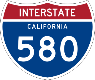
Interstate 580 (I-580) is an approximately 76-mile-long (122 km) east–west auxiliary Interstate Highway in Northern California. The heavily traveled spur route of I-80 runs from US Route 101 (US 101) in San Rafael in the San Francisco Bay Area to I-5 at a point outside the southern city limits of Tracy in the Central Valley. I-580 forms a concurrency with I-80 between Albany and Oakland, the latter of which is the location of the MacArthur Maze interchange immediately east of the San Francisco–Oakland Bay Bridge. I-580 provides a connection from the Bay Area to the southern San Joaquin Valley and Southern California via I-5, as I-5 bypasses the Bay Area to the east.

State Route 91 (SR 91) is a major east–west state highway in the U.S. state of California that serves several regions of the Greater Los Angeles urban area. A freeway throughout its entire length, it officially runs from Vermont Avenue in Gardena, just west of the junction with the Harbor Freeway, east to Riverside at the junction with the Pomona and Moreno Valley freeways.

Route 710, consisting of the non-contiguous segments of State Route 710 (SR 710) and Interstate 710 (I-710), is a major north–south state highway and auxiliary Interstate Highway in the Los Angeles metropolitan area of the U.S. state of California. Also called the Los Angeles River Freeway prior to November 18, 1954, the highway was initially planned to connect Long Beach and Pasadena, but a gap in the route exists from Alhambra to Pasadena through South Pasadena due to community opposition to its construction.

State Route 14 (SR 14) is a north–south state highway in the U.S. state of California that connects Los Angeles to the northern Mojave Desert. The southern portion of the highway is signed as the Antelope Valley Freeway. Its southern terminus is at Interstate 5 in the Los Angeles neighborhoods of Granada Hills and Sylmar just immediately to the south of the border of the city of Santa Clarita. SR 14's northern terminus is at U.S. Route 395 (US 395) near Inyokern. Legislatively, the route extends south of I-5 to SR 1 in the Pacific Palisades area of Los Angeles; however, the portion south of the junction with I-5 has not been constructed. The southern part of the constructed route is a busy commuter freeway serving and connecting the cities of Santa Clarita, Palmdale, and Lancaster to the rest of the Greater Los Angeles area. The northern portion, from Vincent to US 395, is legislatively named the Aerospace Highway, as the highway serves Edwards Air Force Base, once one of the primary landing strips for NASA's Space Shuttle, as well as the Naval Air Weapons Station China Lake that supports military aerospace research, development and testing. This section is rural, following the line between the hot Mojave desert and the forming Sierra Nevada mountain range. Most of SR 14 is loosely paralleled by a rail line originally built by the Southern Pacific Railroad, and was once the primary rail link between Los Angeles and Northern California. While no longer a primary rail line, the southern half of this line is now used for the Antelope Valley Line of the Metrolink commuter rail system.
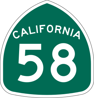
State Route 58 is a major east-west state highway in the U.S. state of California that runs across the Coast Ranges, the southern San Joaquin Valley, the Tehachapi Mountains, which border the southern Sierra Nevada, and the Mojave Desert. It runs between U.S. Route 101 near Santa Margarita and Interstate 15 in Barstow. It has junctions with Interstate 5 near Buttonwillow, State Route 99 in Bakersfield, State Route 202 in Tehachapi, State Route 14 near Mojave, and U.S. Route 395 at Kramer Junction. SR 58 also provides access to Edwards Air Force Base. At various points it is known as the Calf Canyon Highway, Carrisa Highway, Bakersfield-McKittrick Highway, Rosa Parks Highway, Westside Parkway, Barstow-Bakersfield Highway, Bakersfield Tehachapi Highway, Kern County Korean War Veterans Memorial Highway, and Mojave-Barstow Highway.
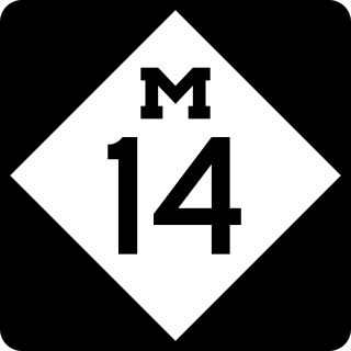
M-14 is an east–west state trunkline highway in the southeastern portion of the US state of Michigan. Entirely freeway, it runs for 22.250 miles (35.808 km) to connect Ann Arbor with Detroit by way of a connection with Interstate 96 (I-96). The western terminus is at a partial interchange with I-94 west of Ann Arbor. From there, the freeway curves around the north side of Ann Arbor and runs concurrently with US Highway 23 (US 23). East of that section, M-14 passes through woodlands and fields in Washtenaw County. In Wayne County, the freeway returns to a suburban area of mixed residential neighborhoods and light industrial areas. It crosses two different rivers and a pair of rail lines as it approaches Detroit's inner suburbs, where it terminates at an interchange between I-96 and I-275.

State Route 82 is a state highway in the U.S. state of California that runs from Interstate 880 (I-880) in San Jose to I-280 in San Francisco following the San Francisco Peninsula. It is the spinal arterial road of the peninsula and runs parallel to the nearby Caltrain line along much of the route. For much of its length, the highway is named El Camino Real and formed part of the historic El Camino Real mission trail. It passes through and near the historic downtowns of many Peninsula cities, including Burlingame, San Mateo, Redwood City, Menlo Park, Palo Alto, Mountain View, Sunnyvale, and Santa Clara, and through some of the most walkable and transit-oriented neighborhoods in the region.

State Route 118 is a state highway in the U.S. state of California that runs west to east through Ventura and Los Angeles counties. It travels from State Route 126 at the eastern edge of Ventura immediately northwest of Saticoy, then through Saticoy, in Ventura County east to Interstate 210 near Lake View Terrace in Los Angeles. SR 118 crosses the Santa Susana Pass and the northern rim of the San Fernando Valley along its route.

State Route 241 (SR 241) is one of the two state highways in California that are controlled-access toll roads for their entire lengths. SR 241's southern half from near Las Flores to near Irvine is the Foothill Transportation Corridor, while its northern half to SR 91 on the Anaheim–Yorba Linda border forms part of the Eastern Transportation Corridor system with SR 133 and SR 261.

State Route 4 is a state highway in the U.S. state of California, routed from Interstate 80 in the San Francisco Bay Area to State Route 89 in the Sierra Nevada. It roughly parallels the Sacramento-San Joaquin River Delta, a popular area for boating and fishing, with a number of accesses to marinas and other attractions. After crossing the Central Valley, the highway ascends up the Sierra foothills. It passes through Ebbetts Pass and contains the Ebbetts Pass Scenic Byway, a National Scenic Byway.

State Route 198 is an east–west state highway in the U.S. state of California that runs from U.S. Route 101 south of King City to Sequoia National Park. It connects the California Central Coast to the mid–Central Valley through Hanford and Visalia, although the most developed portion is in the Central Valley itself. SR 198 intersects the major north–south routes in the Central Valley, including Interstate 5 (I-5), SR 33, and SR 99.

State Route 219 is a state highway in the U.S. state of California that runs north of Modesto in Stanislaus County. It serves as a connector along Kiernan Avenue between State Route 99 and State Route 108.

Route 15, consisting of the contiguous segments of State Route 15 (SR 15) and Interstate 15 (I-15), is a major north–south state highway and Interstate Highway in the U.S. state of California, connecting San Bernardino, Riverside, and San Diego Counties. The route consists of the southernmost 289.24 miles (465.49 km) of I-15, which extends north through Nevada, Arizona, Utah, Idaho, and Montana to the Canada–US border. It is a major thoroughfare for traffic between San Diego and the Inland Empire, as well as between Southern California, Las Vegas, Nevada, and the Intermountain West.

Bucktail State Park Natural Area is a 16,433-acre (6,650 ha) Pennsylvania state park in Cameron and Clinton Counties in Pennsylvania in the United States. The park follows Pennsylvania Route 120 for 75 miles (121 km) between Emporium and Lock Haven. Bucktail State Park Natural Area park runs along Sinnemahoning Creek and the West Branch Susquehanna River and also passes through Renovo. The park is named for the Civil War Pennsylvania Bucktails Regiment and is primarily dedicated to wildlife viewing, especially elk.

An unsigned highway is a highway that has been assigned a route number, but does not bear road markings that would conventionally be used to identify the route with that number. Highways are left unsigned for a variety of reasons, and examples are found throughout the world. Depending on the policy of the agency that maintains the highway, and the reason for not signing the route, the route may instead be signed a different designation from its actual number, with small inventory markers for internal use, or with nothing at all.

U.S. Route 322 is a spur of U.S. Route 22, running from Cleveland, Ohio, east to Atlantic City, New Jersey. The easternmost segment of the route in New Jersey runs 62.64 miles (100.81 km) from the Commodore Barry Bridge over the Delaware River in Logan Township, Gloucester County, where it continues southeast to Atlantic Avenue and Pacific Avenue in Atlantic City, Atlantic County. The portion of the route between the Commodore Barry Bridge and Route 42 in Williamstown is mostly a two-lane undivided road that is concurrently signed with County Route 536 (CR 536), passing through Mullica Hill and Glassboro. From Williamstown, US 322 follows the Black Horse Pike, a four-lane road, southeast to Atlantic City. In Hamilton Township, Atlantic County, US 322 forms a concurrency with U.S. Route 40, continuing with that route all the way to Atlantic City. US 322 intersects several major roads including U.S. Route 130 and Interstate 295 (I-295) in Logan Township, the New Jersey Turnpike in Woolwich Township, Route 55 in Harrison Township, Route 42 in Williamstown, Route 50 and U.S. Route 40 in Hamilton Township, the Garden State Parkway in Egg Harbor Township, and U.S. Route 9 in Pleasantville.

The state highway system in the U.S. state of California dates back to 1896, when the state took over maintenance of the Lake Tahoe Wagon Road. Before then, roads and streets were managed exclusively by local governments. Construction of a statewide highway system began in 1912, after the state's voters approved an $18 million bond issue for over 3,000 miles (4,800 km) of highways. The last large addition was made by the California State Assembly in 1959, after which only minor changes have been made.
The Oklahoma Emergency Management Act of 2003 is an Oklahoma state law that replaced the Oklahoma Civil Defense and Emergency Resources Management Act of 1967 as the primary state law detailing emergency management in Oklahoma. The Emergency Management Act and the Catastrophic Health Emergency Powers Act together form the primary state laws regarding emergency and disastrous situations that may occur in the state.

Iowa Highway 152 (Iowa 152) was a very short route which connected Interstate 35 (I-35) and U.S. Route 69 (US 69) near Osceola, Iowa. Through Iowa, I-35 and US 69 are mostly parallel routes; Iowa 152 connected the two routes at the narrowest location between them. The route was formed in 1980 from a portion of Clarke County Road R35 and did not undergo any changes in alignment while it was designated. The highway was relinquished to Clarke County and the City of Osceola in 2014.

Arkansas Highway 1 (AR 1) is a designation for three state highways in east Arkansas. One segment of 30.8 miles (49.6 km) runs from U.S. Route 278 (US 278) in McGehee north to US 165 at Back Gate. A second segment of 34.3 miles (55.2 km) runs from US 165 in DeWitt north to US 49 in Marvell. A third segment of 95.8 miles (154.2 km) runs from US 49 at Walnut Corner north to the Missouri state line. One of the original 1926 state highways, Highway 1 has remained very close to its original routing.