
Milton Keynes is the largest settlement in Buckinghamshire, England, 50 miles (80 km) north-west of London. At the 2011 Census, the population of its urban area was almost 230,000. The River Great Ouse forms its northern boundary; a tributary, the River Ouzel, meanders through its linear parks and balancing lakes. Approximately 25% of the urban area is parkland or woodland and includes two Sites of Special Scientific Interest (SSSIs).

The Borough of Milton Keynes is a unitary authority and borough of the ceremonial county of Buckinghamshire. It is the northernmost district of the South East England Region. It was originally one of five non-metropolitan districts of Buckinghamshire, but on 1 April 1997, under a recommendation of the Local Government Commission for England, it became a self-governing non-metropolitan county, independent from Buckinghamshire County Council.

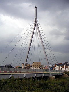
Newport Pagnell is a town and civil parish in the Borough of Milton Keynes, Buckinghamshire, England. The Office for National Statistics records Newport Pagnell as part of the Milton Keynes urban area.

Bletchley is a constituent town of Milton Keynes, Buckinghamshire, England. It is situated in the south-west of Milton Keynes, and is split between the civil parishes of Bletchley and Fenny Stratford and West Bletchley.
Broughton is a historic village, modern district and civil parish in Milton Keynes, Buckinghamshire, England. As of 2020, it is governed by Broughton and Milton Keynes Joint Parish Council, which it shares with the neighboring Milton Keynes parish. Today, Broughton is a large district of (greater) Milton Keynes that has been developed around the original village and that grew substantially during the 2000s and 2010s.
Middleton is a district of Milton Keynes, Buckinghamshire, England, and part of the historic civil parish of Milton Keynes. The district is centred on Milton Keynes Village, the village that gave its name to modern Milton Keynes, which surrounds it extensively. The village also gives its name to the local civil parish, of which Middleton is the more populated district. It is delineated by Childs Way to the north, Tongwell Street to the east, Chaffron Way to the south and Brickhill Street to the west. The River Ouzel runs diagonally through it, from west to north.

Shenley Brook End is a village, district and wider civil parish in Milton Keynes, Buckinghamshire, England. Together with its neighbouring parish, Shenley Church End and the districts of Shenley Wood and Shenley Lodge, the districts are collectively known as "The Shenleys".

Walton (historically) was a hamlet that is now a district and civil parish in Milton Keynes, ceremonial Buckinghamshire, England. For local government purposes, it is part of the Danesborough and Walton electoral ward.

Wavendon is a village and civil parish in the south east of the Milton Keynes urban area, in Buckinghamshire, England.

Willen is a district of Milton Keynes, England and is also one of the ancient villages of Buckinghamshire to have been included in the designated area of the New City in 1967. At the 2011 Census the population of the district was included in the civil parish of Campbell Park. The original village is now a small but important part of the larger district that contains it and to which it gives its name.

West Bletchley is a district and civil parish that covers the western part of Bletchley, a constituent town of Milton Keynes in Buckinghamshire, England. The parish consists of that part of Bletchley which is south of Standing Way (A421), west of the West Coast Main Line, and north of Water Eaton Brook..
Central Milton Keynes is the central business district of Milton Keynes, Buckinghamshire, England and a civil parish in its own right, with a town council.

Campbell Park is the name of the central park for Milton Keynes (England) and of a ward of Central Milton Keynes civil parish..
Kents Hill, Monkston and Brinklow is a civil parish that covers the Kents Hill, Brinklow, Monkston, Monkston Park and Kingston districts of Milton Keynes in Buckinghamshire, England. As the first tier of Local Government, the Parish Council is responsible for the people, living and working in this area of Milton Keynes.

The Milton Keynes urban area or Milton Keynes Built-up Area is a designation established by the United Kingdom's Office for National Statistics. As with other urban areas, it includes settlements that are physically contiguous with the rest of the built up area but, for historical reasons, regard themselves as being outside of the principal settlement: this urban area includes Newport Pagnell and Woburn Sands.
The Borough of Milton Keynes is a unitary authority in Buckinghamshire, England. Until 1 April 1997 it was a non-metropolitan district.

Old Woughton is a district and civil parish in south central Milton Keynes, Buckinghamshire, England. The parish was established in April 2012 by the division into two parts of Woughton parish. The original (undivided) civil parish was itself originally called "Woughton on the Green".
Campbell Park is a civil parish in Milton Keynes, Buckinghamshire, England. The parish is bounded by Childs Way (H6) to the north, the River Ouzel to the east, the A5 to the west, and Chaffron Way to the south. The parish includes the Fishermead, Oldbrook, Springfield, Winterhill, and The Woolstones grid-squares. The parish was originally known as Woolstone-cum-Willen, and was formed on 1 April 1934 as a merger of Great Woolstone, Little Woolstone and Willen. The parish was part of Newport Pagnell Rural District until it became part of the Borough of Milton Keynes in 1974. The parish was redefined in 2012, when the districts of Campbell Park (sic), Newlands and Willen were reallocated to other parishes. Despite the loss of its eponymous district, the Parish Council continues to use its name.