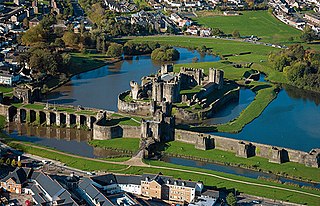
Castle Park is a residential area of the town of Caerphilly, south Wales. As the name suggests, it is located near Caerphilly Castle.
Coordinates: 51°34′34″N3°12′42″W / 51.57611°N 3.21167°W
Castle Park is a residential area of the town of Caerphilly, south Wales. As the name suggests, it is located near Caerphilly Castle.
Coordinates: 51°34′34″N3°12′42″W / 51.57611°N 3.21167°W

Caerphilly Castle is a medieval fortification in Caerphilly in South Wales. The castle was constructed by Gilbert de Clare in the 13th century as part of his campaign to maintain control of Glamorgan, and saw extensive fighting between Gilbert, his descendants, and the native Welsh rulers. Surrounded by extensive artificial lakes – considered by historian Allen Brown to be "the most elaborate water defences in all Britain" – it occupies around 30 acres (12 ha) and is the largest castle in Wales and the second-largest castle in the United Kingdom after Windsor Castle. It is famous for having introduced concentric castle defences to Britain and for its large gatehouses. Gilbert began work on the castle in 1268 following his occupation of the north of Glamorgan, with the majority of the construction occurring over the next three years at a considerable cost. The project was opposed by Gilbert's Welsh rival Llywelyn ap Gruffudd, leading to the site being burnt in 1270 and taken over by royal officials in 1271. Despite these interruptions, Gilbert successfully completed the castle and took control of the region. The core of Caerphilly Castle, including the castle's luxurious accommodation, was built on what became a central island, surrounding by several artificial lakes, a design Gilbert probably derived from that at Kenilworth. The dams for these lakes were further fortified, and an island to the west provided additional protection. The concentric rings of walls inspired Edward I's castles in North Wales, and proved what historian Norman Pounds has termed "a turning point in the history of the castle in Britain".
The extreme points of South America are the points that are farther north, south, east or west than any other location on the continent. The continent's southernmost point is often said to be Cape Horn, but Águila Islet of the Diego Ramírez Islands lies further south.
Stag Harbour is a designated place in the Canadian province of Newfoundland and Labrador. It is on Fogo Island within the Town of Fogo Island.

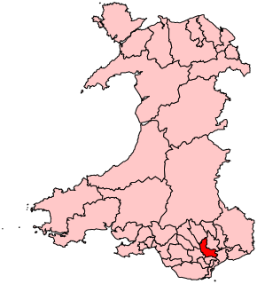
Caerphilly is a constituency centred on the town of Caerphilly in South Wales, represented in the House of Commons of the UK Parliament since 2001 by Wayne David of the Labour Party.
Trecenydd is a residential area in Caerphilly, Wales, United Kingdom.

Caerphilly railway works in Caerphilly in the county of Glamorgan was the only main railway works in Wales.

Grover was an unincorporated community in western St. Louis County, Missouri, United States. It was located on Old Manchester Road, but has now been wholly incorporated into Wildwood, whose City Hall is located in old Grover.

Rhiwderin is a small village in the west of the city of Newport, South Wales.

Lower Machen is a small hamlet of 19 houses on the A468 road at the very western edge of the city of Newport, South Wales.

Caerphilly is a constituency of the Senedd. It elects one Member of the Senedd by the first past the post method of election. Also, however, it is one of eight constituencies in the South Wales East electoral region, which elects four additional members, in addition to eight constituency members, to produce a degree of proportional representation for the region as a whole.

Eastgate is a residential area, immediately to the east of Peterborough Cathedral and west of Fengate, in the county of Cambridgeshire in the United Kingdom. For electoral purposes it forms part of Peterborough Central ward.
Hucisko Przybyszowskie is a village in the administrative district of Gmina Kobiele Wielkie, within Radomsko County, Łódź Voivodeship, in central Poland. It lies approximately 4 kilometres (2 mi) west of Kobiele Wielkie, 10 km (6 mi) south-east of Radomsko, and 84 km (52 mi) south of the regional capital Łódź.
Wilczków is a village in the administrative district of Gmina Goszczanów, within Sieradz County, Łódź Voivodeship, in central Poland. It lies approximately 8 kilometres (5 mi) north-east of Goszczanów, 29 km (18 mi) north-west of Sieradz, and 62 km (39 mi) west of the regional capital Łódź.
Maksymów is a village in the administrative district of Gmina Ujazd, within Tomaszów Mazowiecki County, Łódź Voivodeship, in central Poland. It lies approximately 4 kilometres (2 mi) south-west of Ujazd, 12 km (7 mi) north-west of Tomaszów Mazowiecki, and 37 km (23 mi) south-east of the regional capital Łódź.

Gramada Glacier is a 1.6 nautical miles long glacier on Smith Island in the South Shetland Islands, Antarctica draining the southeast slopes of Imeon Range east of Riggs Peak, southeast of Madan Saddle and south of Neofit Peak. It is situated southwest of Armira Glacier and northeast of Letnitsa Glacier, and flows southeastward into Brashlyan Cove on Osmar Strait. The glacier is named after the town of Gramada in northwestern Bulgaria.
Trzcieliny is a settlement in the administrative district of Gmina Przygodzice, within Ostrów Wielkopolski County, Greater Poland Voivodeship, in west-central Poland.
Taylor is an unincorporated community in Harford County, Maryland, United States. Ladew Topiary Gardens and House was listed on the National Register of Historic Places in 1976.
Hartland is a hamlet in the town of Hartland in Niagara County, New York, United States.

The B4265 road is a main road in the Vale of Glamorgan, southeastern Wales, running in a northwesterly direction along near the coast. It links Cardiff Airport to Bridgend, lasting for 15.9 miles (25.6 km). The road begins at the roundabout near the airport and the village of Penmark at 51°24′21″N3°20′39″W as a continuation of the A4226 road leading from Barry. Passing the junction turnoff to Gileston and St Athan, at Llantwit Major, the B4270 road branches off to the northwest to Llandow Industrial Estate. The road then moves progressively in northwesterly direction until St Brides Major, where the B4524 road to the south connects it to Southerndown and Ogmore-by-Sea. At St Brides Major, the road shifts to a northerly direction, where it passes Ewenny and Ogmore village leading to Bridgend, where it joins the A48 road and finally A473 road at 51°30′7″N3°34′34″W.

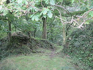
Llangynwyd Castle is a ruined castle, probably of the 12th century, in Llangynwyd, in Bridgend County Borough, South Wales, just to the south of Maesteg.