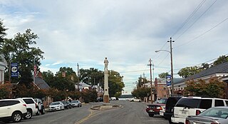
Central Garage, Virginia

Last updated
Central Garage, Virginia
USA Virginia location map.svg
Red pog.svg
Central Garage
Usa edcp location map.svg
Red pog.svg
Central Garage
Coordinates: 37°44′38″N77°7′53″W / 37.74389°N 77.13139°W / 37.74389; -77.13139 Coordinates: 37°44′38″N77°7′53″W / 37.74389°N 77.13139°W / 37.74389; -77.13139
CountryUnited States
State Virginia
County King William
Area
  Total4.9 sq mi (12.6 km2)
  Land4.8 sq mi (12.5 km2)
  Water0.04 sq mi (0.1 km2)
Elevation
168 ft (51 m)
Population
 (2010)
  Total1,318
  Density274/sq mi (105.6/km2)
Time zone UTC−5 (Eastern (EST))
  Summer (DST) UTC−4 (EDT)
Area code(s) 804
FIPS code 51-14312
GNIS feature ID1464687

Central Garage is a census-designated place (CDP) in King William County, Virginia, United States. The population as of the 2010 census was 1,318. [1]

A census-designated place (CDP) is a concentration of population defined by the United States Census Bureau for statistical purposes only. CDPs have been used in each decennial census since 1980 as the counterparts of incorporated places, such as self-governing cities, towns, and villages, for the purposes of gathering and correlating statistical data. CDPs are populated areas that generally include one officially designated but currently unincorporated small community, for which the CDP is named, plus surrounding inhabited countryside of varying dimensions and, occasionally, other, smaller unincorporated communities as well. CDPs include small rural communities, colonias located along the U.S. border with Mexico, and unincorporated resort and retirement communities and their environs.

King William County, Virginia County in the United States

King William County is a county located in the U.S. state of Virginia. As of the 2010 census, the population was 15,935. Its county seat is King William.

Virginia State of the United States of America

Virginia, officially the Commonwealth of Virginia, is a state in the Southeastern and Mid-Atlantic regions of the United States located between the Atlantic Coast and the Appalachian Mountains. The geography and climate of the Commonwealth are shaped by the Blue Ridge Mountains and the Chesapeake Bay, which provide habitat for much of its flora and fauna. The capital of the Commonwealth is Richmond; Virginia Beach is the most populous city, and Fairfax County is the most populous political subdivision. The Commonwealth's estimated population as of 2018 is over 8.5 million.

Geography

The community is northwest of the center of King William County, around the junction of U.S. Route 360 and Virginia State Route 30. US 360 leads northeast 21 miles (34 km) to Tappahannock and southwest 23 miles (37 km) to Richmond, the state capital. VA 30 leads southeast 7 miles (11 km) to King William, the county seat, and northwest 21 miles (34 km) to U.S. Route 1 in Doswell.

U.S. Route 360 is a spur of US 60 in the U.S. state of Virginia. The U.S. Highway runs 225.31 miles (362.60 km) from US 58 Business, Virginia State Route 293, and SR 360 in Danville east to SR 644 in Reedville. US 360 connects Danville, South Boston, and Keysville in Southside Virginia with the state capital of Richmond. The U.S. Highway also connects Richmond with Tappahannock on the Middle Peninsula and the eastern Northern Neck, where the highway serves as the primary route through Northumberland County. US 360 is a four-lane divided highway for almost all of its length.

Virginia State Route 30 highway in Virginia

State Route 30 is a primary state highway in the U.S. state of Virginia. The state highway runs 61.87 miles (99.57 km) from U.S. Route 1 in Doswell east to Interstate 64 (I-64) and SR 607 near Norge. SR 30 runs east–west through Hanover and Caroline Counties, connecting US 1 and I-95 with Kings Dominion and US 301. The state highway serves as the principal highway of King William County, connecting U.S. Route 360 with SR 33 in West Point via the county's namesake county seat. SR 30 also connects SR 33 and US 60 in New Kent and James City Counties.

Tappahannock, Virginia Town in Virginia, United States

Tappahannock is the oldest town in Essex County, Virginia, United States. The population was 2,375 at the 2010 census, up from 2,068 at the 2000 census. Located on the Rappahannock River, Tappahannock is the county seat of Essex County. Its name comes from an Algonquian language word lappihanne, meaning "Town on the rise and fall of water" or "where the tide ebbs and flows." In 1608 John Smith landed in Tappahannock and fought with the local Rappahannock tribe. After defeating them, he later made peace.

According to the U.S. Census Bureau, the Central Garage CDP has a total area of 4.9 square miles (12.6 km2), of which 0.04 square miles (0.1 km2), or 0.81%, are water. [1]

Related Research Articles

Wolf Trap, Virginia Census-designated place in Virginia, United States

Wolf Trap is a census-designated place (CDP) in Fairfax County, Virginia, United States. The population was 16,131 at the 2010 census. Wolf Trap National Park for the Performing Arts is located in the CDP.
King George, Virginia Census-designated place in Virginia, United States

King George is a census-designated place (CDP) in and the county seat of King George County, Virginia, United States. It is sometimes referred to as King George Courthouse, because it is the location of the King George County Courthouse. The population as of the 2010 census was 4,457. The Journal Press is a local weekly newspaper published in King George and serving local areas.

Dranesville, Virginia Census-designated place in Virginia, United States

Dranesville is a census-designated place (CDP) in Fairfax County, Virginia, United States. Dranesville is located on the Leesburg Pike at its intersection with Georgetown Pike. The U.S. Census Bureau defines Dranesville as a census-designated place (CDP) with a population of 11,921 as of 2010.

Palmyra, Virginia Census-designated place in Virginia, United States

Palmyra is a census-designated place (CDP) in and the county seat of Fluvanna County, Virginia, United States. The population as of the 2010 census was 104. Palmyra lies on the eastern bank of the Rivanna River along U.S. Route 15. The ZIP code for Palmyra and surrounding rural land is 22963.

King William, Virginia Census-designated place in Virginia, United States

King William is a census-designated place (CDP) in and the county seat of King William County, Virginia, United States. The population as of the 2010 census was 252. Located in King William is the oldest courthouse in continuous use in the United States, built in 1725. The community is also known as King William Courthouse or, by an alternative spelling, King William Court House.
Passapatanzy, Virginia Census-designated place in Virginia, United States

Passapatanzy is an unincorporated community and census-designated place (CDP) in King George County, Virginia, United States. The population as of the 2010 census was 1,283.

Libertytown, Maryland Census-designated place in Maryland, United States

Libertytown is an unincorporated community and census-designated place (CDP) in Frederick County, in the U.S. state of Maryland. As of the 2010 census it had a population of 950. The Abraham Jones House was listed on the National Register of Historic Places in 1973.

Hutton, Maryland Census-designated place in Maryland, United States

Hutton is an unincorporated community and census-designated place (CDP) in Garrett County, Maryland, United States. Variant names for Hutton include Huttons Switch Station and Kindness.

Fair Oaks, Fairfax County, Virginia Census-designated place in Virginia, United States

Fair Oaks is a census-designated place in Fairfax County, Virginia, United States. The population as of the 2010 census was 30,223. It encompasses a large area west of the city of Fairfax, centered on Fair Oaks Mall. Suburban neighborhoods and office parks occupy most of Fair Oaks, largely developed since the 1980s.

Hayfield, Fairfax County, Virginia Census-designated place in Virginia, United States

Hayfield is a census-designated place (CDP) in Fairfax County, Virginia, United States. The population as of the 2010 census was 3,909.

Henry Fork, Virginia Census-designated place in Virginia, United States

Henry Fork is an unincorporated community and census-designated place (CDP) in Franklin County, Virginia, United States, just south of Rocky Mount. The population as of the 2010 census was 1,234.

Mountain Road, Virginia Census-designated place in Virginia, United States

Mountain Road is a census-designated place (CDP) in Halifax County, Virginia, United States. The population as of the 2010 census was 1,100.

Newington Forest, Virginia Census-designated place in Virginia, United States

Newington Forest is a census-designated place in Fairfax County, Virginia, United States. The population as of the 2010 census was 12,442. It is part of the Washington metropolitan area. It includes the Newington Forest subdivision and several nearby neighborhoods of southern Springfield and northern Lorton.

Riverdale, Halifax County, Virginia Census-designated place in Virginia, United States

Riverdale is a census-designated place in Halifax County, Virginia, United States. The population as of the 2010 census was 956.

South Run, Virginia Census-designated place in Virginia, United States

South Run is a census-designated place in Fairfax County, Virginia, United States. The population as of the 2010 census was 6,389.

Mars Hill (CDP), Maine Census-designated place in Maine, United States

Mars Hill is a census-designated place (CDP) comprising the main village within the town of Mars Hill in Aroostook County, Maine, United States. The population of the CDP was 980 at the 2010 census, out of a population of 1,493 for the entire town. Prior to 2010, the village was part of the Mars Hill-Blaine CDP.

Rushford (CDP), New York Census-designated place in New York, United States

Rushford is a census-designated place comprising the central settlement in the town of Rushford, Allegany County, New York, United States. As of the 2010 census it had a population of 363, out of a total population of 1,150 in the town.

Kersey, Pennsylvania Census-designated place in Pennsylvania, United States

Kersey is an unincorporated community and census-designated place in Fox Township, Elk County, Pennsylvania, United States. As of the 2010 census the population was 937.

Kanauga, Ohio Census-designated place in Ohio, United States

Kanauga is an unincorporated community and census-designated place (CDP) in Gallia County, Ohio, United States. As of the 2010 census it had a population of 175.

Pottery Addition, Ohio Census-designated place in Ohio, United States

Pottery Addition is a census-designated place (CDP) in Jefferson County, Ohio, United States. Its population was 293 as of the 2010 census. The community is located along the Ohio River and is served by Ohio State Route 7.

References

  1. 1 2 "Geographic Identifiers: 2010 Census Summary File 1 (G001), Central Garage CDP, Virginia". American FactFinder. U.S. Census Bureau. Retrieved May 23, 2019.

The Virginia Department of Transportation (VDOT) is the agency of the state government responsible for transportation in the state of Virginia in the United States. VDOT is headquartered at the Virginia Department of Highways Building in downtown Richmond. VDOT is responsible for building, maintaining, and operating the roads, bridges, and tunnels in the commonwealth. It is overseen by the Commonwealth Transportation Board, which has the power to fund airports, seaports, rail, and public transportation.