Pune, previously spelled in English as Poona, is a city in Maharashtra state in the Deccan plateau in Western India. It is the administrative headquarters of the Pune district, and of Pune division. The city of Pune is part of Pune Metropolitan Region. Pune is one of the largest IT hubs in India. It is also one of the most important automobile and manufacturing hubs of India. Pune is often referred to as "Oxford of the East" because of its highly regarded educational institutions in the city. It has been ranked "the most liveable city in India" several times.

The Mutha River is a river in western Maharashtra, India. It arises in the Western Ghats and flows eastward until it merges with the Mula River in the city of Pune. It has been dammed twice, first at the Panshet Dam, used as a source of drinking water for Pune city and irrigation. The water released here is dammed again at Khadakwasla and is an important source of drinking water for Pune. One more dam has been built later on the Mutha river at Temghar.

Pimpri-Chinchwad is a city in the Indian state of Maharashtra. The city is about 15 km (9.3 mi) northwest of the historic city of Pune, at an altitude of 590 m (1,940 ft) above sea level. It is the fifth largest city in Maharashtra and the nineteenth largest city in India and the sixteenth largest satellite city in the world by population. The city is located 135 km (84 mi) southeast from the state's capital Mumbai. It is one of the most rapidly developing suburban areas in India and has emerged as the third fastest growing city in the country. It is well known for its automotive, IT and manufacturing industry.

Pune district is a district in Western Maharashtra with Administrative Headquarters in Pune city. Pune district is the most populous district in the Indian state of Maharashtra. It is one of the most industrialised districts in India.

Pune International Airport is an international airport and an Indian Air Force base serving the city of Pune, Maharashtra, India. It is located at Lohegaon, approximately 11 km (6.8 mi) northeast of the historic centre of Pune. The airport is a civil enclave operated by the Airports Authority of India at the western side of Lohegaon Air Force Station of the Indian Air Force. The airport is the tenth busiest airport by passenger traffic in India. The airport serves both domestic and international flights. In financial year 2020, the airport handled over 8 million passengers.
Chakan is a census town in India, in Pune district of the Indian state of Maharashtra. While agriculture remains an important factor, the town's industrial development is quickly urbanizing the area. The Independent referred Chakan as India's "Motor City".

Pune Municipal Corporation (PMC) is the civic body that governs the inner limits of Pune, India. It is in charge of the civic needs and infrastructure of the metropolis, which is spread over an area of 484.61 sq. km. and has 3.4 million residents. Established on 15 February 1950, the executive power of the PMC is vested in the Municipal Commissioner, an Indian Administrative Service (IAS) officer appointed by the Government of Maharashtra. The position is held by Vikram Kumar, IAS.The general body of the PMC consists of 162 directly elected councilors, popularly known as "corporators", headed by a mayor. Murlidhar Mohol (BJP) was elected as the mayor and Sunita Wadekar as the deputy mayor by the newly elected in April 2021. The land for Pune Municipal Corporation was donated by Late Hon. Shri. Bhausaheb Shirole (Patil) who was second Mayor of Pune city and later became an MLC. The Pune Municipal Corporation has launched an e-Governance initiative, with the goal of leveraging Information Technology to mobilize Government resources and optimize their utilization in order to provide a superior level of service. Pune Municipal Corporation area 484.61 sq km

The Mula-Mutha is a river in India, formed by the confluence of the Mula and Mutha rivers in the city of Pune, which later meets the Bhima River, which itself later meets the Krishna River and finally emptying to the Bay of Bengal.

Pune Metro is a mass rapid transit system serving the city of Pune, India. The system comprises 3 lines with a combined length of 54.14 km (33.64 mi), of which 21.75 km (13.51 mi) on two lines are operational as of August 2023. The 16.59 km (10.31 mi) Purple line from PCMC Bhavan to Swargate runs on an elevated viaduct between PCMC Bhavan to Range Hills, from where it goes underground. The Aqua line runs from Vanaz to Ramwadi covering a distance of 14.66 km (9.11 mi) on an elevated viaduct. The 23.33 km (14.50 mi) elevated Line 3 will run from the Rajiv Gandhi Infotech Park in Hinjawadi via Balewadi to Civil Court. All three lines will align at the Civil Court interchange station.

Katraj is suburb of Pune in the Indian state of Maharashtra, and within the jurisdiction of Pune Municipal Corporation. Katraj is famous for its Peshwa-era lake that supplied water to the city during that period. The village lies at the foot of the Katraj Ghat or mountain pass on the main National Highway 4 connecting Pune with places south of the city, such as Kolhapur and Bangalore. In recent decades area surrounding the lake and the village of Katraj became part the City of Pune. The former rural area is now surrounded by residential complexes. The lakeside hosts the Rajiv Gandhi Zoological Park. Bharati Vidyapeeth, a deemed university, has its main campus here. A large Jain temple was built here in late 20th century.

Pune Junction railway station is the main railway junction of the city of Pune, India. It is one of the major railway junctions in Maharashtra. Pune Junction consists of 6 platforms. It also has a suburban train network.

Shivajinagar is an inner suburb of the city of Pune, India. Shivajinagar is known as Heart of the City.

Pune City Police Department (PCPD) is the law enforcement agency with jurisdiction over 790 km2 in the city of Pune, India. The city police is division of Maharashtra Police, i.e state police department of Maharashtra. The current Pune Commissionerate or Headquarters came into existence on 1 July 1965. Pune City Police Department operates from 30 police stations. It also has the responsibility of traffic policing the city roads.

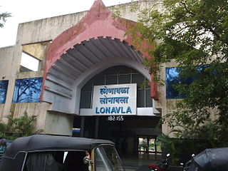
Lonavala railway station is a railway station in Lonavala, a hill station in the state of Maharashtra in India. Lonavala station is the origin of Lonavala–Pune Suburban Trains. 17 suburban trains operate on the Pune–Lonavala route. Lonavala is also a halt for Mumbai–Pune Express and Mail trains. The Karjat–Pune passenger train also has a halt at Lonavala. Trains traveling on the Kalyan–Pune route also halt at Lonavala. This station leads access to Lonavala town and nearby areas like Karla Caves, Bhaja Caves, Lohagad, Visapur Fort, Bhushi Dam and Bhor Ghat. Khandala hill station is just 8 kilometres (5.0 mi) from Lonavla.
Dhayari is a suburb of Pune, Maharashtra, India,
Pune is a city in the state of Maharashtra in India. It is situated in western Maharashtra on the Deccan Plateau. Pune's public transport consists primarily of a bus service, a suburban rail service, metro, public taxis and auto rickshaws. In 2020 it was awarded the Sustainable Transport Award.

Football Club Pune City was an Indian professional football club based in Pune, Maharashtra, which last participated in the Indian Super League, the top flight of Indian football league system, under licence from AIFF. The club was founded in 2014 during the inaugural season of the Indian Super League, with aims to provide stimulus to the growth and development of football in the state of Maharashtra and to participate in the inaugural season of the Indian Super League.

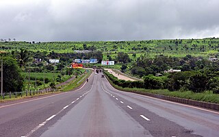
National Highway 48 is a major National Highway of India that starts at Delhi and terminates at Chennai traversing through seven states of India. It has a total length of 2807 km. NH 48 passes through the states of Delhi, Haryana, Rajasthan, Gujarat, Maharashtra, Karnataka and Tamil Nadu. The stretch between Pune and Bengaluru was known as P.B. Road in olden days.
Chhatrapati Sambhaji Raje International Airport is a proposed greenfield airport project to serve the city of Pune, India. It will be built near Saswad and Jejuri in Purandar taluka of the Pune District in the Indian state of Maharashtra. In 2016, it was announced that the proposed airport would be spread over 2,400 hectares. The airport would be named after the King of the Maratha Empire, Sambhaji Maharaj, who was born at Purandar fort.


