The Pike's Peak Gold Rush was the boom in gold prospecting and mining in the Pike's Peak Country of western Kansas Territory and southwestern Nebraska Territory of the United States that began in July 1858 and lasted until roughly the creation of the Colorado Territory on February 28, 1861. An estimated 100,000 gold seekers took part in one of the greatest gold rushes in North American history.
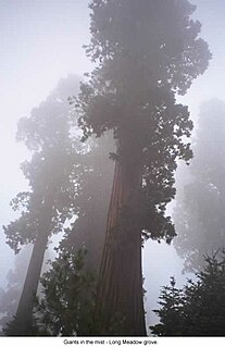
Sequoia National Forest is located in the southern Sierra Nevada mountains of California. The U.S. National Forest is named for the majestic Giant Sequoia trees which populate 38 distinct groves within the boundaries of the forest.

Cherryville is an unincorporated community in the foothills of the Monashee Mountains in British Columbia with a population of approximately 930. It is located 14 miles (22 km) east of Lumby, along Highway 6.
Kingfisher Creek Provincial Park is a provincial park in British Columbia, Canada, located 15 km southeast of Sicamous and west of Mabel Lake, in the Monashee Mountains. The park is 440 ha. in size and was created to enhance the viability of the Kingfisher Creek Ecological Preserve.

Greenwood is a city in south central British Columbia. It was incorporated in 1897 and was formerly one of the principal cities of the Boundary Country smelting and mining district. It was incorporated as a city originally and has retained that title despite the population decline following the closure of the area's industries.

Cherry Creek Shopping Center, also known as Cherry Creek Center, is a shopping mall about three and half miles southeast of downtown Denver, Colorado in the Cherry Creek Neighborhood. It is situated along East First Avenue on the banks of Cherry Creek.

Cherry Creek is a historic mining town located in northern White Pine County, in northeastern Nevada in the western United States. It is a census county division (CCD), with a population at the 2010 census of 72.

Port Navas Creek, or Porthnavas Creek, is one of seven creeks off the Helford River in Cornwall, England, United Kingdom. It splits into three sections with the village of Porth Navas on the west, Trenarth Bridge in the middle and the eastern one is near Budock Veane. The creek is well known for the oyster beds.

Havilah is an unincorporated community in Kern County, California. It is located in the mountains between Walker Basin and the Kern River Valley, 5 miles (8.0 km) south-southwest of Bodfish at an elevation of 3,136 feet (956 m).

Bodie is a ghost town in Okanogan County, Washington, United States.

Camp Cherry Valley is a summer camp on the leeward side of Catalina Island, California, which is owned and operated by the Greater Los Angeles Area Council of the Boy Scouts of America. It is located two coves north of Two Harbors at Cherry Cove. The camp, valley and cove get their name from the Catalina cherry trees native to the island. It also offers non-Scouting programs on a year-round basis.
The Bodie Mine is an inactive, privately owned gold mine in Okanogan County, Washington, United States. It is located within a triangle formed by the town of Wauconda, Washington the original town of Bodie, Washington, and the later ghost town of Bodie, on Toroda Road.

Dog Creek is an unincorporated ranching settlement, located on the Fraser River, in the Cariboo region of British Columbia, Canada. Located on the northeast side of the Fraser's confluence with Dog Creek, it is opposite Gang Ranch on the west side of the river, which is connected by an old suspension bridge serving local ranch roads. Dog Creek's first post office opened in 1873. The Dog Creek reserves of the Canoe Creek/Dog Creek Indian Band are located east of the settlement. The ranches at Dog Creek, along with the Gang Ranch, mostly hire First Nations cowboys, most of them coming from the Canoe Creek/Dog Creek Band.

Gold Rush is a reality television series that airs on Discovery and its affiliates worldwide. The series follows the placer gold mining efforts of various family-run mining companies mostly in the Klondike region of Dawson City, Yukon, Canada, although the prospecting efforts of Todd Hoffman's 316 Mining company have ranged across both South America and western North America.
Granite Creek is a creek and townsite in British Columbia located in the Similkameen region. Granite Creek flows north into the Tulameen River and joins that river approximately one and a half miles to the east of Coalmont, British Columbia. It is assumed Granite Creek yielded more than $500,000 in placer gold since its discovery. Gold nuggets worth $50 in value were not unusual in the early years. The creek was mined by Europeans and Chinese. Granite Creek was hydraulicked near its mouth in the 1890s.
Lockie Creek is a creek located in the Similkameen region of British Columbia. This creek is on the west side of Otter Lake, British Columbia. Originally called Boulder Creek, the creek was mined for gold in the 1800s. Platinum was also found. In 1887, a Chinese worker unearthed a gold nugget weighing about 4 troy pounds and valued at $900. This was the largest nugget recovered from the Similkameen-Tulameen district. The nugget was kept a secret until it was sold to Wells, Fargo and Co.. The nugget was placed on exhibition in their bank located in Victoria, British Columbia.
Carnes Creek is a creek located in the Big Bend Country region of British Columbia. The flows into the Columbia River from the east. It was discovered no later than 1865. The creek has been mined and has produced $200,000 in gold.
El Guindo is a Chilean village located in Pichilemu, Cardenal Caro Province. As of the 2002 census, the population comprised 25 people, and 8 households.
Mountain House or Willow Springs Station, in what is now Kern County, California, was a stage station of the Butterfield Overland Mail, located 12 miles south of Fountain Spring Station, and 15 miles northeast of Posey Creek Station at Willow Springs on Willow Springs Creek.