
Laja River is a river in Chile, along which can be found the Laja Falls. It is located in the Bío Bío Region. The source of the river is Laguna del Laja in the Andes, then flows westward through the Chilean Central Valley and terminates into the Bío Bío River, being an important tributary of it.

The Cautín is a river in Chile. It rises on the western slopes of the Cordillera de Las Raíces and flows in La Araucanía Region. The river's main tributary is the Quepe River. The city of Temuco is located on the Cautín River.
Penco is a Chilean city and commune in Concepción Province, Bío Bío Region on the Bay of Concepción. Founded as the city of Concepción del Nuevo Extremo on February 12, 1550 by Pedro de Valdivia, it is the third oldest city in Chile, after capital Santiago founded first in 1541 and La Serena second in 1544.

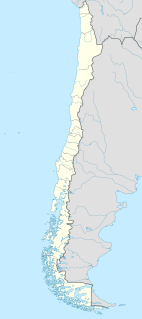
The Zona Sur is one of the five natural regions on which CORFO divided continental Chile in 1950. Its northern border is formed by the Bío-Bío River, the limit with the Central Chile Zone. By west with the Pacific Ocean, by the east with the Andean mountains and Argentina. Its southern border is the Chacao Channel, beyond it lies the Austral Zone. While Chiloé Archipelago belongs geographically to Zona Austral in terms of culture and history it lies closer to Zona Sur.
Toltén River is a river located in the La Araucanía Region of Chile. It rises at Villarrica Lake, close to the city of the same name. Its major tributary is the Allipén River. From its confluence with the Allipén, the river follows a braided course.
Imperial River is a river located in the La Araucanía Region of Chile. It is formed at the confluence of the Chol Chol and Cautín Rivers in the vicinity of the city of Nueva Imperial.

Nueva Imperial is a city and commune in the south of Chile. It is located in Cautín Province in the Araucanía Region. Nueva Imperial lies about 35 km (22 mi) to the west of Temuco, the regional capital.

Ralco Hydroelectric Plant is a hydroelectric power station and dam in Bío Bío Region, Chile. The plant uses water from the upper Bío Bío River and produces 690 megawatts (930,000 hp) of electricity. The plant was built by ENDESA in 2004. The project has proven controversial with local indigenous Mapuche since a graveyard had to be flooded by the dam.

The Andalién River is a river in the province of Concepción, in the Bío Bío Region of Chile. It drains the western side of Chile's Cordillera de la Costa and has a total length of 42 kilometres (26 mi). It is one of the two rivers that bracket the city of Concepción.
Espíritu Santo was a Spanish fortress that existed a little to the north of what is now the Nacimiento commune of Bío Bío Province, Bio-Bio Region of Chile. It was on the left bank of the Bio Bio River immediately below its confluence with the Tavolevo River. Built in 1585 by the Governor Alonso de Sotomayor for defense of the valley of Catiray and was in correspondence with fort Santísima Trinidad, on the opposite shore of the Bio Bio. It was abandoned and destroyed by the year of 1600.

Tavolevo River, a tributary of the Biobío River. in Chile. It has two tributaries the Culenco River flowing southeast from the Nahuelbuta Range in the Catirai region and the Nicodahue River that flows north from the La Araucanía Region and its two tributaries the Esperanza and Maitenrehue Rivers that all originate northwest of Angol. It is sometimes considered part of the Nicodahue River. The Tavolevo flows into the Bio Bio fifty kilometers beyond the confluence of the Nicodahue and Culenco Rivers and seven kilometers to the north of Nacimiento. Immediately downstream from its mouth was the location of the old fort of Espirito Santo and on its banks significant placer gold deposits. The river was navigable by flatboats up to nine kilometers above its confluence with the Bio Bio. Its Mapudungun name meant confluence.

Kosewo is a village in the administrative district of Gmina Żuromin, within Żuromin County, Masovian Voivodeship, in east-central Poland. It lies approximately 6 kilometres (4 mi) east of Żuromin and 116 km (72 mi) north-west of Warsaw.
Santa Cruz de Coya was a city established by the governor of Chile Martín García Oñez de Loyola on the site of the fort of Santa Cruz de Oñez, in 1595. It was named for his wife Beatriz Clara Coya, a member of the royal Incan house. The Mapuche called the city Millacoya, meaning gold princess from the mapudungun milla, gold and the quechua coya, princess.
Laja is a city and commune located in the Bío Bío Province of the Bío Bío Region of Chile. The city of Laja is the communal capital.

The Estero Arrayán is a river of Chile.

The Muco River is a river in the Araucanía Region in Chile. It is a tributary of the Cautín River.

The Yelcho River is a river in the Los Lagos Region of southern Chile.
The Yeso River is a river of Chile.
SURES is a Chilean association created in 2006 during the first Fair Trade Meetings, organized by the Chol-Chol Foundation and the AVINA Foundation. It is a network of small scale producers cooperatives of the Bio-Bio Region and the Araucanía Region, in the south of Chile.


