Church View and Church Cottages

Last updated
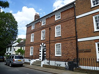
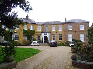
Church View (centre). (White Lodge on the far right) Monken Hadley cottage 3 Aug 2015.JPG
Church View (centre). (White Lodge on the far right)
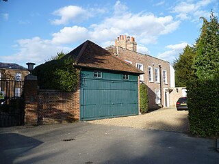
Church Cottages Church Cottages, Monken Hadley.jpg
Church Cottages

Church View and Church Cottages are grade II listed buildings in Hadley Green Road to the north of Chipping Barnet. They face directly on to St Mary the Virgin church, hence the name. Church View dates from the late 17th or early 18th centuries [1] while the three adjacent terraced Church Cottages were built in the mid 19th century. [2]

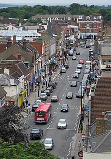
Chipping Barnet area in the London Borough of Barnet, England, United Kingdom

Chipping Barnet or High Barnet is a market town in the London Borough of Barnet, England. Historically in Hertfordshire, it is a suburban development built around a 12th-century settlement, and is located 10 12 miles (17 km) north north-west of Charing Cross, east from Borehamwood, west from Enfield and south from Potters Bar. Its name is very often abbreviated to just Barnet, which is also the name of the borough of which it forms a part. Chipping Barnet is also the name of the Parliamentary constituency covering the local area - the word "Chipping" denotes the presence of a market, one that was established here at the end of the 12th century and persists to this day. Chipping Barnet is one of the highest-lying urban settlements in London, with the town centre having an elevation of about 427 feet (130 m).

St Mary the Virgin, Monken Hadley Church in United Kingdom

St Mary the Virgin is the parish church of Monken Hadley. It is located in the Diocese of London.

Related Research Articles

Ossulston House Barnet, Greater London, EN5

Ossulston House is a Grade II listed building in Hadley Green Road, Hadley, to the north of Chipping Barnet. It is one of an almost complete line of houses that once stood between Chipping Barnet and Monken Hadley along the east side of Hadley Common which were built in the 18th and 19th centuries as wealthy merchants from London populated the area.
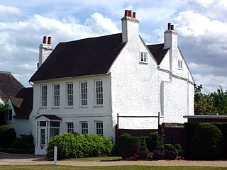
Hurst Cottage grade II listed house in London Borough of Barnet, United kingdom

Hurst Cottage is a grade II listed building on Hadley Common road, in Monken Hadley, north of Chipping Barnet. The building was completed in the late 17th or early 18th century and faces Monken Hadley Common. It was first listed in 1949, originally under the name Coach House Cottage.

Grandon, Hadley Green house in Monken Hadley, London

Grandon is a grade II listed building on Hadley Green Road, in Monken Hadley, north of Chipping Barnet. The house faces Hadley Green and was once the home of the writers Fanny Trollope and her son Anthony Trollope.

Hollybush, Monken Hadley house in Monken Hadley, London

Hollybush is a grade II listed building on Hadley Green Road to the north of Chipping Barnet. The main house was built around 1790 and the adjoining small buildings on the left even earlier.

Anyho Barnet, Greater London, EN5

Anyho is a grade II listed building on Hadley Common road facing Monken Hadley Common.

Livingston Cottage and Monken Cottage two cottages in Monken Hadley, London

Livingstone Cottage and Monken Cottage are grade II listed buildings on Hadley Green Road facing Hadley Green. A plaque to the front reads, "David Livingstone lived here in the year 1857".

Gate House and Gate, Monken Hadley Barnet, Greater London, EN5

The Gate House and Gate, Monken Hadley, in the London Borough of Barnet, are grade II listed buildings The house is in the Gothic style, early nineteenth century. The gates are of timber and are one of a number of white timber gates that mark the main access points to Monken Hadley Common.

Pagitts Almshouses Barnet, Greater London, EN5

Pagitts Almshouses, 1–6 Hadley Green Road, Monken Hadley, in the London Borough of Barnet, are grade II listed buildings. The almshouses are on the north side of the road between St Mary, Monken Hadley church and the Monken Hadley Common Gate House and Gates.

White Lodge, Monken Hadley house in Monken Hadley, London

White Lodge is a grade II listed building on Hadley Green Road in Monken Hadley. The original house was built before 1711, and extended in the late 18th century.

Mount House, Monken Hadley house in Monken Hadley, London

Mount House, Camlet Way, Monken Hadley, in the London Borough of Barnet, is a grade II* listed house. The attached stable block is also listed.
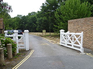
Games Road

Games Road is a road in Cockfosters, London, that runs from Chalk Road in the east into Monken Hadley Common in the west. The road falls into the Monken Hadley Conservation Area.
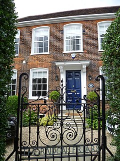
Thorndon Friars house in Monken Hadley, London

Thorndon Friars is a grade II listed building in Dury Road, Monken Hadley, London Borough of Barnet, England. The house dates from the early 1700s.
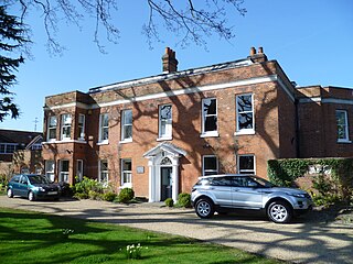
Hadley Bourne Barnet, Greater London, EN5

Hadley Bourne is a grade II listed building in Dury Road, Monken Hadley, England.

Stoberry Lodge house in Monken Hadley, London

Stoberry Lodge is a grade II listed house in Dury Road, Monken Hadley. The house dates from around 1830.
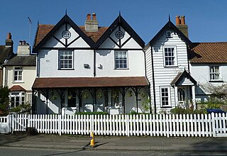
Gothic Place

Gothic Place is a grade II listed house at 5, 7 and 9 Dury Road, Monken Hadley, England.
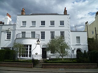
Monkenholt Barnet, Greater London, EN5

Monkenholt is a grade II listed building in Hadley Green Road, Monken Hadley.
The Grove, Monken Hadley Barnet, Greater London, EN5

The Grove is a grade II listed building in Hadley Green Road, Monken Hadley. The house dates from around 1800 but was greatly altered in the 20th century.
Beacon House and Grove Cottage Barnet, Greater London, EN5

Beacon House and Grove Cottage are grade II listed buildings in Hadley Green Road, Monken Hadley.

Ye Olde Cherry Tree historic public house on the corner of The Green and The Mall in Southgate, north London

Ye Olde Cherry Tree is a grade II listed public house on the corner of The Green and The Mall in Southgate, north London, which dates from around 1695.

References

  1. CHURCH VIEW. Historic England. Retrieved 18 April 2016.
  2. CHURCH COTTAGES. Historic England. Retrieved 18 April 2016.

Commons-logo.svg Media related to Church Cottages, Monken Hadley at Wikimedia Commons
Commons-logo.svg Media related to Church View, Monken Hadley at Wikimedia Commons

Coordinates: 51°39′41″N0°11′40″W / 51.66134°N 0.19451°W / 51.66134; -0.19451

Geographic coordinate system Coordinate system

A geographic coordinate system is a coordinate system that enables every location on Earth to be specified by a set of numbers, letters or symbols. The coordinates are often chosen such that one of the numbers represents a vertical position and two or three of the numbers represent a horizontal position; alternatively, a geographic position may be expressed in a combined three-dimensional Cartesian vector. A common choice of coordinates is latitude, longitude and elevation. To specify a location on a plane requires a map projection.