Clowne Rural District

Last updated

Clowne
Clowne Rural District, Derbyshire (1970).svg
Clowne Rural District shown within Derbyshire in 1970.
History
  Created 1894
  Abolished 1974
  Succeeded by Bolsover
Status Rural district
Government Clowne Rural District Council

Clowne was a rural district in Derbyshire, England from 1894 to 1974.

Rural districts were a type of local government area – now superseded – established at the end of the 19th century in England, Wales, and Ireland for the administration of predominantly rural areas at a level lower than that of the administrative counties.

Derbyshire ceremonial county in East Midlands, England

Derbyshire is a county in the East Midlands of England. A substantial portion of the Peak District National Park lies within Derbyshire, containing the southern extremity of the Pennine range of hills which extend into the north of the county. The county contains part of the National Forest, and borders on Greater Manchester to the northwest, West Yorkshire to the north, South Yorkshire to the northeast, Nottinghamshire to the east, Leicestershire to the southeast, Staffordshire to the west and southwest and Cheshire also to the west. Kinder Scout, at 636 metres (2,087 ft), is the highest point in the county, whilst Trent Meadows, where the River Trent leaves Derbyshire, is its lowest point at 27 metres (89 ft). The River Derwent is the county's longest river at 66 miles (106 km), and runs roughly north to south through the county. In 2003 the Ordnance Survey placed Church Flatts Farm at Coton in the Elms as the furthest point from the sea in Great Britain.

England Country in north-west Europe, part of the United Kingdom

England is a country that is part of the United Kingdom. It shares land borders with Wales to the west and Scotland to the north-northwest. The Irish Sea lies west of England and the Celtic Sea lies to the southwest. England is separated from continental Europe by the North Sea to the east and the English Channel to the south. The country covers five-eighths of the island of Great Britain, which lies in the North Atlantic, and includes over 100 smaller islands, such as the Isles of Scilly and the Isle of Wight.

It was created by the Local Government Act 1894 as that part of the Worksop rural sanitary district which was in Derbyshire (the rest becoming either Worksop Rural District or Kiveton Park Rural District). It consisted of four civil parishes  :

Local Government Act 1894

The Local Government Act 1894 was an Act of the Parliament of the United Kingdom that reformed local government in England and Wales outside the County of London. The Act followed the reforms carried out at county level under the Local Government Act 1888. The 1894 legislation introduced elected councils at district and parish level.
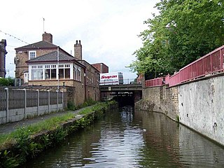
Worksop town in Nottinghamshire, United Kingdom

Worksop is the largest town in the Bassetlaw district of Nottinghamshire, England. Worksop lies on the River Ryton, and is located at the northern edge of Sherwood Forest. Worksop is located 19 miles (31 km) east-south-east of Sheffield, with a population of 41,820.

Worksop Rural District

Worksop was a Rural District in Nottinghamshire, England.

It was abolished in 1974 under the Local Government Act 1972, going on to form part of the new district of Bolsover.

Local Government Act 1972 Act of Parliament in the United Kingdom

The Local Government Act 1972 is an Act of the Parliament of the United Kingdom that reformed local government in England and Wales on 1 April 1974.
Related Research Articles

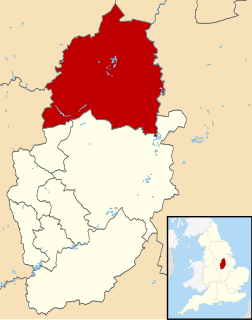
Bassetlaw District District in England

Bassetlaw is the northernmost district of Nottinghamshire, England, with a population of 114,143 according to the mid-2014 estimate by the Office for National Statistics. The borough is predominantly rural, with two towns: Worksop, site of the borough council offices, and Retford. The district was formed on 1 April 1974 by the merger of the boroughs of Worksop and East Retford and most of Worksop Rural District and most of East Retford Rural District. It is named after the historic Bassetlaw wapentake of Nottinghamshire.

Bolsover District Non-metropolitan district in England

Bolsover is a local government district in Derbyshire, England. It is named after the town of Bolsover, which is near the geographic centre of the district, but the council is based in Clowne. At the 2011 Census, the district had a population of 75,866.

Clowne village and civil parish in Bolsover District, Derbyshire

Clowne is a village and civil parish in the Bolsover district of Derbyshire, England. The population at the 2001 Census was 7,447 increasing to 7,590 at the 2011 Census. It forms part of the Bolsover constituency. Clowne lies 9 miles (14 km) north east of Chesterfield and 7 miles (11 km) south west of Worksop. It is mentioned in the Domesday Book as Clune. The name is derived from the Celtic Clun for a river.

Tintwistle Rural District was a local government district in north east Cheshire, England from 1894 to 1974.

Maelor was a rural district in the administrative county of Flintshire, Wales, from 1894 to 1974. The area approximated to the hundred of Maelor or English Maelor, and was notable for forming a detached part of the county, surrounded by Cheshire, Denbighshire and Shropshire. The administrative centre was located at Overton.

Bucklow Rural District was, from 1894 to 1974, a local government district in the north of the administrative county of Cheshire, England. Following the Local Government Act 1972, this rural district was split between the new Greater Manchester boroughs of Trafford and Manchester, and Macclesfield, which was retained in Cheshire.

Tadcaster Rural District was a rural district in the West Riding of Yorkshire from 1894 to 1974. It was named after Tadcaster.

Kiveton Park was a rural district in the West Riding of Yorkshire from 1894 to 1974.

Selby was a rural district in the West Riding of Yorkshire from 1894 to 1974.

South East Derbyshire was a rural district in Derbyshire, England from 1894 to 1974. It covered an area to the south-east of Derby.

Repton was a rural district in Derbyshire, England from 1894 to 1974.

Skegby was a rural district in Nottinghamshire, England from 1894 to 1935.

Blackwell Rural District

Blackwell was a rural district in Derbyshire, England from 1894 to 1974. It was created under the Local Government Act 1894 based on that part of the Mansfield rural sanitary district which was in Derbyshire.

Creswell railway station

Creswell railway station serves the village Creswell in Derbyshire, England. The station is on the Robin Hood Line between Nottingham and Worksop. It is also the nearest station to the larger village of Clowne.

Longendale Urban District

Longendale Urban District was, from 1936 to 1974, a local government district in the administrative county of Cheshire, England. It encompassed parts of Broadbottom, Hattersley, Hollingworth, Matley and Mottram in Longdendale, all of which form part of the non-statutory Longdendale Valley.

Holywell was a rural district in the administrative county of Flintshire, Wales, from 1894 to 1974.

Pocklington was a rural district in the East Riding of Yorkshire, England from 1894 to 1974.

The Clowne Branch is a lifted but protected former railway line in north eastern Derbyshire, England. currently being developed as part of the Greenway network for walkers, cyclists and horse riders

Bolsover Urban District

Bolsover was an Urban District in Derbyshire, England from 1894 to 1974. It was created under the Local Government Act 1894.

References

Coordinates: 53°17′N1°15′W / 53.28°N 1.25°W / 53.28; -1.25

Geographic coordinate system Coordinate system

A geographic coordinate system is a coordinate system that enables every location on Earth to be specified by a set of numbers, letters or symbols. The coordinates are often chosen such that one of the numbers represents a vertical position and two or three of the numbers represent a horizontal position; alternatively, a geographic position may be expressed in a combined three-dimensional Cartesian vector. A common choice of coordinates is latitude, longitude and elevation. To specify a location on a plane requires a map projection.