
Kingman Airport is a city-owned, public-use airport located 9 miles northeast of the central business district of Kingman, a city in Mohave County, Arizona, United States.
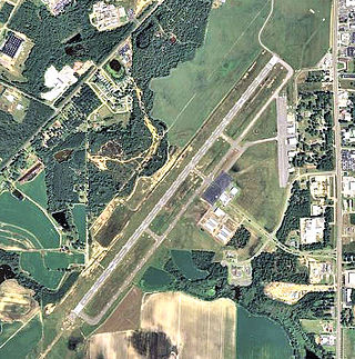
Douglas Municipal Airport is a public airport located two miles (3 km) south of the central business district of Douglas, a city in Coffee County, Georgia, United States. It is owned by the City of Douglas.

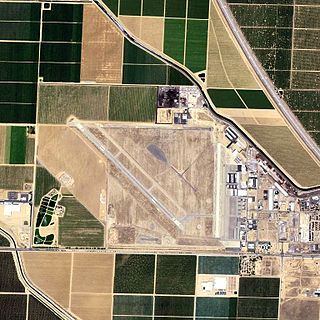
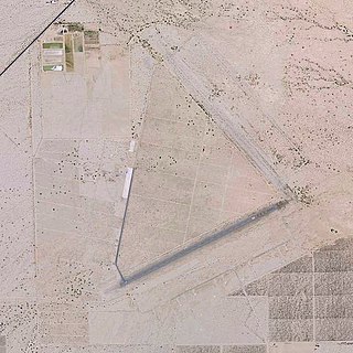
Jacqueline Cochran Regional Airport is a county-owned, public-use airport in Riverside County, California, United States. It is located in the southeastern Coachella Valley, 20 nautical miles southeast of the central business district of Palm Springs, in Thermal, California. This airport is included in the National Plan of Integrated Airport Systems for 2011–2015, which categorized it as a general aviation facility.
Shafter Airport, also known as Minter Field and formerly known as Air Corps Basic Flying School, is a public use airport located four nautical miles east of the central business district of Shafter and 14 miles northwest of Bakersfield, a city in Kern County, California, United States. Originally a World War II primary training facility for pilots, it is currently a public airport owned by the Minter Field Airport District. This airport is included in the National Plan of Integrated Airport Systems for 2011–2015, which categorized it as a general aviation facility.

Sharpe Field is a closed private use airport located six nautical miles northwest of the central business district of Tuskegee, a city in Macon County, Alabama, United States. This airport is privately owned by the Bradbury Family Partnership.

Hatbox Field is a closed airfield located within city limits, two nautical miles (3.7 km) west of central Muskogee, a city in Muskogee County, Oklahoma, United States. It was opened sometime in the early 1920s and was closed in 2000. It is the location of the Love-Hatbox Sports Complex, a large recreation center and waterpark.
Eric Marcus Municipal Airport is a county-owned, public-use airport in Pima County, Arizona, United States. It is located 5.75 miles north of the central business district of Ajo and is about 82 miles southwest of Phoenix. The airport was renamed on February 11, 2006; it was formerly known as Ajo Municipal Airport.
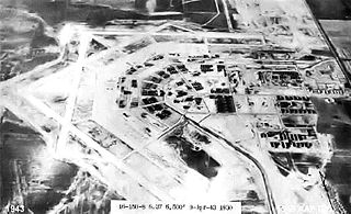
During World War II, the United States Army Air Forces (USAAF) established numerous airfields in California for training pilots and aircrews of USAAF fighters and bombers.

Porterville Municipal Airport is a city-owned public-use airport located three nautical miles southwest of the central business district of Porterville, a city in Tulare County, California, United States. According to the FAA's National Plan of Integrated Airport Systems for 2009–2013, it is categorized as a general aviation facility.

Lemoore Army Air Field, located nine miles (14 km) southwest of Lemoore, California, was a dirt air field usable only in dry weather. It nevertheless was used by the AAF Western Flying Training Command as a processing and training field.

Imeson Field, also known as Jacksonville Imeson Airport, was the airport serving Jacksonville, Florida, from 1927 until its closing in 1968. It was known as Jacksonville Municipal Airport prior to World War II, Jacksonville Army Airfield when the United States Army Air Forces controlled the facility during World War II, and at its closing the airport was Jacksonville – Thomas Cole Imeson Municipal Airport.

Grenada Municipal Airport is a public use airport in Grenada County, Mississippi, United States. It is owned by the City of Grenada and located three nautical miles (6 km) north of the central business district. This airport is included in the National Plan of Integrated Airport Systems for 2011–2015, which categorized it as a general aviation facility. There is no scheduled commercial airline service.
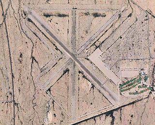
Stuttgart Army Airfield is a former World War II military airfield, located 7 miles north of Stuttgart, Arkansas. It operated as an advanced pilot training school for the United States Army Air Forces from 1942 until 1945.

Anniston Air Force Base is a former United States Air Force airfield located approximately 10 miles north-northeast of Talladega, Alabama. It was active from 1942 to 1945 and 1949 to 1952. It is currently the site of the Talladega Superspeedway and Talladega Municipal Airport.

Fort Sumner Municipal Airport is a village owned, public use airport located two nautical miles (4 km) northeast of the central business district of Fort Sumner, a village in De Baca County, New Mexico, United States. It is included in the National Plan of Integrated Airport Systems for 2011–2015, which categorized it as a general aviation airport.

Hancock Field is a former airport and military airfield about 2 miles (3.2 km) south-southeast of Santa Maria, California. Also known as Santa Maria Municipal Airport, the airport was closed about 1959 and today is the site of Allan Hancock College.
Grand Forks Municipal Airport is a former airport, located within current city limits approximately 3 miles (4.8 km) west-northwest of central Grand Forks, North Dakota. It was closed shortly after World War II and is now redeveloped as part of the urban area of Grand Forks.
Desert Center Airport is a private-use airport located five nautical miles northeast of the central business district of Desert Center, in Riverside County, California, United States.

Dothan Municipal Airport is a closed airport located 3 miles (5 km) west-northwest of Dothan, Alabama, United States.

Helm Field also called Lemoore Auxiliary Army Airfield A-7 is a former US Army Airfield use for training during World War II. Helm Field was location in the town of Coalinga, California, 70 miles south of Fresno. Helm Field had two 3,000 foot runways, one oriented east/west and one oriented northwest/southeast. The Airfield was on a 773 acres site of form farm land. The US Army purchased the land on January 11, 1943 for training pilots. The Airfield was used by the Lemoore Basic Flying School, based at the Lemoore Army Air Field. Helm Field was 15 miles northwest of Lemoore Army Air Field. The Army built at Helm Field to support training stage house, control tower, motor pool building, crash truck shelter and latrines. Helm Field was used by Air Corps Basic Flying School, the AAF Basic Flying School, the AAF Pilot School, the 88th Air Base Squadron, the 3023rd Army Air Force Pilot School and the 461st Army Air Force Base Unit. The army closed Helm Field on October 15, 1844 and the Airfield was sold by the War Assets Administration. Helm Field was used as a farm labor camp in the 1950s. The east/west runway was returned to farmland. The northwest/southeast runway was still intact and was used as a civilian airfield till 1971.


