Cookson Hills

Last updated

The Cookson Hills are in eastern Oklahoma. They are an extension of the Boston Mountains of Arkansas to the east and the southwestern margin of the Ozark Plateau. They lie generally between Stilwell, Sallisaw and Tahlequah. The area became part of the Cherokee Nation in the early 20th century until 1907, when Oklahoma became a state. [1]

Oklahoma State of the United States of America

Oklahoma is a state in the South Central region of the United States, bordered by Kansas on the north, Missouri on the northeast, Arkansas on the east, Texas on the south, New Mexico on the west, and Colorado on the northwest. It is the 20th-most extensive and the 28th-most populous of the fifty United States. The state's name is derived from the Choctaw words okla and humma, meaning "red people". It is also known informally by its nickname, "The Sooner State", in reference to the non-Native settlers who staked their claims on land before the official opening date of lands in the western Oklahoma Territory or before the Indian Appropriations Act of 1889, which dramatically increased European-American settlement in the eastern Indian Territory. Oklahoma Territory and Indian Territory were merged into the State of Oklahoma when it became the 46th state to enter the union on November 16, 1907. Its residents are known as Oklahomans, and its capital and largest city is Oklahoma City.

Boston Mountains

The Boston Mountains is a Level III ecoregion designated by the Environmental Protection Agency (EPA) in the U.S. states of Arkansas and Oklahoma. Part of the Ozark Mountains, the Boston Mountains are a deeply dissected plateau. The ecoregion is steeper than the adjacent Springfield Plateau to the north, and bordered on the south by the Arkansas Valley. The Oklahoma portion of the range is locally referred to as the Cookson Hills.

Arkansas State of the United States of America

Arkansas is a state in the southern region of the United States, home to over 3 million people as of 2018. Its name is of Siouan derivation from the language of the Osage denoting their related kin, the Quapaw Indians. The state's diverse geography ranges from the mountainous regions of the Ozark and the Ouachita Mountains, which make up the U.S. Interior Highlands, to the densely forested land in the south known as the Arkansas Timberlands, to the eastern lowlands along the Mississippi River and the Arkansas Delta.

Contents

History

The Depression-era bank robber Charles Arthur ("Pretty Boy") Floyd was raised in the Cookson Hills. [1]

Pretty Boy Floyd American bank robber

Charles Arthur Floyd nicknamed Pretty Boy Floyd, was an American bank robber. He operated in the West and West South Central States, and his criminal exploits gained widespread press coverage in the 1930s. Like several other prominent outlaws of that era, he was pursued and killed by a group of Federal Bureau of Investigation (FBI) agents led by Melvin Purvis. Historians have speculated as to which officers were at the event, local or FBI: known accounts document that local officers Robert "Pete" Pyle and George Curran were present at his fatal shooting and also at his embalming. Floyd has continued to be a familiar figure in American popular culture, sometimes seen as notorious, but at other times viewed as a tragic figure, partly a victim of the hard times of the Great Depression in the United States.

Geography

The Cooksons are the western extension of the Boston Mountains of Arkansas into eastern Oklahoma. BostMtnOv2.png
The Cooksons are the western extension of the Boston Mountains of Arkansas into eastern Oklahoma.

The region is a rugged dissected plateau with numerous peaks and ridges up to 1,500 feet (460 m) above sea level. The Cooksons are drained by tributaries of the Illinois River (Arkansas). They are heavily wooded, predominantly oak, with patches of black walnut and hickory trees. [1] The J. T. Nickel Family Nature and Wildlife Preserve is located in the Cookson Hills. It is the largest nature preserve in the region.

Dissected plateau Plateau area that has been severely eroded so that the relief is sharp

A dissected plateau is a plateau area that has been severely eroded so that the relief is sharp. Such an area may be referred to as mountainous, but dissected plateaus are distinguishable from orogenic mountain belts by the lack of folding, metamorphism, extensive faulting, or magmatic activity that accompanies orogeny.

Oak genus of plants

An oak is a tree or shrub in the genus Quercus of the beech family, Fagaceae. There are approximately 600 extant species of oaks. The common name "oak" also appears in the names of species in related genera, notably Lithocarpus, as well as in those of unrelated species such as Grevillea robusta and the Casuarinaceae (she-oaks). The genus Quercus is native to the Northern Hemisphere, and includes deciduous and evergreen species extending from cool temperate to tropical latitudes in the Americas, Asia, Europe, and North Africa. North America contains the largest number of oak species, with approximately 90 occurring in the United States, while Mexico has 160 species of which 109 are endemic. The second greatest center of oak diversity is China, which contains approximately 100 species.

Hickory genus of plants

Hickory is a type of tree, comprising the genus Carya. The genus includes 17 to 19 species. Five or six species are native to China, Indochina, and India (Assam), as many as 12 are native to the United States, four are found in Mexico, and two to four are from Canada. A number of hickory species are used by man for products like edible nuts (pecans) or wood.

Related Research Articles

Sequoyah County, Oklahoma County in the United States

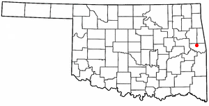
Sequoyah County is a county located in the U.S. state of Oklahoma. As of the 2010 census, the population was 42,391. The county seat is Sallisaw. Sequoyah County was created in 1907 when Oklahoma became a state. It was named after Sequoyah, who created the Cherokee syllabary.

Adair County, Oklahoma County in the United States

Adair County is a county located in the U.S. state of Oklahoma. As of the 2010 census, the population was 22,286. Its county seat is Stilwell. Adair County was named after the Adair family of the Cherokee tribe. One source says that the county was specifically named for Watt Adair, one of the first Cherokees to settle in the area.

Washington County, Arkansas County in the United States

Washington County is a county located in the northwest part of the U.S. state of Arkansas. As of the 2010 census, the population was 203,065, making it the third-most populous county in Arkansas. The county seat is Fayetteville. It is Arkansas's 17th county, formed on October 17, 1828, and named for George Washington, the first President of the United States. Washington County is part of the Fayetteville-Springdale-Rogers, AR-MO Metropolitan Statistical Area.

Stilwell, Oklahoma City in Oklahoma, United States

Stilwell is a city and county seat of Adair County, Oklahoma, United States. The population was 3,949 at the 2010, an increase of 20.5 percent from 3,276 at the 2000 census. In 1949, the Oklahoma governor and legislature proclaimed Stilwell as the "Strawberry Capital of the World." Stilwell also serves as a gateway to Lake Tenkiller and the former Adair State Park.

Westville, Oklahoma Town in Oklahoma, United States

Westville is a town in Adair County, Oklahoma, United States. The population was 1,639 at the 2010 census, an increase of 2.7 percent from 1,596 at the 2000 census.

Tamaha, Oklahoma Town in Oklahoma, United States

Tamaha is a town in Haskell County, Oklahoma, United States. The population was 176 at the 2010 census, a decline of 11.1 percent from 198 at the 2000 census. Tamaha is a Choctaw word meaning town.

Arkoma, Oklahoma Town in Oklahoma, United States

Arkoma is a town in Le Flore County, Oklahoma, United States. It is part of the Fort Smith, Arkansas-Oklahoma Metropolitan Statistical Area. The population was 1,989 at the 2010 census, a decline from 2,180 in 2000. The name of the town is a portmanteau of Arkansas and Oklahoma. Throughout its history, Arkoma has served as a "bedroom community" because many residents commuted to work in Fort Smith.

Cameron, Oklahoma Town in Oklahoma, United States

Cameron is a town in Le Flore County, Oklahoma, United States. It is part of the Fort Smith, Arkansas-Oklahoma Metropolitan Statistical Area. The population was 302 at the 2010 census, a loss of 3.2 percent from 312 at the 2000 census.

Fort Coffee, Oklahoma Town in Oklahoma, United States

Fort Coffee is a town in Le Flore County, Oklahoma, United States. Originally constructed as a U. S. Army fort in 1834, it was named for U. S. General John Coffee, a veteran of the Seminole Wars. It is part of the Fort Smith, Arkansas-Oklahoma Metropolitan Statistical Area. The population was 424 at the 2010 census, a gain of 2.9 percent from 412 at the 2000 census.

Shady Point, Oklahoma Town in Oklahoma, United States

Shady Point is a town in Le Flore County, Oklahoma, United States. It is part of the Fort Smith, Arkansas-Oklahoma Metropolitan Statistical Area. The population was 1,026 at the 2010 census, a 21.0 percent increase from 848 at the 2000 census.

Spiro, Oklahoma Town in Oklahoma, United States

Spiro is a town in Le Flore County, Oklahoma, United States. It is part of the Fort Smith, Arkansas-Oklahoma Metropolitan Statistical Area. The population was 2,164 at the 2010 census, a 2.8 percent decline from 2,227 at the 2000 census.

Marble City, Oklahoma Town in Oklahoma, United States

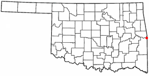
Marble City is a town in Sequoyah County, Oklahoma, United States. It is part of the Fort Smith, Arkansas-Oklahoma Metropolitan Statistical Area. The population was 263 at the 2010 census, an increase of 8.7 percent from 242 at the 2000 census, making it the seventh-largest town by population in Sequoyah County, after Gans and before Moffett.

Moffett, Oklahoma Town in Oklahoma, United States

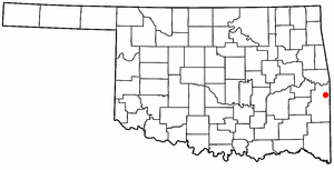
Moffett is a town in Sequoyah County, Oklahoma. It is part of the Fort Smith, Arkansas-Oklahoma Metropolitan Statistical Area. The population was 128 at the 2010 census, a loss of 28.5 percent from 179 at the 2000 census.

Catoosa, Oklahoma City in Oklahoma, United States

Catoosa is a city in Rogers and Wagoner counties in the U.S. state of Oklahoma. The population was 7,159 at the 2010 census compared to 5,449 at the 2000 census. This was a 31.2 percent increase during the decade.

Ozarks Highland region in central-southern United States

The Ozarks, also called the Ozark Mountains or Ozark Plateau, is a physiographic region in the U.S. states of Missouri, Arkansas, Oklahoma, and extreme southeastern Kansas. The Ozarks cover a significant portion of northern Arkansas and most of the southern half of Missouri, extending from Interstate 40 in Arkansas to the Interstate 70 in central Missouri.

Illinois River (Oklahoma) river in Arkansas and Oklahoma

The Illinois River is a 145-mile-long (233 km) tributary of the Arkansas River in the U.S. states of Arkansas and Oklahoma. The Osage Indians named it Ne-eng-wah-kon-dah, which translates as "Medicine Stone River." The state of Oklahoma has designated its portion as a Scenic River. The Illinois River is a significant location in the 1961 Wilson Rawls novel, Where the Red Fern Grows.

Poteau River river in the United States of America

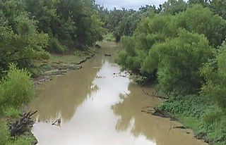
The Poteau River is a 141-mile (227 km) long river located in the U.S. states of Arkansas and Oklahoma. It is the only river in Oklahoma that flows north and is the seventh largest river in the state. It is a tributary of the Arkansas River, which itself is a tributary of the Mississippi River.

Arkansas River Valley Region in Arkansas, United States

The Arkansas River Valley is a region in Arkansas defined by the Arkansas River in the western part of the state. Generally defined as the area between the Ozark and Ouachita Mountains, the River Valley is characterized by flat lowlands covered in fertile farmland and lakes periodically interrupted by high peaks. Mount Magazine, Mount Nebo, and Petit Jean Mountain compose the Tri-Peaks Region, a further subdivision of the River Valley popular with hikers and outdoors enthusiasts. In addition to the outdoor recreational activities available to residents and visitors of the region, the River Valley contains Arkansas's wine country as well as hundreds of historical sites throughout the area.It is one of six natural divisions of Arkansas.

J. T. Nickel Family Nature and Wildlife Preserve

The J.T. Nickel Family Nature and Wildlife Preserve, located in Cherokee County, Oklahoma is privately owned and managed by The Oklahoma Nature Conservancy. The preserve contains 17,000 acres (6,900 ha) of forest and grassland. Spring-fed creeks meander amid a rugged topography of steep slopes and narrow valleys harboring a mosaic of oak-hickory forest, lofty pine woodland, and a diverse mix of savanna, shrubland, and prairie. Elk have been reintroduced at the Preserve

References

Coordinates: 35°42′N94°48′W / 35.7°N 94.8°W / 35.7; -94.8 (Cookson Hills)

Geographic coordinate system Coordinate system

A geographic coordinate system is a coordinate system that enables every location on Earth to be specified by a set of numbers, letters or symbols. The coordinates are often chosen such that one of the numbers represents a vertical position and two or three of the numbers represent a horizontal position; alternatively, a geographic position may be expressed in a combined three-dimensional Cartesian vector. A common choice of coordinates is latitude, longitude and elevation. To specify a location on a plane requires a map projection.