County of Banks, Queensland

Last updated
Map all coordinates using: OpenStreetMap  ·  Google Maps
Download coordinates as: KML  ·  GPX
Banks
Queensland

Banks-county-queensland.png

Location within Queensland
Lands administrative divisions around Banks:
Melville Melville
Mosman Banks Coral Sea
Chelmsford Dagmar Solander

The county of Banks is one of the counties of Queensland, Australia, that existed before 1901. It is located in Far North Queensland, and is named for Sir Joseph Banks, who with Captain James Cook landed in 1770 at a location within the county. Banks includes the towns of Cooktown, Lakeland and Laura. [1]

Far North Queensland Region in Queensland, Australia

Far North Queensland is the northernmost part of the state of Queensland, Australia. Centered on the city of Cairns, the region stretches north to the Torres Strait, and west to the Gulf Country. The region has Australia's only international border, with the independent nation of Papua New Guinea.

Joseph Banks English naturalist, botanist and patron of the natural sciences

Sir Joseph Banks, 1st Baronet, was an English naturalist, botanist and patron of the natural sciences.

James Cook 18th-century British explorer

Captain James Cook was a British explorer, navigator, cartographer, and captain in the Royal Navy. He made detailed maps of Newfoundland prior to making three voyages to the Pacific Ocean, during which he achieved the first recorded European contact with the eastern coastline of Australia and the Hawaiian Islands, and the first recorded circumnavigation of New Zealand.

Parishes

Parish LGA Coordinates Notes
Annan Cook 15°35′S145°15′E / 15.583°S 145.250°E / -15.583; 145.250 (Annan Parish)
Battle Camp Cook 15°22′S144°39′E / 15.367°S 144.650°E / -15.367; 144.650 (Battle Camp Parish)
Bullhead Cook 15°50′S144°49′E / 15.833°S 144.817°E / -15.833; 144.817 (Bullhead Parish) Lakeland
Cahir Cook 15°12′S144°39′E / 15.200°S 144.650°E / -15.200; 144.650 (Cahir Parish)
Cook Cook 15°30′S145°14′E / 15.500°S 145.233°E / -15.500; 145.233 (Cook Parish) Cooktown
Cowton Cook 14°59′S144°52′E / 14.983°S 144.867°E / -14.983; 144.867 (Cowton Parish)
Deighton Cook 15°30′S144°33′E / 15.500°S 144.550°E / -15.500; 144.550 (Deighton Parish) Laura
Discovery Hope Vale (A) 15°13′S145°11′E / 15.217°S 145.183°E / -15.217; 145.183 (Discovery Parish)
Emla Cook 15°20′S144°31′E / 15.333°S 144.517°E / -15.333; 144.517 (Emla Parish)
Endeavour Hope Vale (A) 15°21′S145°15′E / 15.350°S 145.250°E / -15.350; 145.250 (Endeavour Parish)
Flattery Hope Vale (A) 14°54′S145°11′E / 14.900°S 145.183°E / -14.900; 145.183 (Flattery Parish)
Gore Cook 15°52′S145°04′E / 15.867°S 145.067°E / -15.867; 145.067 (Gore Parish)
Green Cook 15°32′S144°56′E / 15.533°S 144.933°E / -15.533; 144.933 (Green Parish)
Gresley Cook 15°47′S144°30′E / 15.783°S 144.500°E / -15.783; 144.500 (Gresley Parish)
Hann Hope Vale (A) 15°20′S145°07′E / 15.333°S 145.117°E / -15.333; 145.117 (Hann Parish) Hope Vale
Hicks Cook 15°34′S145°05′E / 15.567°S 145.083°E / -15.567; 145.083 (Hicks Parish)
Lythe Cook 14°57′S144°40′E / 14.950°S 144.667°E / -14.950; 144.667 (Lythe Parish)
Macquarie Cook 15°39′S144°34′E / 15.650°S 144.567°E / -15.650; 144.567 (Macquarie Parish)
McIvor Cook 15°07′S145°03′E / 15.117°S 145.050°E / -15.117; 145.050 (McIvor Parish)
Melsonby Cook 15°07′S144°51′E / 15.117°S 144.850°E / -15.117; 144.850 (Melsonby Parish)
Monkhouse Cook 15°45′S145°17′E / 15.750°S 145.283°E / -15.750; 145.283 (Monkhouse Parish)
Munburra Cook 14°53′S145°04′E / 14.883°S 145.067°E / -14.883; 145.067 (Munburra Parish)
Ninda Cook 15°38′S144°46′E / 15.633°S 144.767°E / -15.633; 144.767 (Ninda Parish)
Pickersgill Cook 15°18′S144°56′E / 15.300°S 144.933°E / -15.300; 144.933 (Pickersgill Parish)
Pryde Cook 15°10′S145°01′E / 15.167°S 145.017°E / -15.167; 145.017 (Pryde Parish)
Ruby Cook 15°29′S144°47′E / 15.483°S 144.783°E / -15.483; 144.783 (Ruby Parish)
Saunders Cook 15°39′S144°54′E / 15.650°S 144.900°E / -15.650; 144.900 (Saunders Parish)
Solander Cook 15°27′S145°06′E / 15.450°S 145.100°E / -15.450; 145.100 (Solander Parish)
Tayeto Hope Vale (A) 15°03′S145°12′E / 15.050°S 145.200°E / -15.050; 145.200 (Tayeto Parish)
Tupia Cook 15°02′S145°03′E / 15.033°S 145.050°E / -15.033; 145.050 (Tupia Parish)
Welbury Cook 15°06′S144°39′E / 15.100°S 144.650°E / -15.100; 144.650 (Welbury Parish)
Yarico Cook 15°18′S144°48′E / 15.300°S 144.800°E / -15.300; 144.800 (Yarico Parish)

Related Research Articles

Bathurst Bay Bay in Queensland, Australia

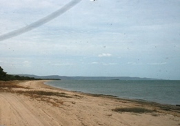
Bathurst Bay is a bay in the localities of Lakefield and Starcke in the Shire of Cook, Queensland, Australia. In the 19th century it was the base for the pearling fleet. It is now a tourist attraction on Cape York Peninsula in northern Queensland, Australia, near the Great Barrier Reef.

Qantas Founders Outback Museum Aviation museum in Longreach, Queensland

The Qantas Founders Outback Museum is a museum located in Longreach, Queensland, Australia. The Qantas Founders Museum is located 177 km. from Winton, Queensland the original home of Qantas. The museum was opened on 9 June 1996 in the heritage-listed Qantas Hangar. Stage 2 of the Qantas Founders Museum was part of a 1999 A$110 million Queensland and federal government project, the heritage trails network.

Northumberland Islands island chain off the coast of Queensland, Australia

The Northumberland Islands are a scattered island chain off the eastern coast of Queensland, Australia.

Mount Mulligan mine disaster

The Mount Mulligan mine disaster occurred on 19 September 1921 in Mount Mulligan, Far North Queensland, Australia. A series of explosions in the local coal mine, audible as much as 30 km away, rocked the close-knit township.

Obišovce municipality of Slovakia

Obišovce is a village and municipality in Košice-okolie District in the Kosice Region of eastern Slovakia.

Végegyháza Place in Békés, Hungary

Végegyháza is a village in Békés County, in the Southern Great Plain region of south-east Hungary.

Bumgyê is a township in Gonjo County, the Tibet Autonomous Region of China. It lies at an altitude of 3,933 metres.

Wiszczelice Village in Kuyavian-Pomeranian, Poland

Wiszczelice is a village in the administrative district of Gmina Izbica Kujawska, within Włocławek County, Kuyavian-Pomeranian Voivodeship, in north-central Poland. It lies approximately 9 kilometres (6 mi) south-east of Izbica Kujawska, 33 km (21 mi) south-west of Włocławek, and 75 km (47 mi) south of Toruń.

Rusaki Village in Podlaskie, Poland

Rusaki is a village in the administrative district of Gmina Mońki, within Mońki County, Podlaskie Voivodeship, in north-eastern Poland. It lies approximately 5 kilometres (3 mi) south-east of Mońki and 36 km (22 mi) north-west of the regional capital Białystok.

Banks Creek, Queensland Suburb of Somerset Region, Queensland, Australia

Banks Creek is a rural locality split between the City of Brisbane and Somerset Region in Queensland, Australia. The locality is also split for the purposes of state and federal elections.

Zbarzewo Village in Greater Poland, Poland

Zbarzewo is a village in the administrative district of Gmina Włoszakowice, within Leszno County, Greater Poland Voivodeship, in west-central Poland. It lies approximately 8 kilometres (5 mi) south of Włoszakowice, 13 km (8 mi) west of Leszno, and 70 km (43 mi) south-west of the regional capital Poznań.

Rzeki Wielkie Village in Silesian, Poland

Rzeki Wielkie is a village in the administrative district of Gmina Kłomnice, within Częstochowa County, Silesian Voivodeship, in southern Poland. It lies 7 kilometres (4 mi) south of Kłomnice, 21 km (13 mi) east of Częstochowa, and 74 km (46 mi) north of the regional capital Katowice.

Wicimice Village in West Pomeranian, Poland

Wicimice is a village in the administrative district of Gmina Płoty, within Gryfice County, West Pomeranian Voivodeship, in north-western Poland. It lies approximately 11 kilometres (7 mi) north-east of Płoty, 14 km (9 mi) south-east of Gryfice, and 73 km (45 mi) north-east of the regional capital Szczecin.

Schořov is a village and municipality in Kutná Hora District in the Central Bohemian Region of the Czech Republic.

Szakácsi is a village in Borsod-Abaúj-Zemplén County in northeastern Hungary. Szakácsi has 150 inhabitants and is situated on either side of the Vadasz-patak (stream) against the hills. It has two churches, a village house, a shop for basic necessities, a slow food restaurant, a bus and two flocks of sheep.

Iztochnik is a village in Gabrovo Municipality, in Gabrovo Province, in northern central Bulgaria.

McNair Nunatak is a small, clearly defined rock exposure in Antarctica, situated 12 nautical miles (22 km) east of the central part of the Masson Range and 5 nautical miles (9 km) south-southeast of Russell Nunatak. It was first seen by R. Dovers during the Australian National Antarctic Research Expeditions southern journey of 1954, and was named by the Antarctic Names Committee of Australia for Richard McNair, a cook at Mawson Station in 1955.

County of Cook, Queensland Cadastral in Queensland, Australia

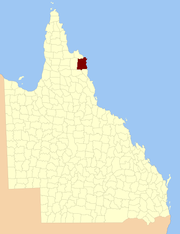
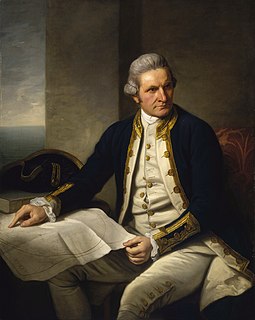
The county of Cook is a cadastral division of Queensland, centred on the city of Bundaberg, and its name honours Captain James Cook. It was officially named and bounded by the Governor in Council on 7 March 1901 under the Land Act 1897.

Shire of Daintree

The Shire of Daintree is a former local government area in Far North Queensland, Australia. It comprised the coastal strip surrounding Cooktown but excluded the town itself which had been established as the Borough of Cooktown in 1886.

Shire of Hann

The Shire of Hann is a former local government area in Far North Queensland, Australia.

References

Coordinates: 15°23′S144°52′E / 15.383°S 144.867°E / -15.383; 144.867

Geographic coordinate system Coordinate system

A geographic coordinate system is a coordinate system that enables every location on Earth to be specified by a set of numbers, letters or symbols. The coordinates are often chosen such that one of the numbers represents a vertical position and two or three of the numbers represent a horizontal position; alternatively, a geographic position may be expressed in a combined three-dimensional Cartesian vector. A common choice of coordinates is latitude, longitude and elevation. To specify a location on a plane requires a map projection.