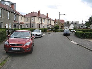
Cardonald is an outlying suburb of the Scottish city of Glasgow. Formerly a village in its own right, it lies to the southwest of the city and is bounded to the south by the White Cart Water. The area was part of Renfrewshire until 1926 when the villages of Cardonald, Crookston, Halfway and their surrounding farmland were annexed to Glasgow.
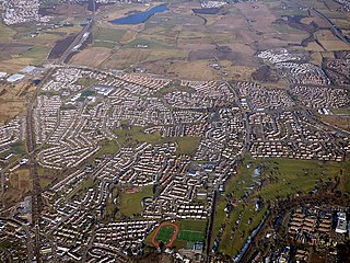
Bishopbriggs is a town in East Dunbartonshire, Scotland. It lies on the northern fringe of Greater Glasgow, approximately 4 miles (6 km) from the city centre. Historically in Lanarkshire, the area was once part of the historic parish of Cadder - originally lands granted by King William the Lion to the Bishop of Glasgow, Jocelin, in 1180. It was later part of the county of Lanarkshire, and then an independent burgh from 1964 to 1975. Today, Bishopbriggs' close geographic proximity to Glasgow now effectively makes it a suburb and commuter town of the city. The town's original Gaelic name Coille Dobhair reflects the name of the old parish of Cadder, but modern Gaelic usage uses Drochaid an Easbaig, a literal translation of Bishopbriggs. It was ranked the 2nd most desirable postcode in Scotland to live in following a study by the Centre for Economic and Business Research in 2015 and 2016.

Rutherglen is a town in South Lanarkshire, Scotland, immediately south-east of the city of Glasgow, three miles from its centre and directly south of the River Clyde. Having previously existed as a separate Lanarkshire burgh, in 1975 Rutherglen lost its own local council and administratively became a component of the City of Glasgow District within the Strathclyde region. In 1996 the towns were reallocated to the South Lanarkshire council area.

Cathcart is an area of Glasgow between Battlefield, Mount Florida, King's Park, Muirend and Newlands. The White Cart Water flows through Cathcart, downstream from Linn Park. In 2014, it was rated one of the most attractive postcode areas to live in Scotland.

Kelvindale is a district in the West End of the city of Glasgow, Scotland. Kelvindale shares the G12 postcode with the neighbouring residential districts of Kelvinside, Hillhead, Hyndland, Dowanhill, as well as Gartnavel General Hospital, Glasgow Clyde College (Anniesland) and the University of Glasgow, and is also close to the Anniesland and Wyndford areas of the city. The area is characterised by traditional interwar housing, formed of tenements and semi-detached houses.

Pollokshields is an area in the Southside of Glasgow, Scotland. Its modern boundaries are largely man-made, being formed by the M77 motorway to the west and northwest with the open land of Pollok Country Park and the Dumbreck neighbourhood beyond, by the Inverclyde Line railway and other branches which separate its territory from the largely industrial areas of Kinning Park, Kingston and Port Eglinton, and by the Glasgow South Western Line running from the east to south, bordering Govanhill, Strathbungo, Crossmyloof and Shawlands residential areas. There is also a suburban railway running through the area.

Queen's Park is a park situated on the south side of the city of Glasgow, Scotland, between Strathbungo, Shawlands, Battlefield, Mount Florida, and Crosshill The 60-hectare (148-acre) park lies about 2+1⁄2 miles (4 km) south of the city centre, and gives its name to a nearby railway station and several other local businesses and institutions, including the football team Queen's Park F.C.
Mount Florida is an area in the south-east of the city of Glasgow, Scotland.
Kilmacolm is a village and civil parish in the Inverclyde council area, and the historic county of Renfrewshire in the west central Lowlands of Scotland. It lies on the northern slope of the Gryffe Valley, 7+1⁄2 miles southeast of Greenock and around 15 miles (24 km) west of the city of Glasgow. The village has a population of around 4,000 and is part of a wider civil parish which covers a large rural hinterland of 15,000 hectares containing within it the smaller settlement of Quarrier's Village, originally established as a 19th-century residential orphans' home.

Dennistoun is a mostly residential district in Glasgow, Scotland, located north of the River Clyde and in the city's east end, about 1+1⁄4 miles east of the city centre. Since 2017 it has formed the core of a Dennistoun ward under Glasgow City Council, having previously been a component of the East Centre ward.

Crosshill is an area of Glasgow, Scotland. It is situated south of the River Clyde. It was an independent police burgh from 1871 to 1891 before being annexed by the City of Glasgow.

Govanhill is an area of Glasgow, Scotland, situated south of the River Clyde between Pollokshields, the Gorbals, Strathbungo, Crosshill, Polmadie and Queen's Park. Historically part of Renfrewshire, Govanhill had the status of a police burgh between 1877 and 1891 before becoming part of the City of Glasgow. Since 2007, it has fallen under the Southside Central ward of Glasgow City Council. A previous smaller ward named Govanhill had boundaries of Dixon Avenue and Dixon Road to the south, Victoria Road to the west, Butterbiggins Road to the north and Aikenhead Road to the east.

King's Park is a district in the city of Glasgow, Scotland. It is situated south of the River Clyde and borders the Glasgow areas of Croftfoot, Cathcart, Simshill, Mount Florida and Toryglen and the neighbourhood of Bankhead in the adjoining town of Rutherglen.

Burnside is a mostly residential area in the town of Rutherglen in South Lanarkshire, Scotland. Including the neighbourhoods of High Burnside and High Crosshill, respectively south and north-west of its main street, it borders Overtoun Park in Rutherglen plus several other residential areas of the town, as well as western parts of neighbouring Cambuslang.

Clarkston is a suburban town in East Renfrewshire, in the Central Lowlands of Scotland. A dormitory town with a population of around 10,000, Clarkston is on the southern fringe of the Greater Glasgow conurbation and directly adjoins the neighbouring suburban villages of Busby and Netherlee, as well as the towns of Newton Mearns and Giffnock.

St Werburgh's Church is in Grosvenor Park Road, Chester, Cheshire, England. It is an active Roman Catholic parish church in the diocese of Shrewsbury. The church is recorded in the National Heritage List for England as a designated Grade II listed building. It should not be confused with the Benedictine Abbey of St Werburgh established in 1093 by Hugh d'Avranches, 1st Earl of Chester.

Queen's Park Govanhill Parish Church is a 19th-century Parish church of the Church of Scotland located in the south side of Glasgow, near Queen's Park, from which the church's name derives.

Strathbungo Parish Church was a 19th-century Church of Scotland building located in the Strathbungo area of Glasgow. The church body was demolished and converted into flats in 2006, but retained the original facade and bell tower of the former church.

Camphill Queen's Park Baptist Church is a 19th-century church building in the south-side of Glasgow, immediately opposite Queen's Park.

Websters is a theatre in Glasgow, Scotland. It also operates as a bar and restaurant. Websters occupies the building of the 19th century former Lansdowne Parish Church.

